Chest opened
+${chestReward.xp} XP
Explorer
NOUVEAU ×${chestReward.collectible.quantity}
tapez pour fermer

See the monuments around you in AR Open chests in the app

Around Us is built for your phone — point your camera at the streets and discover the monuments and places around you in augmented reality. Around Us is built for your phone — chests unlock when you walk, explore and capture nearby places.

Enable Location

We need your location to show you interesting places around you

Discover nearby places

Find interesting locations and hidden gems around you

Precise directions

Get accurate directions and distances to places

Your location is never shared with other users. It's only used when you tap the location button.

Fort Cummings

Log in to your account

Start exploring — it's free

Trusted by 84,971 travelers worldwide

Continue with Google
Continue with Apple
or

We will send you a code to connect

By continuing, you accept our Terms and Conditions and our Privacy Policy

Check your inbox

We've sent a pincode in your inbox. Please enter the code below.

Discussion Reviews 1 Photos
2.9k Popularity

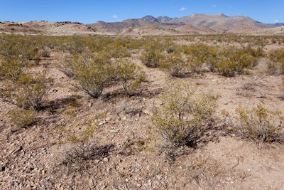
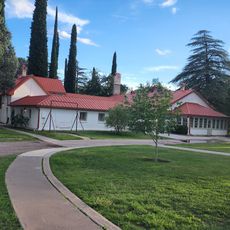
Fort Cummings, Military fort near Cooke's Springs, Luna County, New Mexico, US.

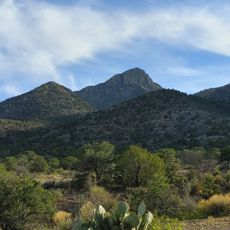
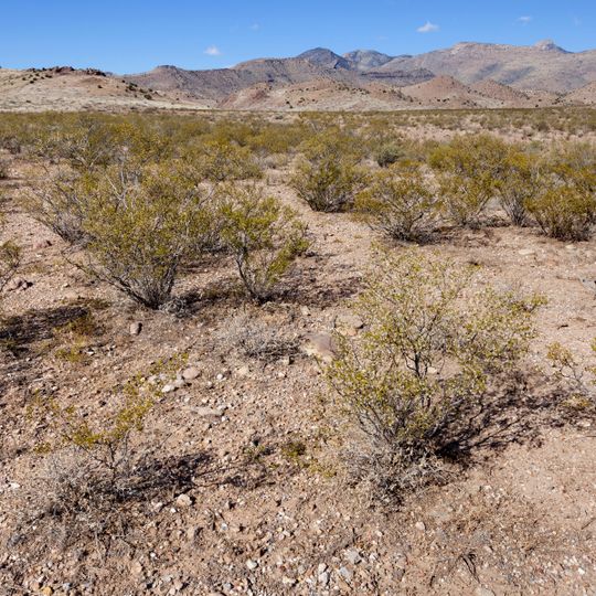
Fort Cummings is a military complex near Cooke's Springs in Luna County built with adobe structures arranged around a central parade ground. The remains show barracks, officers' quarters, a hospital, and defensive walls made of sun-dried mud bricks, positioned at the base of Cooke's Peak.

The fort was founded in 1863 under Captain Valentine Dresher to protect travelers and mail routes from Apache attacks through Cooke's Canyon. It served as a key defensive position in the region during the Indian Wars period.

The site is connected to the Buffalo Soldiers, Black military units stationed here starting in 1867, who left their mark on this place. Their presence represents an important part of American frontier history that many visitors overlook.

The site is accessible via State Highway 26, turning onto Cooke's Canyon Road NE at mile marker 14 in the area. Visitors should expect to see eroding adobe walls and scattered ruins spread across the ground rather than standing structures.

The fort was used in 1886 for testing an early communication system called a heliograph, which bounced sunlight off mirrors to send messages across long distances. This technology connected the fort with Tubac, Arizona, and preceded modern radio by decades.

The community of curious travelers

AroundUs brings together thousands of curated places, local tips, and hidden gems, enriched daily by 60,000 contributors worldwide.

Start exploring
Location
GPS coordinates
32.46560,-107.64600
Latest update
August 30, 2026 12:46
Around this place
City of Rocks State Park
United States of America

City of Rocks State Park

21.1 mi
Rockhound State Park
United States of America

Rockhound State Park

22.1 mi
Deming Armory
United States of America

Deming Armory

15.3 mi
United States of America

NAN Ranch

17.7 mi
Cooke's Canyon
United States of America

Cooke's Canyon

4.2 mi
Downtown Deming Historic District
United States of America

Downtown Deming Historic District

15.2 mi
Luna County Courthouse
United States of America

Luna County Courthouse

13.8 mi
United States of America

George O. Perrault House

24 mi
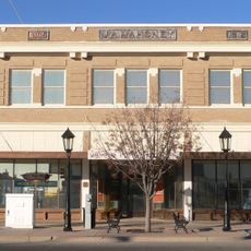
Mahoney Building
United States of America

Mahoney Building

15.2 mi
United States of America

Jesus Valencia House

26.6 mi
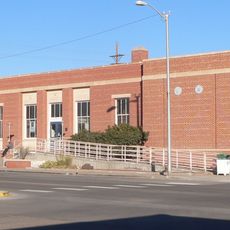
Deming Main Post Office
United States of America

Deming Main Post Office

15.2 mi
United States of America

Maria J. and Juan Trujillo House

17.1 mi
United States of America

Menard-Galaz House

28 mi
United States of America

Trinidad Andazola House

17.1 mi
Seaman Field House
United States of America

Seaman Field House

15.2 mi
United States of America

Soliz-Baca House

17.1 mi
United States of America

Mauricio Portillo House

27.2 mi
United States of America

Antonio Torres House

27.5 mi
United States of America

Tom Eby Storage Building

17.1 mi
Basin Range Geolapidary Museum
United States of America

Basin Range Geolapidary Museum

18.8 mi
United States of America

Fort Cummings 1836-1886 Historical Marker

130 ft
United States of America

Christ Light Community Church

15.2 mi
United States of America

Seaman Field House Historic Site

15.2 mi
United States of America

Tom Eby Storage Building Historic Site

13.4 mi
United States of America

Ramon Baca House Historic Site

17.1 mi
United States of America

Trinidad Andazola House Historic Site

17.1 mi
United States of America

Lake Valley

18.1 mi
United States of America

Scenic viewpoint

20.4 mi
Show the full map
Reviews
Share your experience

No review yet

Discussions
Start a discussion...

No discussion yet

« Fort Cummings - Military fort near Cooke's Springs, Luna County, New Mexico, US » is provided by Around Us (aroundus.com). Images and texts are derived from Wikimedia project under a Creative Commons license. You are allowed to copy, distribute, and modify copies of this page, under the conditions set by the license, as long as this note is clearly visible.

Discover hidden gems everywhere you go!

From secret cafés to breathtaking viewpoints, skip the crowded tourist spots and find places that match your style. Our app makes it easy with voice search, smart filtering, route optimization, and insider tips from travelers worldwide. Download now for the complete mobile experience.

Around Us App Screenshot

A unique approach to discovering new places

Le Figaro

All the places worth exploring

France Info

A tailor-made excursion in just a few clicks

20 Minutes

Around Us
Travel Guide & Maps
Download

Send to your phone

QR Code
1

Open the camera app on your mobile.

2

Point at the QR code with your camera. A notification will appear.

3

Tap the notification to open the link.