Chest opened
+${chestReward.xp} XP
Explorer
NOUVEAU ×${chestReward.collectible.quantity}
tapez pour fermer
Chest locked

Open chests in the app

Around Us is built for your phone — chests unlock when you walk, explore and capture nearby places.

Enable Location

We need your location to show you interesting places around you

Discover nearby places

Find interesting locations and hidden gems around you

Precise directions

Get accurate directions and distances to places

Your location is never shared with other users. It's only used when you tap the location button.

White Sands Missile Range

Log in to your account

Start exploring — it's free

Trusted by 72,877 travelers worldwide

Continue with Google
Continue with Apple
or

We will send you a code to connect

By continuing, you accept our Terms and Conditions and our Privacy Policy

Check your inbox

We've sent a pincode in your inbox. Please enter the code below.

White Sands Missile Range
Discussion Reviews 4 Photos
138k Popularity

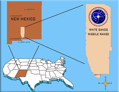
White Sands Missile Range, Military test range and spaceport in New Mexico, United States.

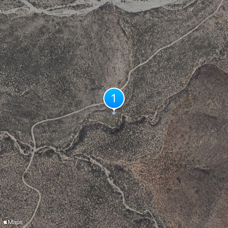
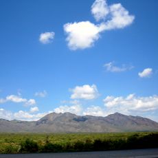
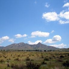
White Sands Missile Range is a military test facility and spaceport in New Mexico that covers five counties and spans more than 3,200 square miles (8,300 square kilometers). The site lies between the Organ Mountains to the west and the Sacramento Mountains to the east, forming the largest military installation in the United States.

The facility was established in 1945 as a testing ground for ballistic missiles and became the site for captured German V-2 rocket trials between 1946 and 1951. These early tests laid the foundation for American space exploration and ballistic missile defense programs.

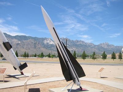
The name comes from the white gypsum dunes that stretch east of the facility and remain visible from the test sites on clear days. Visitors during public access periods can see old launch pads and concrete platforms that still bear traces of earlier rocket tests.

Access to the range requires photo identification, and nearby roads may close temporarily during active test periods. Visitors should bring plenty of water and sun protection, as the desert climate runs hot and dry.

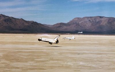
The space shuttle Columbia made an unplanned landing at Northrop Strip in 1982 after bad weather prevented its return to Florida. This emergency touchdown was the first time a shuttle landed outside its regular landing sites.

The community of curious travelers

AroundUs brings together thousands of curated places, local tips, and hidden gems, enriched daily by 60,000 contributors worldwide.

Start exploring
Location
Inception
1948
GPS coordinates
32.56310,-106.57000
Latest update
December 12, 2025 23:59
Around this place
San Andres National Wildlife Refuge
United States of America

San Andres National Wildlife Refuge

13.4 km
San Augustin Mountains
United States of America

San Augustin Mountains

15.3 km
L.B. Bentley General Merchandise
United States of America

L.B. Bentley General Merchandise

15.3 km
United States of America

Parker Lake

20.3 km
United States of America

Monument featuring aircraft, aircraft model

21.5 km
United States of America

Aerobee 170

21.5 km
United States of America

Balloon Launched Decelerator Test Vehicle

21.5 km
United States of America

Monument featuring aircraft, aircraft model

21.5 km
United States of America

QH-60 Dash

21.5 km
United States of America

XM-21

21.5 km
United States of America

Monument featuring aircraft, aircraft model

21.5 km
United States of America

Aircraft model, monument featuring aircraft

21.5 km
United States of America

Aircraft model, monument featuring aircraft

21.5 km
United States of America

MGM-52 Lance

21.5 km
United States of America

Nike Missile

15.3 km
United States of America

Hound Dog

21.5 km
United States of America

Monument featuring aircraft, aircraft model

21.5 km
United States of America

Monument featuring aircraft, aircraft model

21.5 km
United States of America

Monument featuring aircraft, aircraft model

21.5 km
United States of America

Monument featuring aircraft, aircraft model

21.5 km
United States of America

Monument featuring aircraft, aircraft model

21.5 km
United States of America

Aircraft model, monument featuring aircraft

21.5 km
United States of America

Monument featuring aircraft, aircraft model

21.5 km
United States of America

Northrop AQM-35

21.5 km
United States of America

Monument featuring aircraft, aircraft model

21.5 km
United States of America

Monument featuring aircraft, aircraft model

21.5 km
United States of America

Monument featuring aircraft, aircraft model

21.5 km
United States of America

Monument featuring aircraft, aircraft model

21.5 km
Show the full map
Reviews
Share your experience

No review yet

Discussions
Start a discussion...

No discussion yet

« White Sands Missile Range - Military test range and spaceport in New Mexico, United States » is provided by Around Us (aroundus.com). Images and texts are derived from Wikimedia project under a Creative Commons license. You are allowed to copy, distribute, and modify copies of this page, under the conditions set by the license, as long as this note is clearly visible.

Discover hidden gems everywhere you go!

From secret cafés to breathtaking viewpoints, skip the crowded tourist spots and find places that match your style. Our app makes it easy with voice search, smart filtering, route optimization, and insider tips from travelers worldwide. Download now for the complete mobile experience.

Around Us App Screenshot

A unique approach to discovering new places

Le Figaro

All the places worth exploring

France Info

A tailor-made excursion in just a few clicks

20 Minutes

Around Us
Travel Guide & Maps
Download

Send to your phone

QR Code
1

Open the camera app on your mobile.

2

Point at the QR code with your camera. A notification will appear.

3

Tap the notification to open the link.