Enable Location

We need your location to show you interesting places around you

Discover nearby places

Find interesting locations and hidden gems around you

Precise directions

Get accurate directions and distances to places

Your location is never shared with other users. It's only used when you tap the location button.

San Andres National Wildlife Refuge

Log in to your account

Start exploring — it's free

Trusted by travelers worldwide

Continue with Google
Continue with Apple
or

We will send you a code to connect

By continuing, you accept our Terms and Conditions and our Privacy Policy

Check your inbox

We've sent a pincode in your inbox. Please enter the code below.

San Andres National Wildlife Refuge

San Andres National Wildlife Refuge, Wildlife refuge in Doña Ana County, United States.

Description

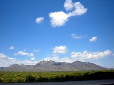
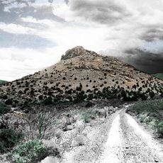
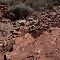
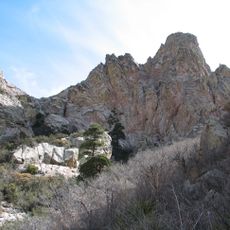
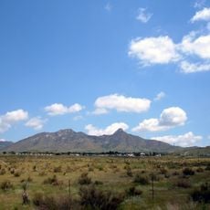
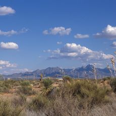
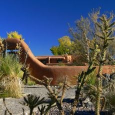
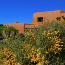
San Andres National Wildlife Refuge is a nature reserve in the southern San Andres Mountains within New Mexico's Chihuahuan Desert. The area spans thousands of acres of mountainous terrain interspersed with natural water sources and vegetated valleys.

History

This refuge was established in 1941 specifically to protect a small population of desert bighorn sheep. Over the decades it has grown into an important sanctuary for this vulnerable species.

Culture

This place draws naturalists and researchers who come to study desert wildlife in its native setting. Visitors experience how the refuge functions as a living classroom for understanding desert ecology.

Practical

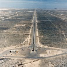
The area sits within a military installation and requires advance permission to visit. Prospective visitors must contact staff ahead of time and follow entry procedures.

Did you know?

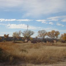
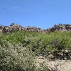
The refuge contains ten natural springs that create pockets of lush vegetation with cottonwoods and willows. These water sources form unexpected green oases in otherwise arid terrain.

Location
Operator
US Fish & Wildlife Service
GPS coordinates
32.68000,-106.53506
Latest update
December 12, 2025 09:05

AroundUs brings together thousands of curated places, local tips, and hidden gems, enriched daily by 60,000 contributors worldwide. Discover all places nearby (Doña Ana County).

Around this place
Aggie Memorial Stadium
United States of America

Aggie Memorial Stadium

48.6 km
Holloman High Speed Test Track
United States of America

Holloman High Speed Test Track

42.7 km
Victorio Peak
United States of America

Victorio Peak

28.9 km
White Sands V-2 Launching Site
United States of America

White Sands V-2 Launching Site

34.4 km
Prehistoric Trackways National Monument
United States of America

Prehistoric Trackways National Monument

48.5 km
Fort Selden
United States of America

Fort Selden

42.2 km
Organ Needle
United States of America

Organ Needle

37.3 km
San Augustin Mountains
United States of America

San Augustin Mountains

28.4 km
Rio Grande Theatre
United States of America

Rio Grande Theatre

47 km
Mesilla Valley Bosque State Park
United States of America

Mesilla Valley Bosque State Park

45.2 km
Cathedral of the Immaculate Heart of Mary
United States of America

Cathedral of the Immaculate Heart of Mary

47.6 km
Thomas Branigan Memorial Library
United States of America

Thomas Branigan Memorial Library

46.5 km
Wells Fargo Tower
United States of America

Wells Fargo Tower

47.6 km
Jornada Biosphere Reserve
United States of America

Jornada Biosphere Reserve

35.4 km
Green Bridge
United States of America

Green Bridge

45.9 km
Alameda-Depot Historic District
United States of America

Alameda-Depot Historic District

47.1 km
Phillips Chapel CME Church
United States of America

Phillips Chapel CME Church

46.4 km
Foster Hall
United States of America

Foster Hall

48.8 km
Rio Grande Bridge at Radium Springs
United States of America

Rio Grande Bridge at Radium Springs

42.5 km
L.B. Bentley General Merchandise
United States of America

L.B. Bentley General Merchandise

28.7 km
Nason House
United States of America

Nason House

48.7 km
Nestor Armijo House
United States of America

Nestor Armijo House

47.4 km
Dona Ana Village Historic District
United States of America

Dona Ana Village Historic District

41.8 km
White Sands Missile Range Museum
United States of America

White Sands Missile Range Museum

33.2 km
White Sands National Park Historic District
United States of America

White Sands National Park Historic District

35.8 km
Old Doña Ana County Courthouse
United States of America

Old Doña Ana County Courthouse

47.5 km
Branigan Cultural Center
United States of America

Branigan Cultural Center

46.9 km
White Sands Visitor Center
United States of America

White Sands Visitor Center

35.7 km
Show the full map
« San Andres National Wildlife Refuge - Wildlife refuge in Doña Ana County, United States » is provided by Around Us (aroundus.com). Images and texts are derived from Wikimedia project under a Creative Commons license. You are allowed to copy, distribute, and modify copies of this page, under the conditions set by the license, as long as this note is clearly visible.

Discover hidden gems everywhere you go!

From secret cafés to breathtaking viewpoints, skip the crowded tourist spots and find places that match your style. Our app makes it easy with voice search, smart filtering, route optimization, and insider tips from travelers worldwide. Download now for the complete mobile experience.

Around Us App Screenshot

A unique approach to discovering new places

Le Figaro

All the places worth exploring

France Info

A tailor-made excursion in just a few clicks

20 Minutes

Around Us
Travel Guide & Maps
Download

Send to your phone

QR Code
1

Open the camera app on your mobile.

2

Point at the QR code with your camera. A notification will appear.

3

Tap the notification to open the link.