Prehistoric Trackways National Monument

Log in to your account

AroundUs is a community-driven map of interesting places, built by curious explorers like you. It grows with every review, story, and photo you share.
Connect to save your favorite spots, contribute locations, and create personalized routes.
Continue with Google
Continue with Apple
Continue with X
Continue with Facebook
Continue with email
By continuing, you accept our Terms and Conditions and our Privacy Policy
Create an account

Prehistoric Trackways National Monument

Add to collection
Map
Suggest a change
Share

Prehistoric Trackways National Monument, Paleontological national monument in Doña Ana County, United States.

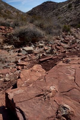
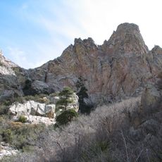
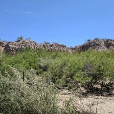
Prehistoric Trackways National Monument is a nature reserve in the Robledo Mountains containing fossilized footprints of ancient animals embedded in desert rock. The landscape holds traces from amphibians, reptiles, insects, and other organisms that once traveled across this terrain.

The monument preserves traces from creatures that lived roughly 280 million years ago during the Permian period when tropical conditions covered the region. The landscape formed as part of the supercontinent Pangea before becoming the desert terrain visible today.

The preserved footprints reveal how ancient creatures moved and behaved, giving visitors a tangible connection to life from before modern times and helping us understand what walking patterns these animals followed.

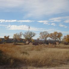
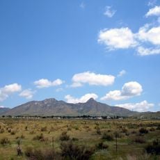
The site offers trails and routes for hikers, horseback riders, and vehicles exploring different sections of the monument. Visitors should prepare for desert weather conditions that vary with the season, as temperatures can fluctuate significantly.

The footprints were preserved in sediments that once formed a tropical marine shoreline, revealing how dramatically the region transformed over time. These ancient coastal conditions remain visible in the rock layers today, telling a story of geological change written in stone.

Location: Doña Ana County

Operator: Bureau of Land Management

GPS coordinates: 32.37026,-106.89902

Latest update: December 9, 2025 18:41

Photos
Around this place
Aggie Memorial Stadium
United States of America

Aggie Memorial Stadium

18 km
Fort Selden
United States of America

Fort Selden

12.8 km
Organ Needle
United States of America

Organ Needle

31.8 km
San Augustin Mountains
United States of America

San Augustin Mountains

32.2 km
Mesilla Plaza
United States of America

Mesilla Plaza

14.5 km
Rio Grande Theatre
United States of America

Rio Grande Theatre

13.2 km
Mesilla Valley Bosque State Park
United States of America

Mesilla Valley Bosque State Park

15.2 km
Cathedral of the Immaculate Heart of Mary
United States of America

Cathedral of the Immaculate Heart of Mary

14.8 km
Thomas Branigan Memorial Library
United States of America

Thomas Branigan Memorial Library

12.9 km
Wells Fargo Tower
United States of America

Wells Fargo Tower

13.4 km
San Jose Church
United States of America

San Jose Church

33.1 km
Green Bridge
United States of America

Green Bridge

18.6 km
Goddard Hall
United States of America

Goddard Hall

16.9 km
Alameda-Depot Historic District
United States of America

Alameda-Depot Historic District

12.6 km
Phillips Chapel CME Church
United States of America

Phillips Chapel CME Church

13.3 km
Chope's Town Cafe and Bar
United States of America

Chope's Town Cafe and Bar

33.3 km
Foster Hall
United States of America

Foster Hall

17 km
Rio Grande Bridge at Radium Springs
United States of America

Rio Grande Bridge at Radium Springs

13.2 km
L.B. Bentley General Merchandise
United States of America

L.B. Bentley General Merchandise

29 km
Nason House
United States of America

Nason House

16.7 km
Barela-Reynolds House
United States of America

Barela-Reynolds House

14.5 km
Frank and Amelia Jones House
United States of America

Frank and Amelia Jones House

30.4 km
Hadley-Ludwick House
United States of America

Hadley-Ludwick House

16.2 km
Nestor Armijo House
United States of America

Nestor Armijo House

13.6 km
Dona Ana Village Historic District
United States of America

Dona Ana Village Historic District

8.1 km
Mesilla Park Historic District
United States of America

Mesilla Park Historic District

16.1 km
Old Doña Ana County Courthouse
United States of America

Old Doña Ana County Courthouse

13.3 km
Branigan Cultural Center
United States of America

Branigan Cultural Center

12.9 km
Show the full map
Reviews

Visited this place? Tap the stars to rate it and share your experience / photos with the community! Try now! You can cancel it anytime.

« Prehistoric Trackways National Monument - Paleontological national monument in Doña Ana County, United States » is provided by Around Us (aroundus.com). Images and texts are derived from Wikimedia project under a Creative Commons license. You are allowed to copy, distribute, and modify copies of this page, under the conditions set by the license, as long as this note is clearly visible.

Discover hidden gems everywhere you go!

From secret cafés to breathtaking viewpoints, skip the crowded tourist spots and find places that match your style. Our app makes it easy with voice search, smart filtering, route optimization, and insider tips from travelers worldwide. Download now for the complete mobile experience.

Around Us App Screenshot

A unique approach to discovering new places

Le Figaro

All the places worth exploring

France Info

A tailor-made excursion in just a few clicks

20 Minutes