Enable Location

We need your location to show you interesting places around you

Discover nearby places

Find interesting locations and hidden gems around you

Precise directions

Get accurate directions and distances to places

Your location is never shared with other users. It's only used when you tap the location button.

Mesilla Valley Bosque State Park

Log in to your account

Start exploring — it's free

Trusted by 62,545 travelers worldwide

Continue with Google
Continue with Apple
or

We will send you a code to connect

By continuing, you accept our Terms and Conditions and our Privacy Policy

Check your inbox

We've sent a pincode in your inbox. Please enter the code below.

Mesilla Valley Bosque State Park

Mesilla Valley Bosque State Park, State park in Doña Ana County, United States.

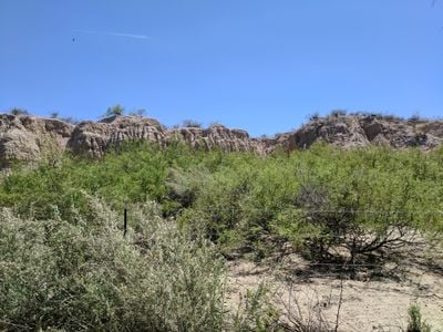
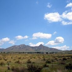
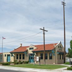
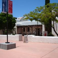
Mesilla Valley Bosque State Park is a protected natural area along the Rio Grande in New Mexico with riverside forests and wetland areas. The site features multiple trails for walking and exploring, along with a visitor center that shares information about the local environment.

This protected area was established in 2003 to safeguard the riverside forest along the Rio Grande for future generations. The site preserves a habitat that has been part of the regional landscape for centuries.

This place holds meaning for the community as a protected example of how the Rio Grande's natural edge can be preserved. Local organizations use the trails and grounds to teach visitors about the plants and animals that depend on riverside forests.

The trails are accessible during daylight hours and easy to walk, with information available at the entrance to help you navigate. There is parking for visitors and the center provides shelter if weather turns.

This place contains a research site for monitoring the Bosque ecosystem where scientists and students work together to study the riverlands. This partnership connects environmental protection with hands-on education.

The community of curious travelers

AroundUs brings together thousands of curated places, local tips, and hidden gems, enriched daily by 60,000 contributors worldwide.

Start exploring
Location
Inception
2003
GPS coordinates
32.31667,-106.75000
Latest update
December 14, 2025 11:05
Around this place
Aggie Memorial Stadium
United States of America

Aggie Memorial Stadium

4.2 km
Prehistoric Trackways National Monument
United States of America

Prehistoric Trackways National Monument

15.2 km
Fort Selden
United States of America

Fort Selden

24.5 km
Organ Needle
United States of America

Organ Needle

18 km
San Augustin Mountains
United States of America

San Augustin Mountains

21.4 km
Mesilla Plaza
United States of America

Mesilla Plaza

6.4 km
Rio Grande Theatre
United States of America

Rio Grande Theatre

2.7 km
Cathedral of the Immaculate Heart of Mary
United States of America

Cathedral of the Immaculate Heart of Mary

2.5 km
Thomas Branigan Memorial Library
United States of America

Thomas Branigan Memorial Library

2.7 km
Wells Fargo Tower
United States of America

Wells Fargo Tower

3 km
San Jose Church
United States of America

San Jose Church

22 km
Green Bridge
United States of America

Green Bridge

3.4 km
Goddard Hall
United States of America

Goddard Hall

3.9 km
Alameda-Depot Historic District
United States of America

Alameda-Depot Historic District

3.2 km
Phillips Chapel CME Church
United States of America

Phillips Chapel CME Church

2.2 km
Chope's Town Cafe and Bar
United States of America

Chope's Town Cafe and Bar

22.3 km
Foster Hall
United States of America

Foster Hall

3.9 km
Rio Grande Bridge at Radium Springs
United States of America

Rio Grande Bridge at Radium Springs

25.1 km
L.B. Bentley General Merchandise
United States of America

L.B. Bentley General Merchandise

18.9 km
Nason House
United States of America

Nason House

3.7 km
Barela-Reynolds House
United States of America

Barela-Reynolds House

6.4 km
Frank and Amelia Jones House
United States of America

Frank and Amelia Jones House

19.4 km
Hadley-Ludwick House
United States of America

Hadley-Ludwick House

3.9 km
Nestor Armijo House
United States of America

Nestor Armijo House

2.8 km
Dona Ana Village Historic District
United States of America

Dona Ana Village Historic District

10.1 km
Mesilla Park Historic District
United States of America

Mesilla Park Historic District

5.2 km
Old Doña Ana County Courthouse
United States of America

Old Doña Ana County Courthouse

3 km
Branigan Cultural Center
United States of America

Branigan Cultural Center

2.9 km
Show the full map
« Mesilla Valley Bosque State Park - State park in Doña Ana County, United States » is provided by Around Us (aroundus.com). Images and texts are derived from Wikimedia project under a Creative Commons license. You are allowed to copy, distribute, and modify copies of this page, under the conditions set by the license, as long as this note is clearly visible.

Discover hidden gems everywhere you go!

From secret cafés to breathtaking viewpoints, skip the crowded tourist spots and find places that match your style. Our app makes it easy with voice search, smart filtering, route optimization, and insider tips from travelers worldwide. Download now for the complete mobile experience.

Around Us App Screenshot

A unique approach to discovering new places

Le Figaro

All the places worth exploring

France Info

A tailor-made excursion in just a few clicks

20 Minutes

Around Us
Travel Guide & Maps
Download

Send to your phone

QR Code
1

Open the camera app on your mobile.

2

Point at the QR code with your camera. A notification will appear.

3

Tap the notification to open the link.