Enable Location

We need your location to show you interesting places around you

Discover nearby places

Find interesting locations and hidden gems around you

Precise directions

Get accurate directions and distances to places

Your location is never shared with other users. It's only used when you tap the location button.

Doña Ana County

Log in to your account

Start exploring — it's free

Trusted by 62,533 travelers worldwide

Continue with Google
Continue with Apple
or

We will send you a code to connect

By continuing, you accept our Terms and Conditions and our Privacy Policy

Check your inbox

We've sent a pincode in your inbox. Please enter the code below.

Doña Ana County, Administrative division in southern New Mexico, United States.

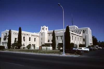
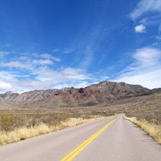
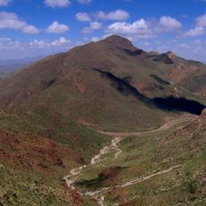
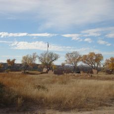
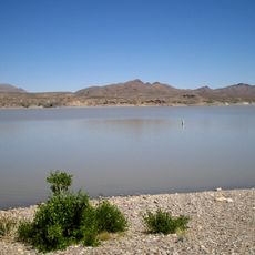
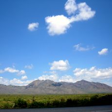
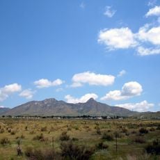
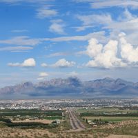
Doña Ana County is an administrative county in southern New Mexico that borders Texas. The landscape consists of desert, mountain ranges, and the Rio Grande running through it, with Las Cruces as its largest city.

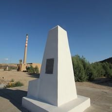
The county was established in 1852 and named after Ana Robledo, who died in the area during the Pueblo Revolt of 1680. The region later became an important trade route along the Rio Grande.

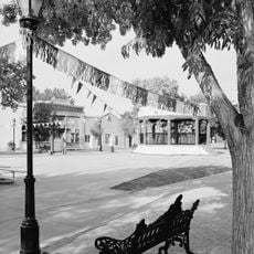
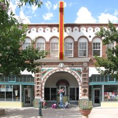
The area shows strong Hispanic roots through language, architecture, and daily traditions that shape community life. Residents celebrate festivals and maintain customs passed down through generations.

The best time to visit is fall and spring when temperatures are comfortable. Bring plenty of water and sun protection since the sun is intense in this desert region.

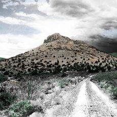
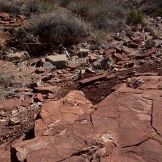
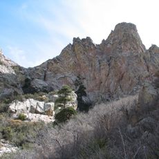
The Organ Mountains Desert Peaks National Monument on its land holds ancient prehistoric trackways left by dinosaurs and other animals. These footprints tell stories from millions of years of Earth's history.

The community of curious travelers

AroundUs brings together thousands of curated places, local tips, and hidden gems, enriched daily by 60,000 contributors worldwide.

Start exploring
Location
Inception
1852
Capital city
Las Cruces
Shares border with
Sierra County, El Paso County, Otero County, Luna County
GPS coordinates
32.31222,-106.77833
Latest update
December 17, 2025 08:35
Around this place
Star on the Mountain
United States of America

Star on the Mountain

65 km
Franklin Mountains State Park
United States of America

Franklin Mountains State Park

54.4 km
Aggie Memorial Stadium
United States of America

Aggie Memorial Stadium

5 km
Victorio Peak
United States of America

Victorio Peak

69.3 km
Kilbourne Hole
United States of America

Kilbourne Hole

41.7 km
United States of America

Wyler Aerial Tramway

62.8 km
Western Playland
United States of America

Western Playland

60.3 km
White Sands V-2 Launching Site
United States of America

White Sands V-2 Launching Site

38.9 km
North Franklin Mountain
United States of America

North Franklin Mountain

52.9 km
Prehistoric Trackways National Monument
United States of America

Prehistoric Trackways National Monument

13.1 km
Fort Selden
United States of America

Fort Selden

23.2 km
United States of America

Fort Fillmore

6.9 km
Caballo Lake
United States of America

Caballo Lake

83.8 km
Organ Needle
United States of America

Organ Needle

20.7 km
Wet N' Wild Waterworld
United States of America

Wet N' Wild Waterworld

40.2 km
Cohen Stadium
United States of America

Cohen Stadium

56.8 km
Caballo Lake State Park
United States of America

Caballo Lake State Park

89.8 km
United States of America

Aden Crater

37.7 km
San Andres National Wildlife Refuge
United States of America

San Andres National Wildlife Refuge

46.9 km
National Border Patrol Museum
United States of America

National Border Patrol Museum

55.1 km
O. T. Bassett Tower
United States of America

O. T. Bassett Tower

50.8 km
San Augustin Mountains
United States of America

San Augustin Mountains

23.9 km
United States of America

El Paso Holocaust Museum and Study Center

66.9 km
Mesilla Plaza
United States of America

Mesilla Plaza

4.5 km
El Paso Museum of Archaeology
United States of America

El Paso Museum of Archaeology

55.1 km
Rio Grande Theatre
United States of America

Rio Grande Theatre

183 m
International Boundary Marker No. 1, U.S. and Mexico
Mexico

International Boundary Marker No. 1, U.S. and Mexico

63.3 km
United States of America

Leasburg Dam State Park

24.6 km
Show the full map
Administrative divisions
« Doña Ana County - Administrative division in southern New Mexico, United States » is provided by Around Us (aroundus.com). Images and texts are derived from Wikimedia project under a Creative Commons license. You are allowed to copy, distribute, and modify copies of this page, under the conditions set by the license, as long as this note is clearly visible.

Discover hidden gems everywhere you go!

From secret cafés to breathtaking viewpoints, skip the crowded tourist spots and find places that match your style. Our app makes it easy with voice search, smart filtering, route optimization, and insider tips from travelers worldwide. Download now for the complete mobile experience.

Around Us App Screenshot

A unique approach to discovering new places

Le Figaro

All the places worth exploring

France Info

A tailor-made excursion in just a few clicks

20 Minutes

Around Us
Travel Guide & Maps
Download

Send to your phone

QR Code
1

Open the camera app on your mobile.

2

Point at the QR code with your camera. A notification will appear.

3

Tap the notification to open the link.