Enable Location

We need your location to show you interesting places around you

Discover nearby places

Find interesting locations and hidden gems around you

Precise directions

Get accurate directions and distances to places

Your location is never shared with other users. It's only used when you tap the location button.

Log in to your account

Start exploring — it's free

Trusted by 62,535 travelers worldwide

Continue with Google
Continue with Apple
or

We will send you a code to connect

By continuing, you accept our Terms and Conditions and our Privacy Policy

Check your inbox

We've sent a pincode in your inbox. Please enter the code below.

Fort Fillmore, Military outpost near Mesilla, United States.

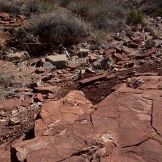
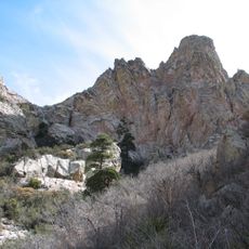
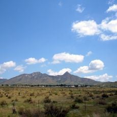
Fort Fillmore was a military outpost near Mesilla in southwestern New Mexico constructed with adobe walls and wooden posts. The installation sat on sand hills above the Rio Grande, positioned roughly one mile from the river.

Colonel Edwin Vose Sumner founded this outpost in 1851 to protect settlers and merchants traveling the route between El Paso and California. It served as a strategic position during the period of westward expansion in the mid-1800s.

The fort was built by military personnel working alongside local laborers who used traditional adobe brick methods common to the region. This building approach reflects how remote outposts adapted to available materials and local knowledge.

The site is located on Fort Fillmore Road about 2 kilometers east of New Mexico State Route 478 and marked with a state historical sign. Access is straightforward once you follow local road markers and signs to the location.

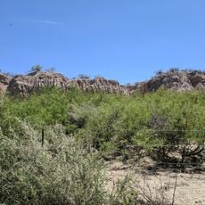
After its military use ended, plans to convert the site into a state park never materialized. Today the grounds are covered with a pecan tree grove, creating an unexpected green canopy in the otherwise dry landscape.

The community of curious travelers

AroundUs brings together thousands of curated places, local tips, and hidden gems, enriched daily by 60,000 contributors worldwide.

Start exploring
Location
GPS coordinates
32.25780,-106.74300
Latest update
December 11, 2025 11:01
Around this place
Aggie Memorial Stadium
United States of America

Aggie Memorial Stadium

2.4 km
Prehistoric Trackways National Monument
United States of America

Prehistoric Trackways National Monument

19.3 km
Organ Needle
United States of America

Organ Needle

19.6 km
San Augustin Mountains
United States of America

San Augustin Mountains

25.2 km
Mesilla Plaza
United States of America

Mesilla Plaza

5.3 km
Rio Grande Theatre
United States of America

Rio Grande Theatre

6.7 km
Mesilla Valley Bosque State Park
United States of America

Mesilla Valley Bosque State Park

6.6 km
Cathedral of the Immaculate Heart of Mary
United States of America

Cathedral of the Immaculate Heart of Mary

5.1 km
Thomas Branigan Memorial Library
United States of America

Thomas Branigan Memorial Library

7.3 km
Wells Fargo Tower
United States of America

Wells Fargo Tower

6.3 km
San Jose Church
United States of America

San Jose Church

15.4 km
Green Bridge
United States of America

Green Bridge

5 km
Goddard Hall
United States of America

Goddard Hall

2.8 km
Alameda-Depot Historic District
United States of America

Alameda-Depot Historic District

7.2 km
Mesilla Park Elementary School
United States of America

Mesilla Park Elementary School

3.1 km
Phillips Chapel CME Church
United States of America

Phillips Chapel CME Church

7 km
Chope's Town Cafe and Bar
United States of America

Chope's Town Cafe and Bar

15.8 km
Foster Hall
United States of America

Foster Hall

2.8 km
L.B. Bentley General Merchandise
United States of America

L.B. Bentley General Merchandise

23.3 km
Nason House
United States of America

Nason House

3.1 km
Barela-Reynolds House
United States of America

Barela-Reynolds House

5.2 km
Frank and Amelia Jones House
United States of America

Frank and Amelia Jones House

12.8 km
Hadley-Ludwick House
United States of America

Hadley-Ludwick House

3.3 km
Nestor Armijo House
United States of America

Nestor Armijo House

6.2 km
Dona Ana Village Historic District
United States of America

Dona Ana Village Historic District

16 km
Mesilla Park Historic District
United States of America

Mesilla Park Historic District

3.2 km
White Sands Missile Range Museum
United States of America

White Sands Missile Range Museum

28.7 km
Old Doña Ana County Courthouse
United States of America

Old Doña Ana County Courthouse

6.4 km
Show the full map
« Fort Fillmore - Military outpost near Mesilla, United States » is provided by Around Us (aroundus.com). Images and texts are derived from Wikimedia project under a Creative Commons license. You are allowed to copy, distribute, and modify copies of this page, under the conditions set by the license, as long as this note is clearly visible.

Discover hidden gems everywhere you go!

From secret cafés to breathtaking viewpoints, skip the crowded tourist spots and find places that match your style. Our app makes it easy with voice search, smart filtering, route optimization, and insider tips from travelers worldwide. Download now for the complete mobile experience.

Around Us App Screenshot

A unique approach to discovering new places

Le Figaro

All the places worth exploring

France Info

A tailor-made excursion in just a few clicks

20 Minutes

Around Us
Travel Guide & Maps
Download

Send to your phone

QR Code
1

Open the camera app on your mobile.

2

Point at the QR code with your camera. A notification will appear.

3

Tap the notification to open the link.