Victorio Peak

Log in to your account

AroundUs is a community-driven map of interesting places, built by curious explorers like you. It grows with every review, story, and photo you share.
Connect to save your favorite spots, contribute locations, and create personalized routes.
Continue with Google
Continue with Apple
Continue with X
Continue with Facebook
Continue with email
By continuing, you accept our Terms and Conditions and our Privacy Policy
Create an account
Add to collection
Map
Suggest a change
Share

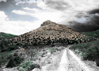
Victorio Peak, Mountain summit in San Andres Mountains, USA

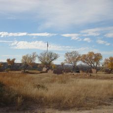
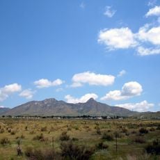
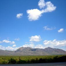
Victorio Peak is a mountain summit in the San Andres Mountains that rises prominently from the desert landscape of southern New Mexico. The peak displays steep rocky slopes and stands as a distinctive landmark in this arid, rugged terrain.

The peak served as a strategic location for Apache forces under Chief Victorio during the 1880s as they resisted American military campaigns. The mountain's natural position offered defensive advantages during this pivotal period in regional history.

The mountain bears the name of Mimbres Apache leader Chief Victorio, whose presence in this landscape remains part of local memory and identity. The surrounding terrain reflects a time when these lands witnessed resistance and conflict.

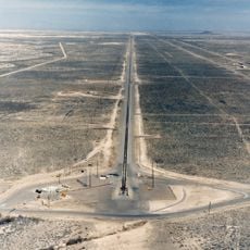
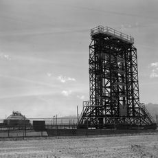
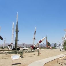
Access to the peak requires prior permission from White Sands Missile Range authorities, as the area falls under military control. Visitors should arrange this approval in advance and contact the relevant authorities before attempting to visit the region.

In the 1930s, a treasure hunter claimed to find gold and ancient artifacts hidden inside the mountain, attracting explorers for decades afterward. This story has kept the peak in public attention, though evidence of the discovery remains disputed.

Location: New Mexico

Elevation above the sea: 1,676.1 m

GPS coordinates: 32.92397,-106.64056

Latest update: December 7, 2025 20:50

Photos
Around this place
United States of America

Elephant Butte Reservoir

57.5 km
Holloman High Speed Test Track
United States of America

Holloman High Speed Test Track

46.1 km
Elephant Butte Dam
United States of America

Elephant Butte Dam

57.5 km
White Sands V-2 Launching Site
United States of America

White Sands V-2 Launching Site

63.2 km
Fort Selden
United States of America

Fort Selden

55.5 km
Elephant Butte Lake State Park
United States of America

Elephant Butte Lake State Park

61 km
United States of America

Truth or Consequences Hot Springs

61.7 km
Caballo Lake
United States of America

Caballo Lake

61.3 km
Alameda Park Zoo
United States of America

Alameda Park Zoo

63.6 km
Caballo Lake State Park
United States of America

Caballo Lake State Park

60.9 km
San Andres National Wildlife Refuge
United States of America

San Andres National Wildlife Refuge

28.9 km
San Augustin Mountains
United States of America

San Augustin Mountains

55.9 km
The Toy Train Depot
United States of America

The Toy Train Depot

63.5 km
Salinas Peak
United States of America

Salinas Peak

42.9 km
Alamogordo Museum of History
United States of America

Alamogordo Museum of History

63.5 km
Hot Springs Bathhouse and Commercial Historic District in Truth or Consequences
United States of America

Hot Springs Bathhouse and Commercial Historic District in Truth or Consequences

61.6 km
Carrie Tingley Hospital Historic District
United States of America

Carrie Tingley Hospital Historic District

61.9 km
Rio Grande Bridge at Radium Springs
United States of America

Rio Grande Bridge at Radium Springs

55.5 km
Elephant Butte Historic District
United States of America

Elephant Butte Historic District

56.9 km
L.B. Bentley General Merchandise
United States of America

L.B. Bentley General Merchandise

55.4 km
Tularosa Original Townsite District
United States of America

Tularosa Original Townsite District

60.6 km
Dona Ana Village Historic District
United States of America

Dona Ana Village Historic District

61.9 km
US Post Office-Truth or Consequences Main
United States of America

US Post Office-Truth or Consequences Main

61.6 km
White Sands Missile Range Museum
United States of America

White Sands Missile Range Museum

61.8 km
White Sands National Park Historic District
United States of America

White Sands National Park Historic District

46.7 km
Toy Train Depot
United States of America

Toy Train Depot

63.5 km
White Sands Visitor Center
United States of America

White Sands Visitor Center

46.6 km
Tularosa Basin Museum of History
United States of America

Tularosa Basin Museum of History

63.7 km
Show the full map
Reviews

Visited this place? Tap the stars to rate it and share your experience / photos with the community! Try now! You can cancel it anytime.

« Victorio Peak - Mountain summit in San Andres Mountains, USA » is provided by Around Us (aroundus.com). Images and texts are derived from Wikimedia project under a Creative Commons license. You are allowed to copy, distribute, and modify copies of this page, under the conditions set by the license, as long as this note is clearly visible.

Discover hidden gems everywhere you go!

From secret cafés to breathtaking viewpoints, skip the crowded tourist spots and find places that match your style. Our app makes it easy with voice search, smart filtering, route optimization, and insider tips from travelers worldwide. Download now for the complete mobile experience.

Around Us App Screenshot

A unique approach to discovering new places

Le Figaro

All the places worth exploring

France Info

A tailor-made excursion in just a few clicks

20 Minutes