Chest opened
+${chestReward.xp} XP
Explorer
NOUVEAU ×${chestReward.collectible.quantity}
tapez pour fermer

See the monuments around you in AR Open chests in the app

Around Us is built for your phone — point your camera at the streets and discover the monuments and places around you in augmented reality. Around Us is built for your phone — chests unlock when you walk, explore and capture nearby places.

•

Enable Location

We need your location to show you interesting places around you

Discover nearby places

Find interesting locations and hidden gems around you

Precise directions

Get accurate directions and distances to places

Your location is never shared with other users. It's only used when you tap the location button.

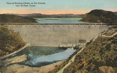
Elephant Butte Dam

Log in to your account

Start exploring — it's free

Trusted by 88,490 travelers worldwide

Continue with Google
Continue with Apple
or

We will send you a code to connect

By continuing, you accept our Terms and Conditions and our Privacy Policy

Check your inbox

We've sent a pincode in your inbox. Please enter the code below.

Discussion Reviews 1 Photos
9.1k Popularity

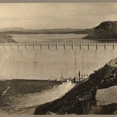
Elephant Butte Dam, Historic dam in Sierra County, United States.

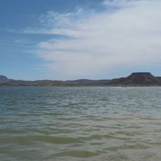
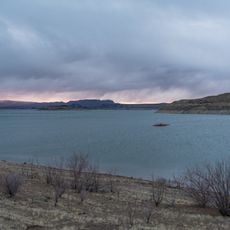
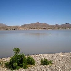
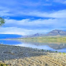
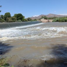
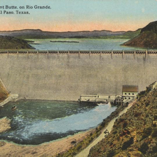
Elephant Butte Dam is a concrete structure spanning the Rio Grande that creates New Mexico's largest reservoir for irrigation and flood control purposes. The facility includes hydroelectric generation capabilities and recreational areas along the water's edge.

The U.S. Bureau of Reclamation built this concrete structure between 1911 and 1916 as a major advancement in regional water management. A hydroelectric facility was added later, expanding the structure's role in regional development.

The dam transformed how people lived and farmed across the region by providing reliable water supplies to agricultural areas. Today, visitors see how this infrastructure shaped community development and settlement patterns in southern New Mexico.

The site is easily accessible from Highway 51 and offers walking paths and observation areas around the reservoir. Plan for outdoor exploration in the desert environment where sun and heat are strong during most of the year.

The power plant was added in 1940, yet the spillway operated fully only three times across more than 80 years of operation. This rarity shows how dry the region typically is and how carefully water must be managed.

The community of curious travelers

AroundUs brings together thousands of curated places, local tips, and hidden gems, enriched daily by 60,000 contributors worldwide.
Start exploring
Location
GPS coordinates
33.15426,-107.19231
Latest update
September 17, 2026 00:26
Around this place
Elephant Butte Reservoir
United States of America

Elephant Butte Reservoir

4.2 mi
Elephant Butte Lake State Park
United States of America

Elephant Butte Lake State Park

6.8 mi
Truth or Consequences Hot Springs
United States of America

Truth or Consequences Hot Springs

3.8 mi
Caballo Lake
United States of America

Caballo Lake

16.9 mi
Caballo Lake State Park
United States of America

Caballo Lake State Park

12.2 mi
Percha Dam State Park
United States of America

Percha Dam State Park

20.9 mi
Hot Springs Bathhouse and Commercial Historic District in Truth or Consequences
United States of America

Hot Springs Bathhouse and Commercial Historic District in Truth or Consequences

4.1 mi
Carrie Tingley Hospital Historic District
United States of America

Carrie Tingley Hospital Historic District

4.5 mi
Percha Creek Bridge
United States of America

Percha Creek Bridge

29.1 mi
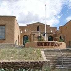
Elephant Butte Historic District
United States of America

Elephant Butte Historic District

0.4 mi
George Tambling Miller and Ninette Stocker Miller House
United States of America

George Tambling Miller and Ninette Stocker Miller House

27.2 mi
Hillsboro High School
United States of America

Hillsboro High School

27.1 mi
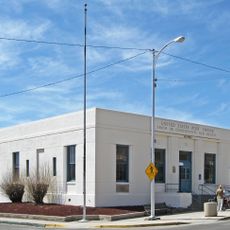
US Post Office-Truth or Consequences Main
United States of America

US Post Office-Truth or Consequences Main

3.9 mi
John M. Webster House
United States of America

John M. Webster House

27.3 mi
Will M. Robins House
United States of America

Will M. Robins House

27.3 mi
United States of America

Lions Beach

3 mi
United States of America

Palomas Gap

7.5 mi
United States of America

Spaceport America Visitor's Center

4 mi
United States of America

Long Point

5.6 mi
United States of America

Alamosa Ranch House and Blacksmith Shop Historic Site

10 mi
United States of America

Unknown Arch

8.9 mi
United States of America

Lions Beach

2.8 mi

Rattle Snake Beach

2.5 mi
United States of America

Sculpture

16.6 mi
United States of America

Sculpture

3 mi
United States of America

Scenic viewpoint

0.2 mi
United States of America

Garcia Falls

27.8 mi
United States of America

Monument featuring aircraft

7.2 mi
Show the full map
Reviews
Share your experience

No review yet

Discussions
Start a discussion...

No discussion yet

« Elephant Butte Dam - Historic dam in Sierra County, United States » is provided by Around Us (aroundus.com). Images and texts are derived from Wikimedia project under a Creative Commons license. You are allowed to copy, distribute, and modify copies of this page, under the conditions set by the license, as long as this note is clearly visible.

Discover hidden gems everywhere you go!

From secret cafés to breathtaking viewpoints, skip the crowded tourist spots and find places that match your style. Our app makes it easy with voice search, smart filtering, route optimization, and insider tips from travelers worldwide. Download now for the complete mobile experience.

Around Us App Screenshot
❝

A unique approach to discovering new places❞

— Le Figaro

❝

All the places worth exploring❞

— France Info

❝

A tailor-made excursion in just a few clicks❞

— 20 Minutes

Around Us
Travel Guide & Maps
Download

Send to your phone

QR Code
1

Open the camera app on your mobile.

2

Point at the QR code with your camera. A notification will appear.

3

Tap the notification to open the link.