Chichicastenango

Log in to your account

AroundUs is a community-driven map of interesting places, built by curious explorers like you. It grows with every review, story, and photo you share.
Connect to save your favorite spots, contribute locations, and create personalized routes.
Continue with Google
Continue with Apple
Continue with X
Continue with Facebook
Continue with email
By continuing, you accept our Terms and Conditions and our Privacy Policy
Create an account
Add to collection
Map
Suggest a change
Share

Chichicastenango, Indigenous ceremonial center in Quiché Department, Guatemala.

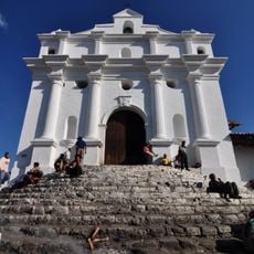
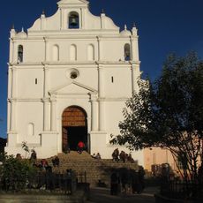
Chichicastenango is an administrative center in Quiché Department at 2,075 meters elevation, dominated by the Santo Tomás Church built on an ancient Maya temple platform. The central plaza is surrounded by traditional stone houses and narrow streets leading to the market.

The Santo Tomás Church was built at a Maya sacred site and is known as the location where Father Francisco Ximénez discovered the Popol Vuh, a sacred Maya text. This site thus connects both Spanish colonial history and the region's indigenous heritage.

On the church steps, local shamans perform ceremonies with incense and flower petals, blending Maya and Catholic traditions. These practices remain visible today and show how two belief systems coexist in daily life.

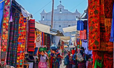
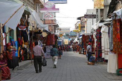
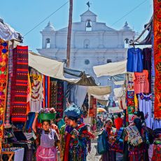
The central market is active on Thursdays and Sundays, with streets full of vendors selling textiles, masks, ceramics, and local goods. The best time to explore is early morning when it is less crowded and lighting is better for photographs.

The cemetery displays color-painted tombs where each section is painted in specific hues representing family lineages according to Maya tradition. This color-coding reveals genealogy and social structures of local communities at a glance.

Location: Quiché Department

Inception: 1872

Elevation above the sea: 2,075 m

Shares border with: Totonicapán, Santa Cruz del Quiché, Chiché, Chinique, Tecpán Guatemala, Sololá, Patzité, Concepción

Website: http://inforpressca.com/chichicastenango

GPS coordinates: 14.94421,-91.11053

Latest update: December 20, 2025 12:06

Photos
Reviews

Visited this place? Tap the stars to rate it and share your experience / photos with the community! Try now! You can cancel it anytime.

« Chichicastenango - Indigenous ceremonial center in Quiché Department, Guatemala » is provided by Around Us (aroundus.com). Images and texts are derived from Wikimedia project under a Creative Commons license. You are allowed to copy, distribute, and modify copies of this page, under the conditions set by the license, as long as this note is clearly visible.

Discover hidden gems everywhere you go!

From secret cafés to breathtaking viewpoints, skip the crowded tourist spots and find places that match your style. Our app makes it easy with voice search, smart filtering, route optimization, and insider tips from travelers worldwide. Download now for the complete mobile experience.

Around Us App Screenshot

A unique approach to discovering new places

Le Figaro

All the places worth exploring

France Info

A tailor-made excursion in just a few clicks

20 Minutes