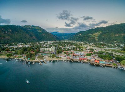
Panajachel, Gateway municipality on Lake Atitlán in Sololá Department, Guatemala.
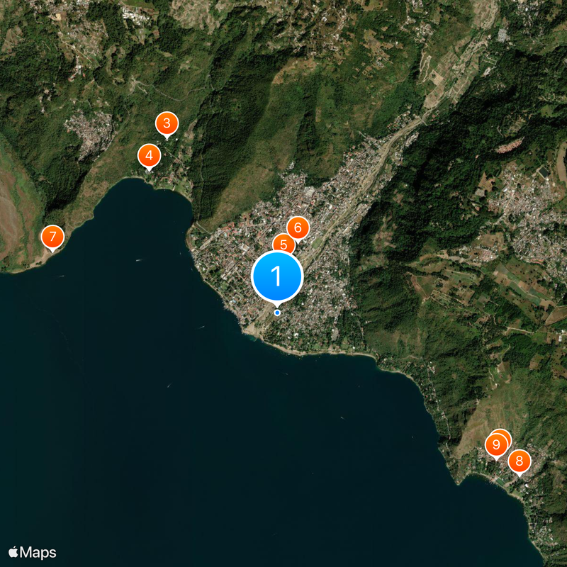
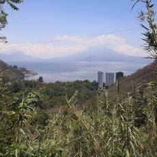
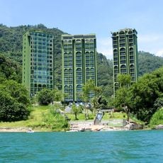
Panajachel sits on the northern shore of Lake Atitlán at 1,597 meters elevation, surrounded by three volcanoes and thick vegetation. The town spreads along the waterfront with residential areas, markets, and visitor facilities nestled in a wide valley.
The town grew from a pre-Hispanic settlement into an important trading center during the colonial period. It connected different indigenous communities around the lake and shaped the region's trade networks.
The markets showcase traditional Mayan textiles and crafts made by indigenous communities around the lake. You can speak directly with local artisans and see how they create their work using ancestral techniques.
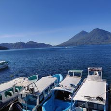
You can take shuttle buses from Guatemala City in about three hours or use regular boat services to reach other lake villages. Coming early in the day helps you see the markets in full activity and catch the best connections to other places.
The place serves as the primary commercial hub for the lake, where traditional Mayan vendors meet international travelers every day. This blend of local trading customs and global tourism shapes daily life and street activity here.
Location: Sololá Department
Elevation above the sea: 1,597 m
Shares border with: Lago de Atitlán, Sololá, San Andrés Semetabaj, Santa Catarina Palopó, Concepción
Website: https://municipalidaddepanajachel.gob.gt
GPS coordinates: 14.73605,-91.15584
Latest update: December 7, 2025 09:26
Volcán de Fuego
41.6 km
Santa María
42.7 km
Acatenango
39.8 km
Santiaguito
44.5 km
Volcán Atitlán
17.4 km
Almolonga
39.9 km
Volcán San Pedro
14.6 km
Volcán Tolimán
13.3 km
Pascual Abaj
22.8 km
Quetzaltenango Municipal Theatre
40.7 km
El Baúl
42.2 km
Chocolá
32.1 km
Estadio Mario Camposeco
40.6 km
Chimaltenango Central Park
37.2 km
Iglesia de Santo Tomás
23.4 km
Iximche
17.1 km
Holy Spirit Cathedral, Quetzaltenango
40.7 km
Quetzaltenango Guatemala Temple
43.1 km
Holy Cross Cathedral, Santa Cruz del Quiché
32.7 km
Chapel of the Conqueress of the Immaculate Conception
36.5 km
Minerva
42.4 km
Santa María Hydroelectric Dam
33.1 km
Museo Iximche
17.3 km
Chocolá, Suchitepéquez, Iglesia Católica
31.7 km
Museo el Baul
42.2 km
Canton Las Ruinas de Gumarkaaj
31.9 km
Chichicastenango Market
23.5 km
Mariposario Reserva De Atitlan
2 kmVisited this place? Tap the stars to rate it and share your experience / photos with the community! Try now! You can cancel it anytime.
Discover hidden gems everywhere you go!
From secret cafés to breathtaking viewpoints, skip the crowded tourist spots and find places that match your style. Our app makes it easy with voice search, smart filtering, route optimization, and insider tips from travelers worldwide. Download now for the complete mobile experience.
A unique approach to discovering new places❞
— Le Figaro
All the places worth exploring❞
— France Info
A tailor-made excursion in just a few clicks❞
— 20 Minutes