Jalapa Department, Administrative department in southeastern Guatemala.
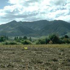
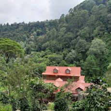
Jalapa Department covers varied terrain between 800 and 1720 meters (2,625 and 5,643 feet) in elevation, containing multiple municipalities like Mataquescuintla, Monjas, and San Pedro Pinula. The landscape shifts between mountain zones and valleys with different vegetation patterns.
After the Santa Marta earthquakes in 1773, officials considered moving Guatemala's capital to this area's valleys for its safer location. Water scarcity in the region ultimately made the plan unfeasible.
Local people farm coffee, corn, and tobacco using methods passed down through generations, shaping the rhythm of rural life here. These agricultural practices remain central to how communities identify themselves and sustain their families.
The departmental capital connects to Guatemala City via two main routes: one through Sanarate covering about 96 kilometers, and another through Jutiapa and Santa Rosa extending about 168 kilometers. Your choice of route depends on road conditions and available travel time.
The region contains several water bodies including the Colorado and Monjas rivers, plus hidden lakes like Laguna Escondida and Laguna del Hoyo. These natural formations shape the landscape and offer interesting discoveries for visitors exploring the area.
The community of curious travelers
AroundUs brings together thousands of curated places, local tips, and hidden gems, enriched daily by 60,000 contributors worldwide.