Chiquibul National Park, Nature reserve and national park in Cayo District, Belize
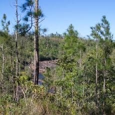
Chiquibul National Park is a protected nature reserve along the Guatemalan border that contains an extensive cave network with underground rivers. The landscape features dense tropical forest covering thousands of acres, with archaeological remains from Maya civilization scattered throughout.
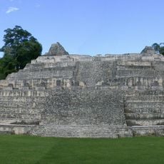
The protected area was established in 1995 to preserve the natural landscape and the archaeological site of Caracol. This Maya city was a major settlement that thrived for centuries before being abandoned around the 10th century.
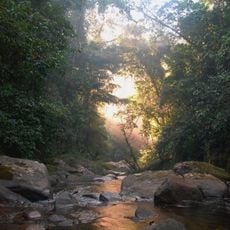
Local communities and researchers value this land for its living forests and water systems that sustain wildlife and plant life. The caves hold deep meaning as natural structures that shaped how people moved through and understood this region.
Visitors should prepare for uneven terrain, wet conditions, and limited marked trails since much of the area remains undeveloped and forested. Sturdy footwear and rain gear are essential for safe exploration of the landscape.
A significant portion of the underground river system flows toward Guatemala, making the park part of a landscape that spans political borders. This shows how natural water systems connect ecosystems across different countries.
The community of curious travelers
AroundUs brings together thousands of curated places, local tips, and hidden gems, enriched daily by 60,000 contributors worldwide.