Tumaco, Coastal municipality in Nariño Department, Colombia
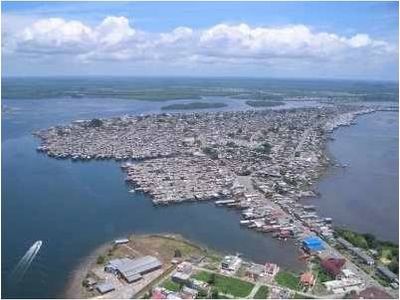
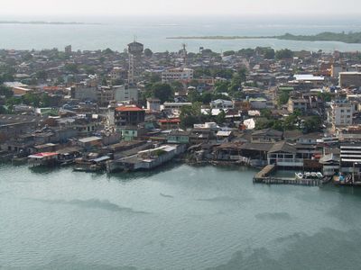
Tumaco is a coastal municipality in Nariño Department on Colombia's Pacific shore, spread across several islands and the adjacent mainland. Mangroves line channels and inlets, while wooden houses stand on stilts above the water and among palm groves.
The settlement began in the 17th century as a small colonial outpost and grew through trade in ivory, gold and timber. During the 20th century, the area developed into a major port for exporting agricultural products.
Local kitchens prepare dishes with coconut milk, plantains and fresh seafood that reflect African and Pacific traditions. Along the waterfront, fishermen mend nets by hand and women sell shrimp and crabs from baskets carried on their heads.
Small boats and canoes run regularly between islands, connecting residential areas with markets and docks. The hot and humid climate calls for light clothing and frequent breaks, especially during midday hours.
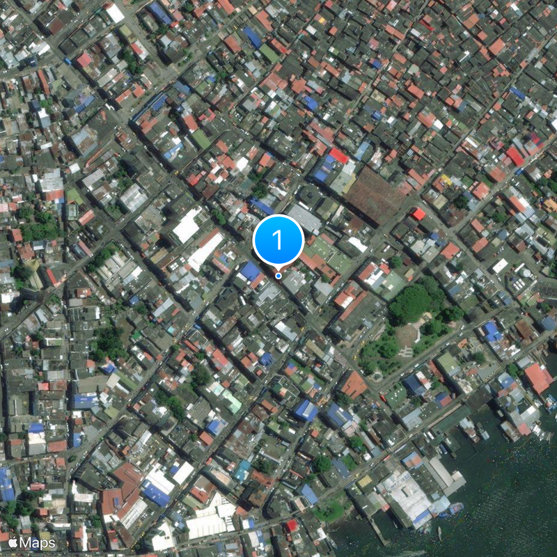
The entire old town sits on an island that becomes accessible only by narrow wooden walkways or boat at high tide. Many streets are actually channels where residents paddle canoes directly to their front doors.
Location: Nariño Department
Inception: November 30, 1640
Elevation above the sea: 2 m
Website: http://tumaco-narino.gov.co
GPS coordinates: 1.80667,-78.76472
Latest update: December 4, 2025 23:03
Las Lajas Sanctuary
172.1 km
Galeras
169.5 km
El Ángel Ecological Reserve
151.2 km
Cuicocha
173.5 km
Chiles volcano
143.6 km
Cumbal
136.1 km
Volcán Azufral
141.4 km
Estadio Departamental Libertad
178.8 km
Manglares Cayapas-Mataje Ecological Reserve
59.6 km
Cotacachi Cayapas Ecological Reserve
135.4 km
Cotacachi Volcano
167.5 km
Cultural Complex Fabrica Imbabura
176.3 km
Sanquianga National Natural Park
107.9 km
Imbabura UNESCO Global Geopark
176.3 km
Unidad Educativa "Bolívar"
161.1 km
Laguna Verde (Nariño)
141.7 km
Sagrado Corazón, Pasto
177.9 km
Cerro Morazurco
179.8 km
Playa de Súa
162.1 km
Nuestra Señora de la Merced
178.2 km
Santiago
177.8 km
Cristo Rey
178.2 km
San Felipe Neri
178 km
San Andrés
177.6 km
Gorgona Island National Park
144.7 km
Galeras Fauna and Flora Sanctuary
168.5 km
Registraduría Nacional Del Estado Civil
166.5 km
Parque Infantil
177.5 kmReviews
Visited this place? Tap the stars to rate it and share your experience / photos with the community! Try now! You can cancel it anytime.
Discover hidden gems everywhere you go!
From secret cafés to breathtaking viewpoints, skip the crowded tourist spots and find places that match your style. Our app makes it easy with voice search, smart filtering, route optimization, and insider tips from travelers worldwide. Download now for the complete mobile experience.
A unique approach to discovering new places❞
— Le Figaro
All the places worth exploring❞
— France Info
A tailor-made excursion in just a few clicks❞
— 20 Minutes