Nariño Department, Administrative department in southwestern Colombia
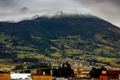
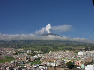
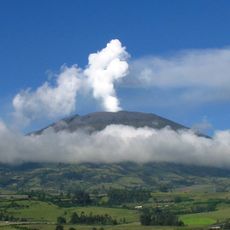
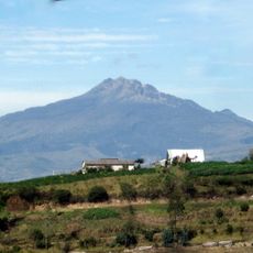
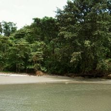
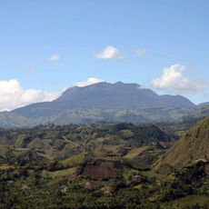
Nariño is an administrative department in southwestern Colombia that stretches from the Pacific coast to the Andean mountain range, covering both lowland shores and volcanic plateaus. The capital city Pasto sits within the highlands, while Tumaco on the coast serves as a key port.
The region was named after Antonio Nariño, a key figure in Colombia's independence movement, in the early 20th century. Indigenous groups such as the Quillacingas and Awá lived here long before Spanish arrival.
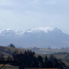
The population of 1.6 million residents concentrates in the volcanic Andean highlands, maintaining agricultural traditions of wheat, barley, and potato cultivation.
The Pan-American Highway links Pasto with coastal Tumaco and border town Ipiales, making travel between highlands and lowlands more straightforward. Visitors should be ready for changing elevations, as climate and scenery shift quickly.
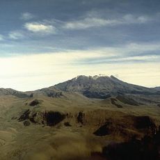
The highland plateau near Túquerres and Ipiales sits right on the Ecuadorian border and is separated from Pasto by the deep valley of the Guáitara River. This natural cut shapes the region's terrain and divides it into two contrasting zones.
Location: Colombia
Inception: 1904
Capital city: Pasto
Elevation above the sea: 496 m
Shares border with: Cauca Department, Putumayo Department, Sucumbíos Province, Carchi Province, Esmeraldas Province
Website: http://gobernar.gov.co
GPS coordinates: 1.60000,-77.86667
Latest update: December 4, 2025 19:04
Las Lajas Sanctuary
93.8 km
Galeras
70.5 km
El Ángel Ecological Reserve
94.1 km
Chiles volcano
87.5 km
Cumbal
71.8 km
Volcán Azufral
59.6 km
La Corota Island Flora Sanctuary
95.4 km
Estadio Departamental Libertad
79.4 km
Manglares Cayapas-Mataje Ecological Reserve
122.9 km
Cotacachi Cayapas Ecological Reserve
143.7 km
Doña Juana
104.2 km
Sanquianga National Natural Park
125.8 km
Doña Juana-Cascabel Volcanic Complex
117.8 km
Unidad Educativa "Bolívar"
88.5 km
Laguna Verde (Nariño)
59.9 km
Sagrado Corazón, Pasto
78.1 km
Cerro Morazurco
78.7 km
Petacas
112.4 km
Nuestra Señora de la Merced
78.5 km
Santiago
78.2 km
Cristo Rey
78.4 km
San Felipe Neri
78.2 km
Brigada 27 Mocoa
144.9 km
San Andrés
77.8 km
Galeras Fauna and Flora Sanctuary
70.1 km
Torres de Santa Lucia
100.5 km
Registraduría Nacional Del Estado Civil
90 km
Parque Infantil
77.7 kmVisited this place? Tap the stars to rate it and share your experience / photos with the community! Try now! You can cancel it anytime.
Discover hidden gems everywhere you go!
From secret cafés to breathtaking viewpoints, skip the crowded tourist spots and find places that match your style. Our app makes it easy with voice search, smart filtering, route optimization, and insider tips from travelers worldwide. Download now for the complete mobile experience.
A unique approach to discovering new places❞
— Le Figaro
All the places worth exploring❞
— France Info
A tailor-made excursion in just a few clicks❞
— 20 Minutes