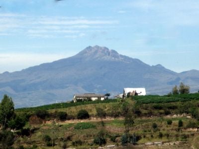
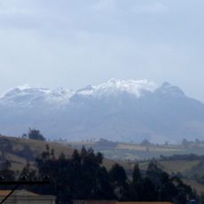
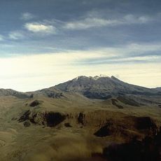
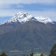
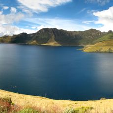
Chiles volcano, Stratovolcano at Colombia-Ecuador border.
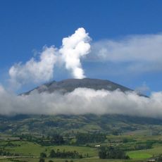
Chiles volcano sits at the Colombia-Ecuador border and forms part of a larger volcanic complex with Cerro Negro. The mountain displays steep slopes and shows clear signs of ongoing volcanic activity through vents and gas emissions.
During the 1800s, the volcano displayed intense fumarolic activity with stronger episodes recorded between 1860 and 1869. These events made it a notable phenomenon that residents of the region closely observed.
The indigenous Pastos people have maintained deep ties to this volcanic landscape for centuries through their settlements and land use. Their presence continues to shape the daily rhythm and character of the border region today.
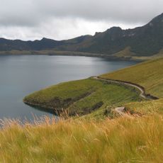
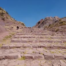
The dry season offers the best conditions for visiting, with more accessible trails and clearer visibility. Reaching the summit demands good physical fitness and preparation for high altitude and changing weather.
The mountain hosts natural thermal springs and sulfur vents on both the Colombian and Ecuadorian sides. These geothermal features occasionally draw visitors who want to experience the warm mineral waters.
Location: Carchi Province
Location: Nariño Department
Elevation above the sea: 4,723 m
Part of: Chiles-Cerro Negro
GPS coordinates: 0.81695,-77.93725
Latest update: December 7, 2025 19:30
Las Lajas Sanctuary
39.1 km
Galeras
78.6 km
El Ángel Ecological Reserve
7.8 km
Cayambe Coca National Park
86.7 km
Cuicocha
74.5 km
Cumbal
16.4 km
Volcán Azufral
38.6 km
Estadio Departamental Libertad
84.8 km
Imbabura Volcano
68.2 km
Cotacachi Cayapas Ecological Reserve
85.8 km
Cotacachi Volcano
68.4 km
Cultural Complex Fabrica Imbabura
63.1 km
Imbabura UNESCO Global Geopark
60.4 km
Mojanda
86.5 km
Lagunas de mojanda
83.8 km
Unidad Educativa "Bolívar"
25.9 km
Laguna Verde
38.5 km
Sagrado Corazón, Pasto
85.6 km
Nuestra Señora de la Merced
85.5 km
Santiago
85.1 km
Cristo Rey
85.8 km
San Felipe Neri
85.5 km
San Andrés
85.5 km
Galeras Fauna and Flora Sanctuary
76.2 km
Torres de Santa Lucia
87.2 km
Registraduría Nacional Del Estado Civil
33.6 km
Parque Infantil
85.7 km
Qhapaq Ñan, Andean Road System
31.6 kmVisited this place? Tap the stars to rate it and share your experience / photos with the community! Try now! You can cancel it anytime.
Discover hidden gems everywhere you go!
From secret cafés to breathtaking viewpoints, skip the crowded tourist spots and find places that match your style. Our app makes it easy with voice search, smart filtering, route optimization, and insider tips from travelers worldwide. Download now for the complete mobile experience.
A unique approach to discovering new places❞
— Le Figaro
All the places worth exploring❞
— France Info
A tailor-made excursion in just a few clicks❞
— 20 Minutes