Enable Location

We need your location to show you interesting places around you

Discover nearby places

Find interesting locations and hidden gems around you

Precise directions

Get accurate directions and distances to places

Your location is never shared with other users. It's only used when you tap the location button.

Guatapé

Log in to your account

Start exploring — it's free

Trusted by 62,407 travelers worldwide

Continue with Google
Continue with Apple
or

We will send you a code to connect

By continuing, you accept our Terms and Conditions and our Privacy Policy

Check your inbox

We've sent a pincode in your inbox. Please enter the code below.

Guatapé, Lakeside municipality in Eastern Antioquia, Colombia

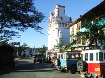
Guatapé is a municipality in Eastern Antioquia, Colombia, located on the shores of an artificial reservoir. The streets rise and fall along the hillsides, while colorful houses cluster around a central plaza and lead into narrow lanes.

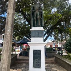
The settlement began in 1811 under the leadership of Francisco Giraldo y Jimenez and received municipality status in 1867. The name honors a native cacique who once lived in this region.

The painted baseboards on buildings depict scenes from daily routines, including coffee farming, fishing and traditional crafts. Each house tells a small story through its own motifs about the family or trade located there.

Buses leave regularly from Medellín Terminal Norte and take about two hours to cover the 79 kilometer route. The streets in town are steep and paved, so comfortable footwear is advisable.

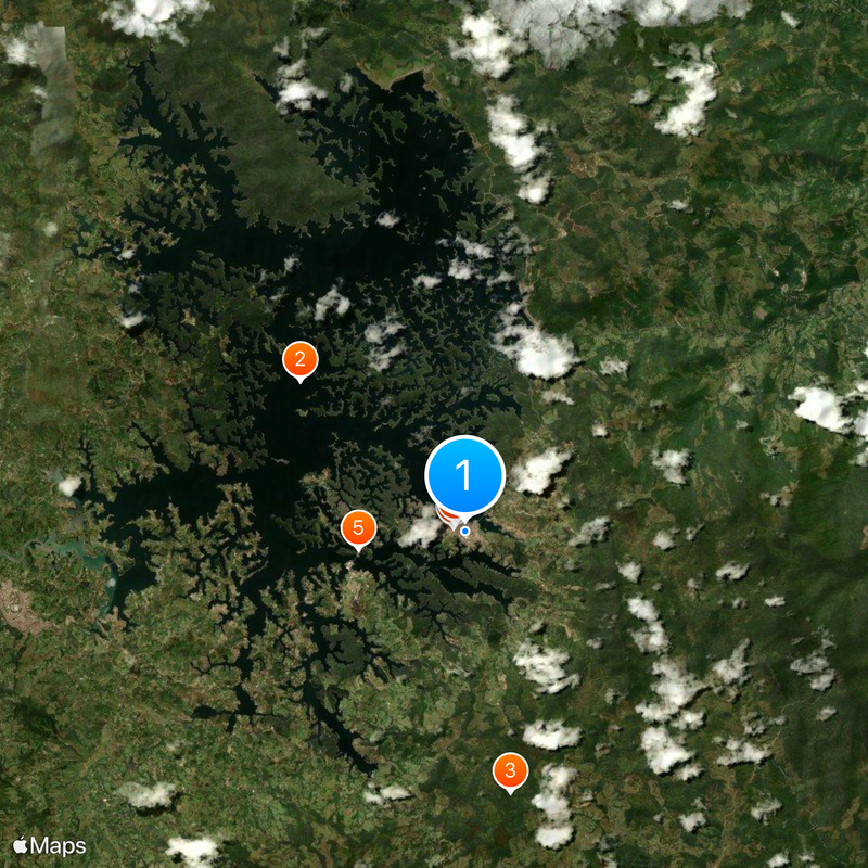
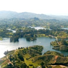
A massive rock formation rises 200 meters (656 feet) above the surrounding terrain and carries 740 steps carved into its surface. From the top, visitors see the branching network of the reservoir, which consists of several interconnected arms.

The community of curious travelers

AroundUs brings together thousands of curated places, local tips, and hidden gems, enriched daily by 60,000 contributors worldwide.

Start exploring
Location
Eastern Antioquia
Location
Inception
1811
Elevation above the sea
1,890 m
GPS coordinates
6.23250,-75.15861
Latest update
December 13, 2025 17:15
« Guatapé - Lakeside municipality in Eastern Antioquia, Colombia » is provided by Around Us (aroundus.com). Images and texts are derived from Wikimedia project under a Creative Commons license. You are allowed to copy, distribute, and modify copies of this page, under the conditions set by the license, as long as this note is clearly visible.

Discover hidden gems everywhere you go!

From secret cafés to breathtaking viewpoints, skip the crowded tourist spots and find places that match your style. Our app makes it easy with voice search, smart filtering, route optimization, and insider tips from travelers worldwide. Download now for the complete mobile experience.

Around Us App Screenshot

A unique approach to discovering new places

Le Figaro

All the places worth exploring

France Info

A tailor-made excursion in just a few clicks

20 Minutes

Around Us
Travel Guide & Maps
Download

Send to your phone

QR Code
1

Open the camera app on your mobile.

2

Point at the QR code with your camera. A notification will appear.

3

Tap the notification to open the link.