Arikok National Park, National park in Aruba.
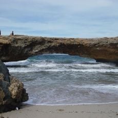
Arikok National Park covers 7,907 acres (32 km²) in northeastern Aruba, about 20% of the island. It contains the Arikok and Jamanota hills, at 176 and 188 metres the island's highest, plus volcanic lava and quartz-diorite rock, limestone terraces, and the white dunes of Boca Prins and Dos Playa.
Plans for a national park in the Arikok-Jamanota area date from 1980, and a 1995 government plan with the Nature Protection Regulation set the framework. The Nature and Landscape Structure Memorandum followed in 1996, a management policy document in 1997, and the park was officially established by Ministerial Order in 2000. In 2003 it became a foundation, now the Aruba Conservation Foundation.
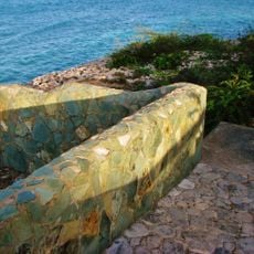
The park's name comes from Arie Kok, a Dutch settler who kept a small plantation and lived in a cunucu house here, as a map of 1827 suggests. The restored farmstead Cunucu Arikok keeps that name and recalls Aruba's smallholder agriculture, with cactus hedges and stone walls built to keep goats, sheep and donkeys out.
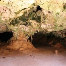
The park is split into three zones, two of them "quiet" zones with very limited human influence and one with more activity. The highest hills of Aruba lie inside it: Jamanota at 188 m and Arikok at 176 m. Fontein Cave can only be entered on guided tours with park staff, as it is gated and locked.
The park's name comes from Arie Kok, a Dutch settler who kept a small plantation and lived in a cunucu house here, as suggested by an 1827 map. His adobe cas di torto still stands in the reserve, restored, and the wild garden around it once carried nameplates for common Aruban plants.
The community of curious travelers
AroundUs brings together thousands of curated places, local tips, and hidden gems, enriched daily by 93,848 contributors worldwide.