Enable Location

We need your location to show you interesting places around you

Discover nearby places

Find interesting locations and hidden gems around you

Precise directions

Get accurate directions and distances to places

Your location is never shared with other users. It's only used when you tap the location button.

Tamasopo

Log in to your account

Start exploring — it's free

Trusted by 63,388 travelers worldwide

Continue with Google
Continue with Apple
or

We will send you a code to connect

By continuing, you accept our Terms and Conditions and our Privacy Policy

Check your inbox

We've sent a pincode in your inbox. Please enter the code below.

Discussion Reviews 2 Photos
21.8k Popularity

Tamasopo, Municipality in San Luis Potosi, Mexico

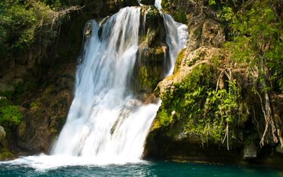
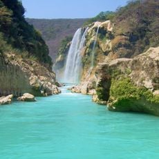
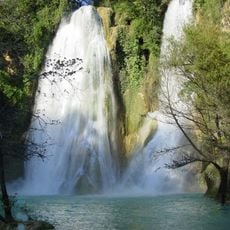
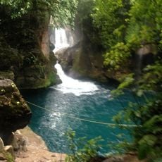
Tamasopo is a municipality in the Sierra Madre Oriental, spanning mountainous terrain with steep slopes and forested ridges. The landscape is defined by river systems that carve waterfalls and natural pools throughout the area, most notably the El Puente de Dios waterfall complex.

The area was originally known as La Palma until its name changed to Tamasopo in 1932, with the name derived from the Nahuatl language. This administrative shift reflected growing recognition of the region's indigenous heritage and its abundant water resources.

The Huasteca and Pame peoples have deep roots here, and their languages and traditions remain woven into how locals live and interact with their surroundings. Walking through the region, you notice these cultural influences in everyday habits and the way people relate to the land.

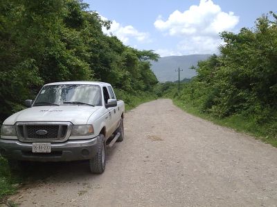
The terrain is mountainous and visitors should prepare for uneven paths and wet conditions, especially when exploring waterfall areas. The best time to visit is during the dry season, when trails are easier to navigate and water levels are more manageable.

The name Tamasopo derives from Nahuatl and essentially means "place of flowing water," which is a surprisingly precise description of this water-rich area. This explains why the region hosts so many natural water basins and cascading features.

The community of curious travelers

AroundUs brings together thousands of curated places, local tips, and hidden gems, enriched daily by 60,000 contributors worldwide.

Start exploring
Location
Capital city
Tamasopo
Elevation above the sea
721 m
GPS coordinates
21.92250,-99.39250
Latest update
December 22, 2025 18:27
Reviews
Share your experience

No review yet

Discussions
Start a discussion...

No discussion yet

« Tamasopo - Municipality in San Luis Potosi, Mexico » is provided by Around Us (aroundus.com). Images and texts are derived from Wikimedia project under a Creative Commons license. You are allowed to copy, distribute, and modify copies of this page, under the conditions set by the license, as long as this note is clearly visible.

Discover hidden gems everywhere you go!

From secret cafés to breathtaking viewpoints, skip the crowded tourist spots and find places that match your style. Our app makes it easy with voice search, smart filtering, route optimization, and insider tips from travelers worldwide. Download now for the complete mobile experience.

Around Us App Screenshot

A unique approach to discovering new places

Le Figaro

All the places worth exploring

France Info

A tailor-made excursion in just a few clicks

20 Minutes

Around Us
Travel Guide & Maps
Download

Send to your phone

QR Code
1

Open the camera app on your mobile.

2

Point at the QR code with your camera. A notification will appear.

3

Tap the notification to open the link.