Enable Location

We need your location to show you interesting places around you

Discover nearby places

Find interesting locations and hidden gems around you

Precise directions

Get accurate directions and distances to places

Your location is never shared with other users. It's only used when you tap the location button.

Mission

Log in to your account

Join the adventure

Create your free account and start exploring (like 60k+ others)

We will send you a code to connect

or
Continue with Google
Continue with Apple
By continuing, you accept our Terms and Conditions and our Privacy Policy

Check your inbox

We've sent a pincode in your inbox. Please enter the code below.

Mission, Metropolitan city in South Texas, United States.

Description

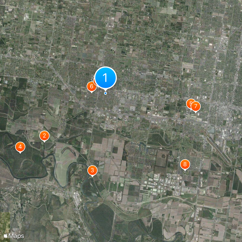
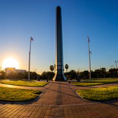
Mission is a town in southern Texas near the Mexico border, where residential neighborhoods alternate with agricultural fields and low buildings shape the skyline. The two main traffic corridors, Interstate 2 and US Route 83, run through the center and link the place to neighboring communities in the Rio Grande Valley.

History

The founding took place in 1907, when two investors started a settlement project based initially on farming and trade. Three years later, the place was officially declared a town, while farmers began growing citrus fruit and let the community expand.

Culture

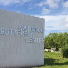
In the southern part of town, Shary Plantation stands as the place where red grapefruit was first cultivated and visitors can still see the roots of this variety. Along the main streets, murals and sculptures remind passersby of the link between residents and the citrus industry that shaped everyday life for decades.

Practical

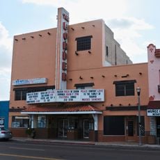
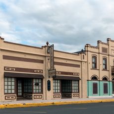
Visitors can walk along the business streets in the center, where local shops and restaurants show daily life in the area. During summer, heat can become intense, so earlier or later hours in the day make for a more comfortable stroll through the neighborhood.

Did you know?

A small collection of red grapefruit specimens still grows on part of the original plantation, where the fruit was first noticed in the early 20th century. Few visitors know that a mutation was discovered here that changed citrus farming worldwide.

Location
Inception
1910
Elevation above the sea
43 m
GPS coordinates
26.21139,-98.32111
Latest update
December 13, 2025 19:37

AroundUs brings together thousands of curated places, local tips, and hidden gems, enriched daily by 60,000 contributors worldwide. Discover all places nearby (Hidalgo County).

Around this place
National Butterfly Center
United States of America

National Butterfly Center

5.6 km
La Lomita Chapel
United States of America

La Lomita Chapel

6 km
Bentsen-Rio Grande Valley State Park
United States of America

Bentsen-Rio Grande Valley State Park

7.5 km
McAllen Convention Center
United States of America

McAllen Convention Center

6.3 km
First Lift Station
United States of America

First Lift Station

991 m
Veterans War Memorial of Texas
United States of America

Veterans War Memorial of Texas

6.6 km
United States of America

Sam Houston Elementary School

8 km
Border Theater
United States of America

Border Theater

709 m
Mcallen public pool
United States of America

Mcallen public pool

8.5 km
United States of America

Our Lady of Guadalupe Catholic Church

599 m
Rio Theater
United States of America

Rio Theater

582 m
United States of America

Cine El Rey Theatre

8.4 km
United States of America

Rotary Park

645 m
United States of America

Jaycee Park

2.1 km
United States of America

Oblate Park Historic District

812 m
United States of America

Mission Historical Museum

516 m
United States of America

Gregg Wood Home

1.1 km
United States of America

Roosevelt School Auditorium and Classroom Addition

346 m
La Lomita Historic District
United States of America

La Lomita Historic District

6.4 km
United States of America

Río Theatre

432 m
United States of America

Southern Pacific Depot

8.2 km
United States of America

D. Guerra & Sons Store

8.3 km
United States of America

Teatro La Paz

390 m
United States of America

Lomita Boulevard Commercial Historic District

526 m
United States of America

Adobe Wells Golf Course

5.9 km
United States of America

Shary Municipal Golf Course

1.5 km
United States of America

Hawk observation deck

7.6 km
United States of America

R&N Thrift

7.1 km
Show the full map
« Mission - Metropolitan city in South Texas, United States » is provided by Around Us (aroundus.com). Images and texts are derived from Wikimedia project under a Creative Commons license. You are allowed to copy, distribute, and modify copies of this page, under the conditions set by the license, as long as this note is clearly visible.

Discover hidden gems everywhere you go!

From secret cafés to breathtaking viewpoints, skip the crowded tourist spots and find places that match your style. Our app makes it easy with voice search, smart filtering, route optimization, and insider tips from travelers worldwide. Download now for the complete mobile experience.

Around Us App Screenshot

A unique approach to discovering new places

Le Figaro

All the places worth exploring

France Info

A tailor-made excursion in just a few clicks

20 Minutes

Around Us
Travel Guide & Maps
Download

Send to your phone

QR Code
1

Open the camera app on your mobile.

2

Point at the QR code with your camera. A notification will appear.

3

Tap the notification to open the link.