Enable Location

We need your location to show you interesting places around you

Discover nearby places

Find interesting locations and hidden gems around you

Precise directions

Get accurate directions and distances to places

Your location is never shared with other users. It's only used when you tap the location button.

Mitchell County

Log in to your account

Start exploring — it's free

Trusted by 62,486 travelers worldwide

Continue with Google
Continue with Apple
or

We will send you a code to connect

By continuing, you accept our Terms and Conditions and our Privacy Policy

Check your inbox

We've sent a pincode in your inbox. Please enter the code below.

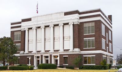
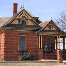
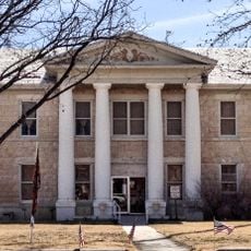
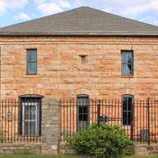
Mitchell County, County administration center in Bakersville, North Carolina, US.

Mitchell County is an administrative division in North Carolina with its county seat in Bakersville, where local government services operate. The area includes several towns, most notably Spruce Pine, a community built around mineral extraction and geology.

The county formed in 1861 from parts of five neighboring counties to manage the growing mountain region's population. It was named after Elisha Mitchell, a geography professor at the University of North Carolina who had ties to the area.

The yearly North Carolina Mineral and Gem Festival shows how mining has shaped life in this region for generations. You can see how minerals and gems remain part of what people here value and celebrate.

Visitors can reach the administrative offices in Bakersville, which sit in a central location with good road access. The terrain is hilly throughout the area, so a car is helpful for exploring the different towns and natural areas.

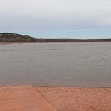
The area holds the world's largest natural rhododendron garden, located in the mountains near the Tennessee border where these flowers grow wild. Visitors often overlook this botanical wonder, finding colorful blooms throughout the hillsides in spring and early summer.

The community of curious travelers

AroundUs brings together thousands of curated places, local tips, and hidden gems, enriched daily by 60,000 contributors worldwide.

Start exploring
GPS coordinates
32.28980,-100.92130
Latest update
December 10, 2025 15:53
Around this place
Fort Chadbourne
United States of America

Fort Chadbourne

69.8 km
Settles Hotel
United States of America

Settles Hotel

52.3 km
Abilene State Park
United States of America

Abilene State Park

98.2 km
E.V. Spence Reservoir
United States of America

E.V. Spence Reservoir

55.9 km
Big Spring State Park
United States of America

Big Spring State Park

54 km
Foster Communications Coliseum
United States of America

Foster Communications Coliseum

97.5 km
Potton-Hayden House
United States of America

Potton-Hayden House

52.7 km
Lake Abilene
United States of America

Lake Abilene

96.6 km
Glasscock County Courthouse
United States of America

Glasscock County Courthouse

70.9 km
Mitchell County Courthouse
United States of America

Mitchell County Courthouse

12.2 km
Hangar 25 Air Museum
United States of America

Hangar 25 Air Museum

56.1 km
Scott-Majors House
United States of America

Scott-Majors House

12.5 km
Old Kent County Jail
United States of America

Old Kent County Jail

99 km
Buffalo Gap Historic Village
United States of America

Buffalo Gap Historic Village

103 km
Sterling County Courthouse
United States of America

Sterling County Courthouse

50.9 km
Lance Theatre
United States of America

Lance Theatre

73.3 km
Ritz Theater
United States of America

Ritz Theater

47.5 km
Nolan County Courthouse
United States of America

Nolan County Courthouse

52.3 km
Coke County Courthhouse
United States of America

Coke County Courthhouse

60.3 km
First National Bank Building
United States of America

First National Bank Building

52.2 km
Texas Theater
United States of America

Texas Theater

74 km
Scurry County Courthouse
United States of America

Scurry County Courthouse

47.5 km
Sweetwater Commercial Historic District
United States of America

Sweetwater Commercial Historic District

52.2 km
Borden County Jail
United States of America

Borden County Jail

72.6 km
Old Taylor County Courthouse and Jail
United States of America

Old Taylor County Courthouse and Jail

102.9 km
Old Kent County Courthouse
United States of America

Old Kent County Courthouse

98.9 km
118th District State Court
United States of America

118th District State Court

52.6 km
Veterans Administration Hospital
United States of America

Veterans Administration Hospital

52.2 km
Show the full map
« Mitchell County - County administration center in Bakersville, North Carolina, US » is provided by Around Us (aroundus.com). Images and texts are derived from Wikimedia project under a Creative Commons license. You are allowed to copy, distribute, and modify copies of this page, under the conditions set by the license, as long as this note is clearly visible.

Discover hidden gems everywhere you go!

From secret cafés to breathtaking viewpoints, skip the crowded tourist spots and find places that match your style. Our app makes it easy with voice search, smart filtering, route optimization, and insider tips from travelers worldwide. Download now for the complete mobile experience.

Around Us App Screenshot

A unique approach to discovering new places

Le Figaro

All the places worth exploring

France Info

A tailor-made excursion in just a few clicks

20 Minutes

Around Us
Travel Guide & Maps
Download

Send to your phone

QR Code
1

Open the camera app on your mobile.

2

Point at the QR code with your camera. A notification will appear.

3

Tap the notification to open the link.