Enable Location

We need your location to show you interesting places around you

Discover nearby places

Find interesting locations and hidden gems around you

Precise directions

Get accurate directions and distances to places

Your location is never shared with other users. It's only used when you tap the location button.

Stonewall County

Log in to your account

Start exploring — it's free

Trusted by 62,491 travelers worldwide

Continue with Google
Continue with Apple
or

We will send you a code to connect

By continuing, you accept our Terms and Conditions and our Privacy Policy

Check your inbox

We've sent a pincode in your inbox. Please enter the code below.

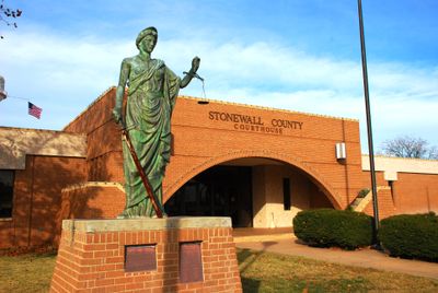
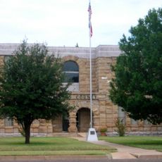
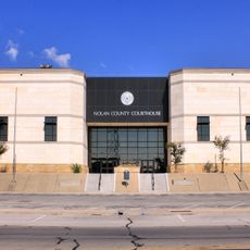
Stonewall County, Administrative division in Texas, United States.

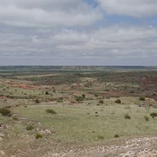
Stonewall County is an administrative division spanning roughly 920 square miles (2,382 square kilometers) across central Texas. The region contains small communities and is crossed by major highways that connect the rural landscape to surrounding areas.

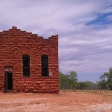
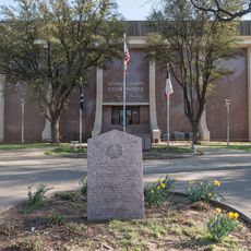
The area was established in 1876 and organized in 1888, taking its name from Confederate General Stonewall Jackson. This timing placed it within the broader era of settling the Texas frontier and building rural communities.

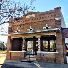
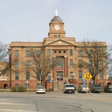
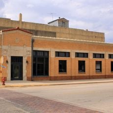
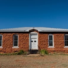
The people here build their lives around ranching and farming, activities that shape daily routines and how communities come together. These practices remain central to local identity and help neighbors connect across the sparse landscape.

Three major highways cross the territory and connect the scattered communities with each other and neighboring regions. Visitors should expect longer distances between towns and limited services in remote areas.

Two rivers, the Double Mountain Fork and the Salt Fork, meet within the county to form the Brazos River. This meeting point marks where one of Texas's major waterways begins its journey across the state.

The community of curious travelers

AroundUs brings together thousands of curated places, local tips, and hidden gems, enriched daily by 60,000 contributors worldwide.

Start exploring
GPS coordinates
33.15717,-100.24530
Latest update
December 7, 2025 20:50
Around this place
Blanco Canyon
United States of America

Blanco Canyon

94.8 km
Anthony Field at Wildcat Stadium
United States of America

Anthony Field at Wildcat Stadium

91.2 km
Crutcher Scott Field
United States of America

Crutcher Scott Field

91.3 km
The Grace Museum
United States of America

The Grace Museum

92.1 km
Paramount Theatre
United States of America

Paramount Theatre

91.9 km
Hotel Wooten
United States of America

Hotel Wooten

91.9 km
First Presbyterian Church
United States of America

First Presbyterian Church

91.6 km
First Baptist Church
United States of America

First Baptist Church

47.5 km
Saint John’s Methodist Church
United States of America

Saint John’s Methodist Church

47.9 km
Dickens County Courthouse and Jail
United States of America

Dickens County Courthouse and Jail

75.4 km
First National Bank Building
United States of America

First National Bank Building

32.3 km
Old Kent County Jail
United States of America

Old Kent County Jail

47.3 km
Jones County Courthouse
United States of America

Jones County Courthouse

55.2 km
Knox County Courthouse
United States of America

Knox County Courthouse

63.5 km
Ritz Theater
United States of America

Ritz Theater

79.7 km
Nolan County Courthouse
United States of America

Nolan County Courthouse

77.9 km
Federal Building, United States Post Office and Courthouse
United States of America

Federal Building, United States Post Office and Courthouse

92 km
Lance Theatre
United States of America

Lance Theatre

42.2 km
First National Bank Building
United States of America

First National Bank Building

77.9 km
Henry Sayles House
United States of America

Henry Sayles House

92 km
US Post Office
United States of America

US Post Office

47.6 km
Cape & Son
United States of America

Cape & Son

91.9 km
Grand Theatre
United States of America

Grand Theatre

47.7 km
Cottle County Courthouse
United States of America

Cottle County Courthouse

95.5 km
Sweetwater Commercial Historic District
United States of America

Sweetwater Commercial Historic District

77.9 km
Scurry County Courthouse
United States of America

Scurry County Courthouse

79.7 km
West Texas Utilities Building
United States of America

West Texas Utilities Building

47.6 km
Old Kent County Courthouse
United States of America

Old Kent County Courthouse

47.4 km
Show the full map
« Stonewall County - Administrative division in Texas, United States » is provided by Around Us (aroundus.com). Images and texts are derived from Wikimedia project under a Creative Commons license. You are allowed to copy, distribute, and modify copies of this page, under the conditions set by the license, as long as this note is clearly visible.

Discover hidden gems everywhere you go!

From secret cafés to breathtaking viewpoints, skip the crowded tourist spots and find places that match your style. Our app makes it easy with voice search, smart filtering, route optimization, and insider tips from travelers worldwide. Download now for the complete mobile experience.

Around Us App Screenshot

A unique approach to discovering new places

Le Figaro

All the places worth exploring

France Info

A tailor-made excursion in just a few clicks

20 Minutes

Around Us
Travel Guide & Maps
Download

Send to your phone

QR Code
1

Open the camera app on your mobile.

2

Point at the QR code with your camera. A notification will appear.

3

Tap the notification to open the link.