Enable Location

We need your location to show you interesting places around you

Discover nearby places

Find interesting locations and hidden gems around you

Precise directions

Get accurate directions and distances to places

Your location is never shared with other users. It's only used when you tap the location button.

Throckmorton County

Log in to your account

Start exploring — it's free

Trusted by 62,487 travelers worldwide

Continue with Google
Continue with Apple
or

We will send you a code to connect

By continuing, you accept our Terms and Conditions and our Privacy Policy

Check your inbox

We've sent a pincode in your inbox. Please enter the code below.

Throckmorton County

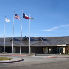
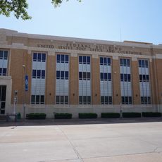
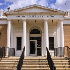
Throckmorton County, Administrative county in north-central Texas, United States

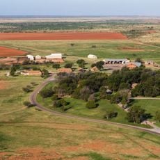
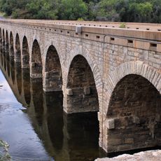
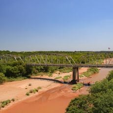
Throckmorton County is an administrative county in north-central Texas covering rolling terrain with red to black soils. The Clear Fork and Salt Fork of the Brazos River flow through the region, shaping its landscape.

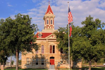
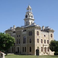
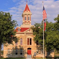
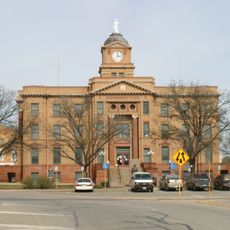
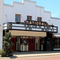
The Texas legislature created this county in 1858 and named it after William Throckmorton. The town of Throckmorton became the county seat in 1879.

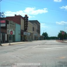
Ranching and farming remain central to local life, shaping how people work the land and organize their communities across the region. These practices connect today's residents to their predecessors who settled the Rolling Plains generations ago.

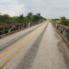
Three main highways connect the area: U.S. Highway 380, U.S. Highway 283, and State Highway 79 link communities and neighboring regions. Driving is the practical way to move around and reach different parts of the county.

This county is one of only four in Texas where alcohol sales remain completely prohibited by law. This makes it a place with unusual restrictions that stand out in a state otherwise known for permissive alcohol regulations.

The community of curious travelers

AroundUs brings together thousands of curated places, local tips, and hidden gems, enriched daily by 60,000 contributors worldwide.

Start exploring
GPS coordinates
33.15711,-99.20178
Latest update
December 8, 2025 13:42
Around this place
Waggoner Ranch
United States of America

Waggoner Ranch

84.8 km
Fort Belknap
United States of America

Fort Belknap

42.9 km
Possum Kingdom State Park
United States of America

Possum Kingdom State Park

67.8 km
Anthony Field at Wildcat Stadium
United States of America

Anthony Field at Wildcat Stadium

89.7 km
Abilene Zoological Gardens
United States of America

Abilene Zoological Gardens

92.4 km
Crutcher Scott Field
United States of America

Crutcher Scott Field

89.6 km
Shackelford County Courthouse Historic District
United States of America

Shackelford County Courthouse Historic District

49.2 km
First Baptist Church
United States of America

First Baptist Church

60.7 km
Beaver Creek Bridge
United States of America

Beaver Creek Bridge

87.8 km
Archer County Courthouse and Jail
United States of America

Archer County Courthouse and Jail

72.4 km
Saint John’s Methodist Church
United States of America

Saint John’s Methodist Church

60.6 km
Throckmorton County Courthouse and Jail
United States of America

Throckmorton County Courthouse and Jail

3.3 km
Fort Belknap Historic Site
United States of America

Fort Belknap Historic Site

42.9 km
Conrad N. Hilton Center & Museum
United States of America

Conrad N. Hilton Center & Museum

87.7 km
Jones County Courthouse
United States of America

Jones County Courthouse

78.8 km
Knox County Courthouse
United States of America

Knox County Courthouse

72.6 km
National Theater
United States of America

National Theater

57.2 km
Federal Building, United States Post Office and Courthouse
United States of America

Federal Building, United States Post Office and Courthouse

92.9 km
US Post Office
United States of America

US Post Office

60.8 km
Majestic Theatre
United States of America

Majestic Theatre

91.3 km
Grand Theatre
United States of America

Grand Theatre

60.8 km
Eastland County Museum
United States of America

Eastland County Museum

91.5 km
Old Post Office Museum & Art Center
United States of America

Old Post Office Museum & Art Center

57.3 km
Baird Depot Museum
United States of America

Baird Depot Museum

87.1 km
West Texas Utilities Building
United States of America

West Texas Utilities Building

60.8 km
Possum Kingdom Bridge
United States of America

Possum Kingdom Bridge

80.9 km
State Highway 120 Bridge at the Brazos River
United States of America

State Highway 120 Bridge at the Brazos River

41.6 km
Breckenridge Stephens Walker Home
United States of America

Breckenridge Stephens Walker Home

52.9 km
Show the full map
« Throckmorton County - Administrative county in north-central Texas, United States » is provided by Around Us (aroundus.com). Images and texts are derived from Wikimedia project under a Creative Commons license. You are allowed to copy, distribute, and modify copies of this page, under the conditions set by the license, as long as this note is clearly visible.

Discover hidden gems everywhere you go!

From secret cafés to breathtaking viewpoints, skip the crowded tourist spots and find places that match your style. Our app makes it easy with voice search, smart filtering, route optimization, and insider tips from travelers worldwide. Download now for the complete mobile experience.

Around Us App Screenshot

A unique approach to discovering new places

Le Figaro

All the places worth exploring

France Info

A tailor-made excursion in just a few clicks

20 Minutes

Around Us
Travel Guide & Maps
Download

Send to your phone

QR Code
1

Open the camera app on your mobile.

2

Point at the QR code with your camera. A notification will appear.

3

Tap the notification to open the link.