Enable Location

We need your location to show you interesting places around you

Discover nearby places

Find interesting locations and hidden gems around you

Precise directions

Get accurate directions and distances to places

Your location is never shared with other users. It's only used when you tap the location button.

Coryell County

Log in to your account

Start exploring — it's free

Trusted by 62,127 travelers worldwide

Continue with Google
Continue with Apple
or

We will send you a code to connect

By continuing, you accept our Terms and Conditions and our Privacy Policy

Check your inbox

We've sent a pincode in your inbox. Please enter the code below.

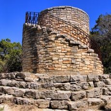
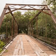
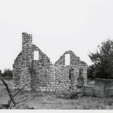
Coryell County, County division in central Texas, US

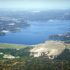
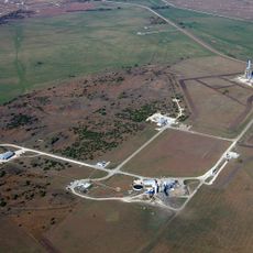
Coryell County is a county in central Texas covering plateaus and grasslands with varying terrain. The Leon River flows through the northern and eastern sections, while Cowhouse Creek waters the western and southern areas.

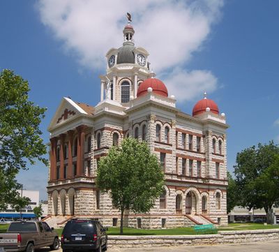
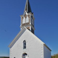
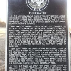
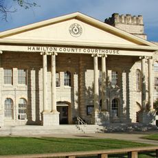
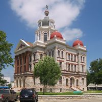
The Texas Legislature established this county in 1854, naming it after frontiersman James Coryell who died during frontier conflicts. The region developed as settlers moved into the area and established ranches and farms.

Native Americans, including Tonkawa, Lipan Apache, Kiowa, and Comanche tribes, established settlements along the Leon River starting from 4500 BC.

The region is accessible by road and offers outdoor exploration of natural landscape and river areas. Visitors can access farmland and grassland areas for recreation and sightseeing.

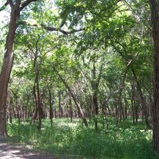
A significant portion of the county qualifies as prime agricultural land, featuring native trees such as red cedar, live oak, and pecan that shape the landscape character. These trees remain central to the region's agricultural and visual identity.

The community of curious travelers

AroundUs brings together thousands of curated places, local tips, and hidden gems, enriched daily by 60,000 contributors worldwide.

Start exploring
Location
Inception
1854
Capital city
Gatesville
Shares border with
Bosque County, Bell County, McLennan County, Lampasas County, Hamilton County
GPS coordinates
31.39000,-97.80000
Latest update
December 7, 2025 10:08
Around this place
Prairie Chapel Ranch
United States of America

Prairie Chapel Ranch

32.4 km
Belton Lake
United States of America

Belton Lake

44.2 km
Mother Neff State Park
United States of America

Mother Neff State Park

32.2 km
St. Olaf Kirke
United States of America

St. Olaf Kirke

44.8 km
Fort Gates
United States of America

Fort Gates

11 km
Coryell County Courthouse
United States of America

Coryell County Courthouse

6.9 km
Grand Avenue Theaters
United States of America

Grand Avenue Theaters

46.9 km
Urban Air Trampoline and Adventure Park
United States of America

Urban Air Trampoline and Adventure Park

32.2 km
Hallmark Lanes
United States of America

Hallmark Lanes

36 km
SpaceX Rocket Development and Test Facility
United States of America

SpaceX Rocket Development and Test Facility

31.8 km
Hamilton County Courthouse
United States of America

Hamilton County Courthouse

46.5 km
Phantom Warrior Lanes
United States of America

Phantom Warrior Lanes

29.5 km
Bowlerama
United States of America

Bowlerama

31.8 km
Killeen Family Aquatics Center
United States of America

Killeen Family Aquatics Center

36.4 km
Apache Arts and Crafts Center
United States of America

Apache Arts and Crafts Center

27.9 km
Coryell Museum and Historical Center
United States of America

Coryell Museum and Historical Center

7 km
Bosque Museum
United States of America

Bosque Museum

47.6 km
Mother Neff State Park Recreational Pavilion
United States of America

Mother Neff State Park Recreational Pavilion

32.2 km
Texas Theatre
United States of America

Texas Theatre

37.7 km
Clubhouse
United States of America

Clubhouse

32.2 km
Water Tower
United States of America

Water Tower

32.3 km
Leon Street Bridge at the Leon River
United States of America

Leon Street Bridge at the Leon River

6 km
Wilson Homesite
United States of America

Wilson Homesite

45.9 km
Adolf and Christine Godager Homesite
United States of America

Adolf and Christine Godager Homesite

48.2 km
Burford, R. F. and Lena, House
United States of America

Burford, R. F. and Lena, House

48.7 km
Baylor Female College Historic District
United States of America

Baylor Female College Historic District

48.1 km
Caretaker's House
United States of America

Caretaker's House

32.4 km
George Boutwell's Texas Collection
United States of America

George Boutwell's Texas Collection

43.9 km
Show the full map
Administrative divisions
« Coryell County - County division in central Texas, US » is provided by Around Us (aroundus.com). Images and texts are derived from Wikimedia project under a Creative Commons license. You are allowed to copy, distribute, and modify copies of this page, under the conditions set by the license, as long as this note is clearly visible.

Discover hidden gems everywhere you go!

From secret cafés to breathtaking viewpoints, skip the crowded tourist spots and find places that match your style. Our app makes it easy with voice search, smart filtering, route optimization, and insider tips from travelers worldwide. Download now for the complete mobile experience.

Around Us App Screenshot

A unique approach to discovering new places

Le Figaro

All the places worth exploring

France Info

A tailor-made excursion in just a few clicks

20 Minutes

Around Us
Travel Guide & Maps
Download

Send to your phone

QR Code
1

Open the camera app on your mobile.

2

Point at the QR code with your camera. A notification will appear.

3

Tap the notification to open the link.