Cherokee County, Administrative county division in Georgia, United States.
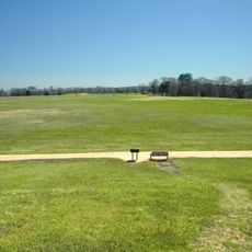
Cherokee County in Texas is a mix of residential neighborhoods, farmland, and forested areas with several lakes throughout the region. The landscape features rolling terrain and open spaces that define the area's rural character.
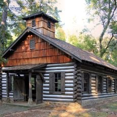
The land was home to the Cherokee Nation for centuries until the population was removed in the 1800s. After that, farms and settlements grew here, transforming it into the residential area it is today.
The county has developed as a residential area where families use schools, parks, and local shops as gathering points. You notice how newer suburbs sit alongside older communities, shaping how residents move through and experience daily life.
Main roads connect the county with nearby towns and make driving through fairly straightforward. The best time to visit is spring or fall, when the weather is pleasant and many outdoor activities are happening.
The county was once known for extensive tobacco farming before the economy shifted to other crops and later to residential development. You can still find traces of this agricultural past in older structures and family farms scattered around.
The community of curious travelers
AroundUs brings together thousands of curated places, local tips, and hidden gems, enriched daily by 60,000 contributors worldwide.