Enable Location

We need your location to show you interesting places around you

Discover nearby places

Find interesting locations and hidden gems around you

Precise directions

Get accurate directions and distances to places

Your location is never shared with other users. It's only used when you tap the location button.

Lake Pat Cleburne

Log in to your account

Start exploring — it's free

Trusted by 62,492 travelers worldwide

Continue with Google
Continue with Apple
or

We will send you a code to connect

By continuing, you accept our Terms and Conditions and our Privacy Policy

Check your inbox

We've sent a pincode in your inbox. Please enter the code below.

Lake Pat Cleburne

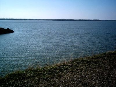
Lake Pat Cleburne, body of water

Lake Pat Cleburne is a large reservoir in Texas built on the Nolan River, located about four miles southwest of the city of Cleburne. The earthfill dam stretches over a mile long, stands about 76 feet tall, and can hold approximately 26,000 acre-feet of water when the lake covers roughly 1,568 acres.

The project was approved in 1962 by the Texas Water Commission, with construction starting in August 1963 and finishing in summer 1964. Originally called Cleburne Reservoir, it was built to control flooding and supply water to the city of Cleburne, surrounding farms, and local industries.

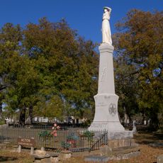
The reservoir is named after Patrick Cleburne, a general from the Civil War era, keeping local history present in the landscape. This naming connects the past with the present and reminds visitors of Texas history as they spend time along the shore.

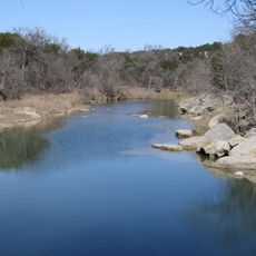
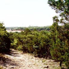
The lake sits about four miles from the city of Cleburne and has boat ramps for easy access with small boats or kayaks. The surrounding area offers parks and open spaces where visitors can walk, watch birds, or simply enjoy nature, making it a quiet place for a relaxed visit.

The lake holds various fish species including largemouth bass, three kinds of catfish, crappie, and white bass, while shorelines are planted with aquatic plants like water willow, lotus, and cattail. Local biologists and volunteers installed small structures called crappie condos near the dam to provide additional hiding spots for fish.

The community of curious travelers

AroundUs brings together thousands of curated places, local tips, and hidden gems, enriched daily by 60,000 contributors worldwide.

Start exploring
Location
GPS coordinates
32.28833,-97.41667
Latest update
February 9, 2026 08:23
Around this place
Dinosaur Valley State Park
United States of America

Dinosaur Valley State Park

38 km
Creation Evidence Museum
United States of America

Creation Evidence Museum

37.2 km
Fossil Rim Wildlife Center
United States of America

Fossil Rim Wildlife Center

37.7 km
Cleburne State Park
United States of America

Cleburne State Park

13.5 km
Acton State Historic Site
United States of America

Acton State Historic Site

30.3 km
Hood County Courthouse Historic District
United States of America

Hood County Courthouse Historic District

38.5 km
Johnson County Courthouse
United States of America

Johnson County Courthouse

7.2 km
Barnard's Mill
United States of America

Barnard's Mill

32.6 km
Nolan River Bridge 303-A of the Gulf, Colorado and Santa Fe Railway
United States of America

Nolan River Bridge 303-A of the Gulf, Colorado and Santa Fe Railway

15.8 km
Smith Ranch
United States of America

Smith Ranch

6 km
Lost Oak Winery

Lost Oak Winery

24.5 km
Somervell County Courthouse
United States of America

Somervell County Courthouse

32.5 km
Church of the Holy Comforter
United States of America

Church of the Holy Comforter

7.4 km
Brazos Drive In
United States of America

Brazos Drive In

40.4 km
Granbury Opera House
United States of America

Granbury Opera House

38.8 km
Henry Briden Cabin
United States of America

Henry Briden Cabin

6.9 km
Granbury Live Theatre
United States of America

Granbury Live Theatre

38.8 km
Glen Rose Downtown Historic District
United States of America

Glen Rose Downtown Historic District

32.4 km
Johnson County Feeders Supply
United States of America

Johnson County Feeders Supply

7 km
Lester H. and Mabel Bryant Chorn House
United States of America

Lester H. and Mabel Bryant Chorn House

40.2 km
Granbury Railroad Depot
United States of America

Granbury Railroad Depot

39.1 km
Peoria Cumberland Presbyterian Church
United States of America

Peoria Cumberland Presbyterian Church

40.9 km
Tarlton Building
United States of America

Tarlton Building

41 km
First Methodist Church
United States of America

First Methodist Church

23.2 km
John L. and Annie Upshaw Cleveland House
United States of America

John L. and Annie Upshaw Cleveland House

6.7 km
Emory Home
United States of America

Emory Home

22.9 km
Dotey-Kirkham House
United States of America

Dotey-Kirkham House

7.2 km
Itasca Railroad Depot
United States of America

Itasca Railroad Depot

29.3 km
Show the full map
« Lake Pat Cleburne - body of water » is provided by Around Us (aroundus.com). Images and texts are derived from Wikimedia project under a Creative Commons license. You are allowed to copy, distribute, and modify copies of this page, under the conditions set by the license, as long as this note is clearly visible.

Discover hidden gems everywhere you go!

From secret cafés to breathtaking viewpoints, skip the crowded tourist spots and find places that match your style. Our app makes it easy with voice search, smart filtering, route optimization, and insider tips from travelers worldwide. Download now for the complete mobile experience.

Around Us App Screenshot

A unique approach to discovering new places

Le Figaro

All the places worth exploring

France Info

A tailor-made excursion in just a few clicks

20 Minutes

Around Us
Travel Guide & Maps
Download

Send to your phone

QR Code
1

Open the camera app on your mobile.

2

Point at the QR code with your camera. A notification will appear.

3

Tap the notification to open the link.