Chest opened
+${chestReward.xp} XP
Explorer
NOUVEAU ×${chestReward.collectible.quantity}
tapez pour fermer

See the monuments around you in AR Open chests in the app

Around Us is built for your phone — point your camera at the streets and discover the monuments and places around you in augmented reality. Around Us is built for your phone — chests unlock when you walk, explore and capture nearby places.

Enable Location

We need your location to show you interesting places around you

Discover nearby places

Find interesting locations and hidden gems around you

Precise directions

Get accurate directions and distances to places

Your location is never shared with other users. It's only used when you tap the location button.

Log in to your account

Start exploring — it's free

Trusted by 86,434 travelers worldwide

Continue with Google
Continue with Apple
or

We will send you a code to connect

By continuing, you accept our Terms and Conditions and our Privacy Policy

Check your inbox

We've sent a pincode in your inbox. Please enter the code below.

Discussion Reviews Photo
1.3k Popularity

Gillham Lake, reservoir in Howard County and Polk County, Arkansas

Gillham Lake is a large reservoir in southern Arkansas created by damming the Cossatot River, stretching across approximately 1,370 acres. The water is clear and still, surrounded by forests and open spaces, with boat ramps, camping areas, swimming zones, and picnic sites distributed around its shoreline.

The lake was created in 1975 through damming of the Cossatot River, serving both to control water flow and provide a recreation area. The U.S. Army Corps of Engineers has managed the site since its creation, maintaining facilities and ensuring public access.

The lake takes its name from the nearby community and has served as a gathering place for families and outdoor enthusiasts across generations. Visitors come here to experience a slower pace of life, where fishing, picnicking, and waterside relaxation are central to how people use the space.

The lake is easily accessible from De Queen and surrounding areas with straightforward directions for first-time visitors. Plan to find basic amenities including walking paths, camping areas, and fishing spots throughout the site.

The lake is home to largemouth bass known for their fighting ability when hooked, alongside crappie, bream, and catfish. This mix of species attracts anglers of all skill levels, with visitors often returning year after year to pursue these fish.

The community of curious travelers

AroundUs brings together thousands of curated places, local tips, and hidden gems, enriched daily by 60,000 contributors worldwide.
Start exploring
Location
GPS coordinates
34.21614,-94.22312
Latest update
September 13, 2026 18:50
Around this place
Cossatot River State Park-Natural Area
United States of America

Cossatot River State Park-Natural Area

6.3 mi
United States of America

Katy Falls

14.9 mi
Bard Springs Bathhouse
United States of America

Bard Springs Bathhouse

17.1 mi
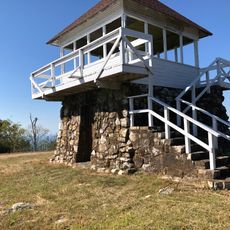
Tall Peak Fire Tower
United States of America

Tall Peak Fire Tower

15.7 mi
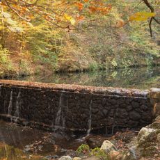
Bard Springs Dam No. 1
United States of America

Bard Springs Dam No. 1

17.1 mi
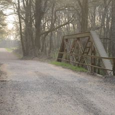
Hale Creek Bridge
United States of America

Hale Creek Bridge

9.7 mi
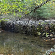
Bard Springs Dam No. 2
United States of America

Bard Springs Dam No. 2

17.1 mi
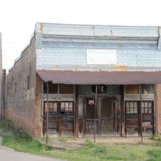
Goff and Gamble Merchandise Store
United States of America

Goff and Gamble Merchandise Store

6.2 mi
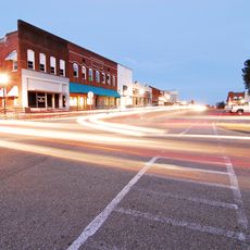
DeQueen Commercial Historic District
United States of America

DeQueen Commercial Historic District

14.1 mi
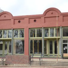
Hayes Hardware Store
United States of America

Hayes Hardware Store

14.1 mi
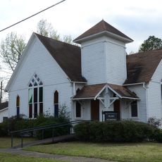
First Presbyterian Church
United States of America

First Presbyterian Church

14 mi
Buckeye Vista Overlook
United States of America

Buckeye Vista Overlook

17.4 mi
Bishop Brookes House
United States of America

Bishop Brookes House

14 mi
Sugar Creek Vista Overlook
United States of America

Sugar Creek Vista Overlook

17.5 mi
Otis Theodore and Effiegene Locke Wingo House
United States of America

Otis Theodore and Effiegene Locke Wingo House

14.1 mi
King Schoolhouse
United States of America

King Schoolhouse

6.4 mi
Shady Lake Cascade
United States of America

Shady Lake Cascade

14.9 mi
Eagle Rock Vista
United States of America

Eagle Rock Vista

17.3 mi
United States of America

Scenic viewpoint

16.7 mi
United States of America

Scenic viewpoint

17 mi
United States of America

Scenic viewpoint

15.7 mi
United States of America

Cossatot Falls

7.1 mi
United States of America

Trailhead Falls

16.9 mi
United States of America

Katy Falls

14.9 mi
United States of America

Robert Wells’ Chain Sculptures

6.7 mi
United States of America

Panther Bluff Falls

8.1 mi
United States of America

Devils Hollow Falls

5.8 mi
United States of America

Waterfall

7.9 mi
Show the full map
Reviews
Share your experience

No review yet

Discussions
Start a discussion...

No discussion yet

« Gillham Lake - reservoir in Howard County and Polk County, Arkansas » is provided by Around Us (aroundus.com). Images and texts are derived from Wikimedia project under a Creative Commons license. You are allowed to copy, distribute, and modify copies of this page, under the conditions set by the license, as long as this note is clearly visible.

Discover hidden gems everywhere you go!

From secret cafés to breathtaking viewpoints, skip the crowded tourist spots and find places that match your style. Our app makes it easy with voice search, smart filtering, route optimization, and insider tips from travelers worldwide. Download now for the complete mobile experience.

Around Us App Screenshot

A unique approach to discovering new places

Le Figaro

All the places worth exploring

France Info

A tailor-made excursion in just a few clicks

20 Minutes

Around Us
Travel Guide & Maps
Download

Send to your phone

QR Code
1

Open the camera app on your mobile.

2

Point at the QR code with your camera. A notification will appear.

3

Tap the notification to open the link.