Cossatot River State Park-Natural Area

Log in to your account

AroundUs is a community-driven map of interesting places, built by curious explorers like you. It grows with every review, story, and photo you share.
Connect to save your favorite spots, contribute locations, and create personalized routes.
Continue with Google
Continue with Apple
Continue with X
Continue with Facebook
Continue with email
By continuing, you accept our Terms and Conditions and our Privacy Policy
Create an account

Cossatot River State Park-Natural Area

Add to collection
Map
Suggest a change
Share

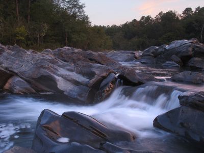
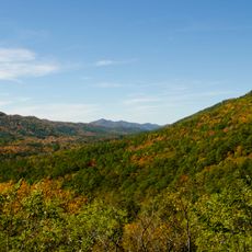
Cossatot River State Park-Natural Area, State park with rapids and waterfalls in Howard and Polk counties, Arkansas.

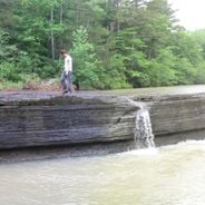
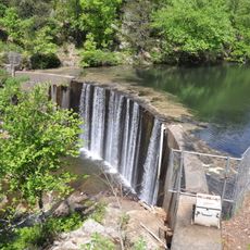
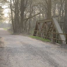
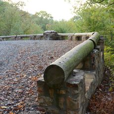
Cossatot River State Park extends about 12 miles along the Cossatot River in Howard and Polk counties, featuring Class IV rapids that flow through a canyon. Four hiking trails wind through the protected land, offering access to waterfalls and forest areas.

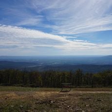
The park was established in 1988 to protect this stretch of the Ouachita Mountains and preserve its native wilderness. This designation safeguarded thousands of acres of forest, rapids, and wildlife habitat for ongoing conservation.

The visitor center offers year-round programs where you can learn about the plants and animals that live in this part of the Ouachita Mountains. Staff members help guests understand how the river shapes the local ecosystem and what makes the region special.

Camping spots are spread across three main areas where you can pitch a tent, plus a separate area for groups. Before visiting, check water conditions since the Class IV rapids require caution and proper experience.

Two fish species found nowhere else but in the Little River system make their home in these waters, while a rare plant called Browne's waterleaf grows along the banks. These species highlight why the area matters for conservation efforts.

Location: Arkansas

Inception: 1988

Website: https://arkansasstateparks.com/parks/cossatot-river-state-park-natural-area

GPS coordinates: 34.29580,-94.16810

Latest update: December 6, 2025 17:44

Photos
Uncommon places to visit in Arkansas

Arkansas sits in the southern United States, where the Ozark and Ouachita mountains meet forested valleys and slow rivers. Away from the main highways, the state holds waterfalls hidden in national forests, abandoned settlements from mining days, and caves filled with limestone formations. Haw Creek...

Around this place
Queen Wilhelmina State Park
United States of America

Queen Wilhelmina State Park

47.1 km
Shady Lake Recreation Area
United States of America

Shady Lake Recreation Area

14.6 km
Ebenezer Campground
United States of America

Ebenezer Campground

32.5 km
Huddleston Store and McKinzie Store
United States of America

Huddleston Store and McKinzie Store

40.1 km
Mountain Fork Bridge
United States of America

Mountain Fork Bridge

33.5 km
Ebenezer Monument
United States of America

Ebenezer Monument

32.8 km
Bard Springs Bathhouse
United States of America

Bard Springs Bathhouse

17.9 km
Mena City Hall
United States of America

Mena City Hall

32.7 km
Janssen Park
United States of America

Janssen Park

32.7 km
Tall Peak Fire Tower
United States of America

Tall Peak Fire Tower

15.3 km
Little Cossatot River Bridge
United States of America

Little Cossatot River Bridge

35.9 km
Hale Creek Bridge
United States of America

Hale Creek Bridge

24.1 km
Polk County Courthouse
United States of America

Polk County Courthouse

33 km
First United Methodist Church
United States of America

First United Methodist Church

36.5 km
Self Creek Bridge
United States of America

Self Creek Bridge

38.4 km
Judge Benjamin Shaver House
United States of America

Judge Benjamin Shaver House

32.8 km
DeQueen Commercial Historic District
United States of America

DeQueen Commercial Historic District

32.9 km
Hayes Hardware Store
United States of America

Hayes Hardware Store

32.8 km
First Presbyterian Church
United States of America

First Presbyterian Church

32.7 km
Elks Lodge
United States of America

Elks Lodge

32.9 km
Bishop Brookes House
United States of America

Bishop Brookes House

32.8 km
Buckeye Vista Overlook
United States of America

Buckeye Vista Overlook

18 km
Mena Commercial Historic District
United States of America

Mena Commercial Historic District

32.6 km
Sugar Creek Vista Overlook
United States of America

Sugar Creek Vista Overlook

18 km
Otis Theodore and Effiegene Locke Wingo House
United States of America

Otis Theodore and Effiegene Locke Wingo House

32.8 km
King Schoolhouse
United States of America

King Schoolhouse

20.5 km
Lockesburg Waterworks
United States of America

Lockesburg Waterworks

36.4 km
Rich Mountain Lookout Tower
United States of America

Rich Mountain Lookout Tower

44.7 km
Show the full map
Reviews

Visited this place? Tap the stars to rate it and share your experience / photos with the community! Try now! You can cancel it anytime.

« Cossatot River State Park-Natural Area - State park with rapids and waterfalls in Howard and Polk counties, Arkansas » is provided by Around Us (aroundus.com). Images and texts are derived from Wikimedia project under a Creative Commons license. You are allowed to copy, distribute, and modify copies of this page, under the conditions set by the license, as long as this note is clearly visible.

Discover hidden gems everywhere you go!

From secret cafés to breathtaking viewpoints, skip the crowded tourist spots and find places that match your style. Our app makes it easy with voice search, smart filtering, route optimization, and insider tips from travelers worldwide. Download now for the complete mobile experience.

Around Us App Screenshot

A unique approach to discovering new places

Le Figaro

All the places worth exploring

France Info

A tailor-made excursion in just a few clicks

20 Minutes