See the monuments around you in AROpen chests in the app
Around Us is built for your phone — point your camera at the streets and discover the monuments and places around you in augmented reality.Around Us is built for your phone — chests unlock when you walk, explore and capture nearby places.
Arkansas sits in the southern United States, where the Ozark and Ouachita mountains meet forested valleys and slow rivers. Away from the main highways, the state holds waterfalls hidden in national forests, abandoned settlements from mining days, and caves filled with limestone formations. Haw Creek Falls drops over a series of ledges in the Ozarks, while Blanchard Springs Caverns opens into chambers where underground streams have carved stone over thousands of years. Rush, once a zinc mining town, now stands empty along the Buffalo River. Boxley Valley offers open fields where elk graze beneath ridges, and the Cossatot River cuts through rocky rapids in the Ouachita range. These places show different chapters of the region's natural and human history. Historical sites and cultural centers add depth to the landscape. Monte Ne preserves the ruins of an early resort built beside Beaver Lake. The Hampson Archeological Museum holds artifacts from indigenous peoples who lived in the Mississippi River floodplain. Jacksonport once served as a river port on the White River, and the Delta Cultural Center documents the agricultural heritage of eastern Arkansas. From Sam's Throne, a rock outcrop with views across the Ozarks, to the old railway bridge in Clarendon, these locations lie off the usual routes and reward those who take the time to seek them out.
Arkansas sits in the southern United States, where the Ozark and Ouachita mountains meet forested valleys and slow rivers. Away from the main highways, the state holds waterfalls hidden in national forests, abandoned settlements from mining days, and caves filled with limestone formations. Haw Creek Falls drops over a series of ledges in the Ozarks, while Blanchard Springs Caverns opens into chambers where underground streams have carved stone over thousands of years. Rush, once a zinc mining town, now stands empty along the Buffalo River. Boxley Valley offers open fields where elk graze beneath ridges, and the Cossatot River cuts through rocky rapids in the Ouachita range. These places show different chapters of the region's natural and human history. Historical sites and cultural centers add depth to the landscape. Monte Ne preserves the ruins of an early resort built beside Beaver Lake. The Hampson Archeological Museum holds artifacts from indigenous peoples who lived in the Mississippi River floodplain. Jacksonport once served as a river port on the White River, and the Delta Cultural Center documents the agricultural heritage of eastern Arkansas. From Sam's Throne, a rock outcrop with views across the Ozarks, to the old railway bridge in Clarendon, these locations lie off the usual routes and reward those who take the time to seek them out.
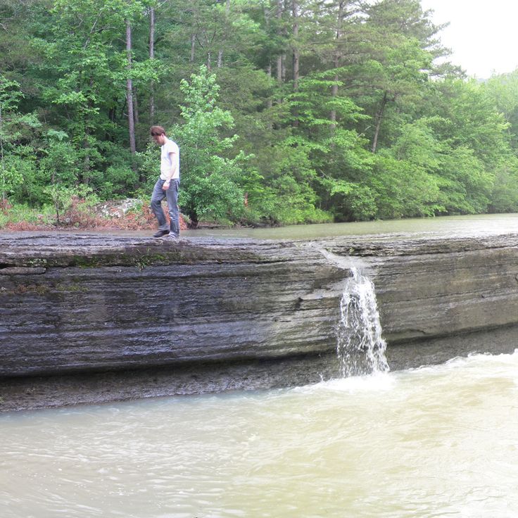
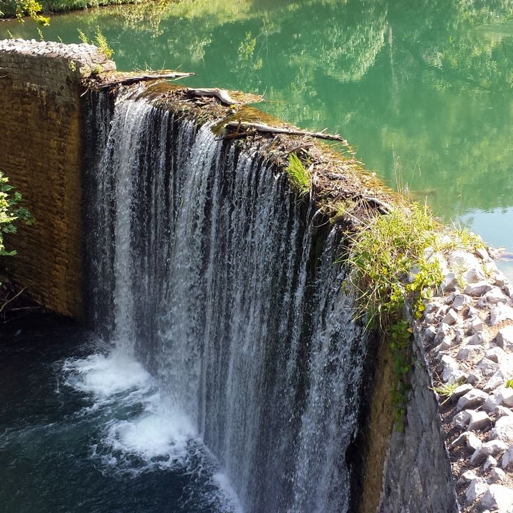
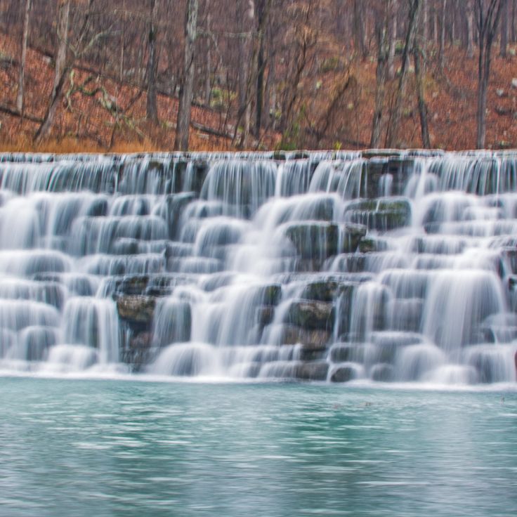
This waterfall flows over several rock ledges into a natural pool, deep in the woods of Ozark National Forest. Haw Creek Falls sits away from usual tourist paths in Arkansas and shows the quiet forest landscape of the region. Mosses and ferns grow on the wet stones as the water drops between the trees.
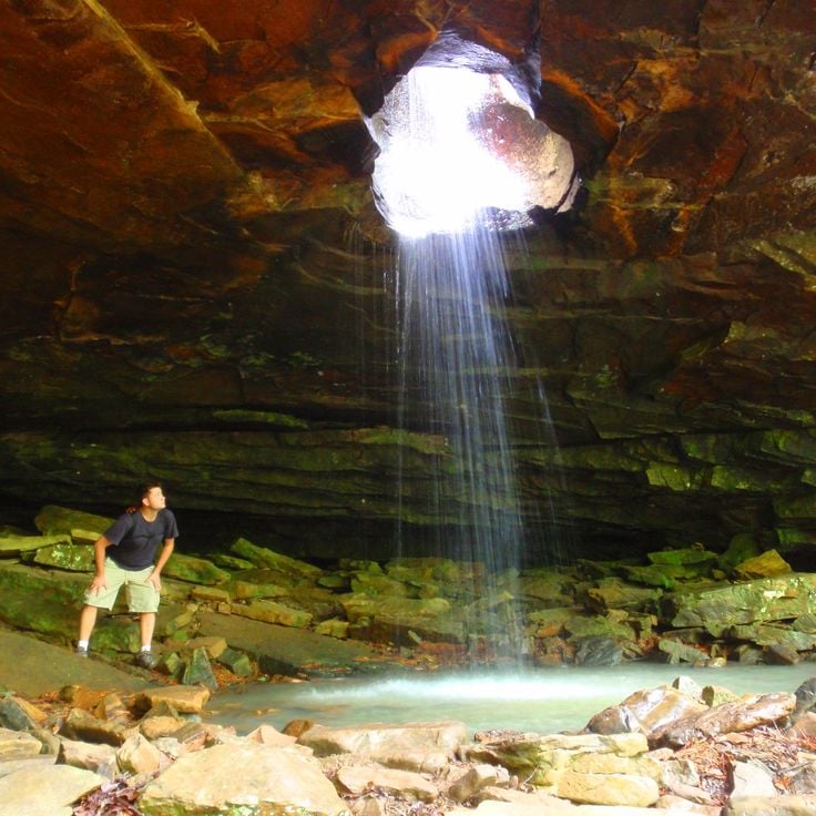
This waterfall in the Ozark National Forest flows through a circular opening in the rock ceiling and drops about 25 feet (7.6 meters) below. The passage formed through erosion of the limestone over thousands of years. Water falls only after heavy rain, especially in spring. The path leads through dense forest over slippery rocks. Glory Hole Waterfall remains a remote spot in the mountains of Arkansas.
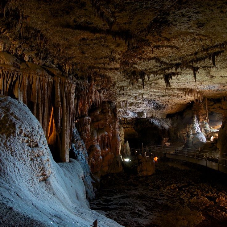
This cave system extends across three levels, showing stalactites, stalagmites and underground streams. The limestone has created formations over thousands of years, and guided tours walk through lit chambers of varying sizes. The temperature stays cool year-round, and water still drips from the ceilings, continuing to shape the structures. The caverns sit within the Ozark National Forest and remain one of the less traveled natural sites in Arkansas, offering a look at geology that formed long before human presence.
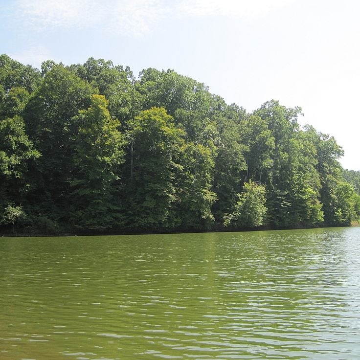
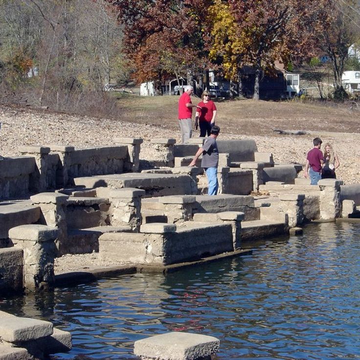
This sunken ruin in Beaver Lake shows the remains of an 1901 hotel. Concrete walls and foundations rise from the water when the lake level drops. The site lies off regular routes and gives a sense of past times and failed ambitions in the Ozarks.
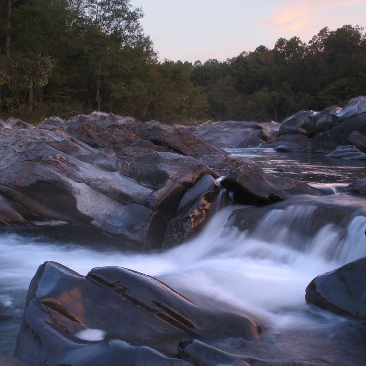
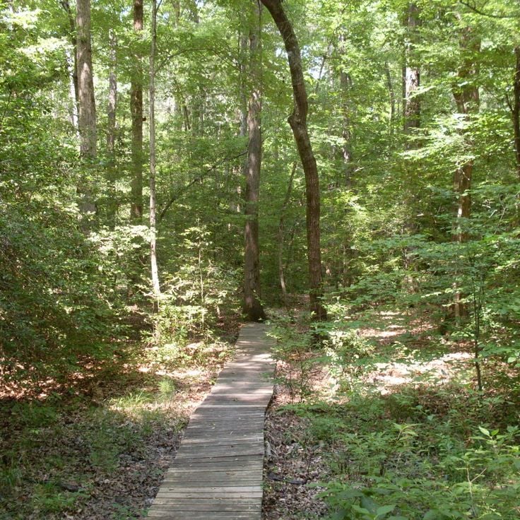
This park lies in the southwest of the state, where the river cuts through narrow granite canyons and forms several sets of rapids. Trails follow the water through thick forest, and you can hear the rush of water over rocks. In some places, you can walk right down to the bank and see the clear current. The area is quiet and undeveloped, good for those who want to hike away from regular routes or experience the river.
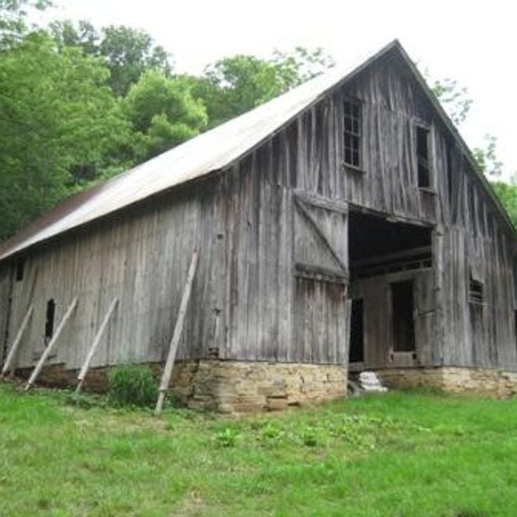
This valley sits in the Ozark Mountains and holds 19th century barns alongside a herd of about 200 elk living in the wild. Boxley Valley offers a look at the region's early farming history and the successful return of wildlife to the area. Visitors can see early settler architecture and open grasslands where the elk roam, especially at sunrise and sunset.
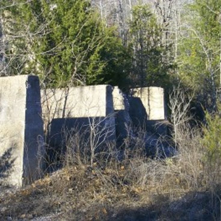
This abandoned settlement sits in the Ozark National Forest and shows stone buildings from the 1880s. The mine extracted zinc until 1940, after which residents left the area. Today several structures stand along the Buffalo River, including an old post office and homes. Trails lead through the ruins and to mine shafts. In spring and fall, hikers come here to explore the history of mining in the Ozarks. The forest has reclaimed the buildings, with trees growing between the walls. A short walk from the parking area brings visitors to the main ruins, where signs explain the history of the settlement.
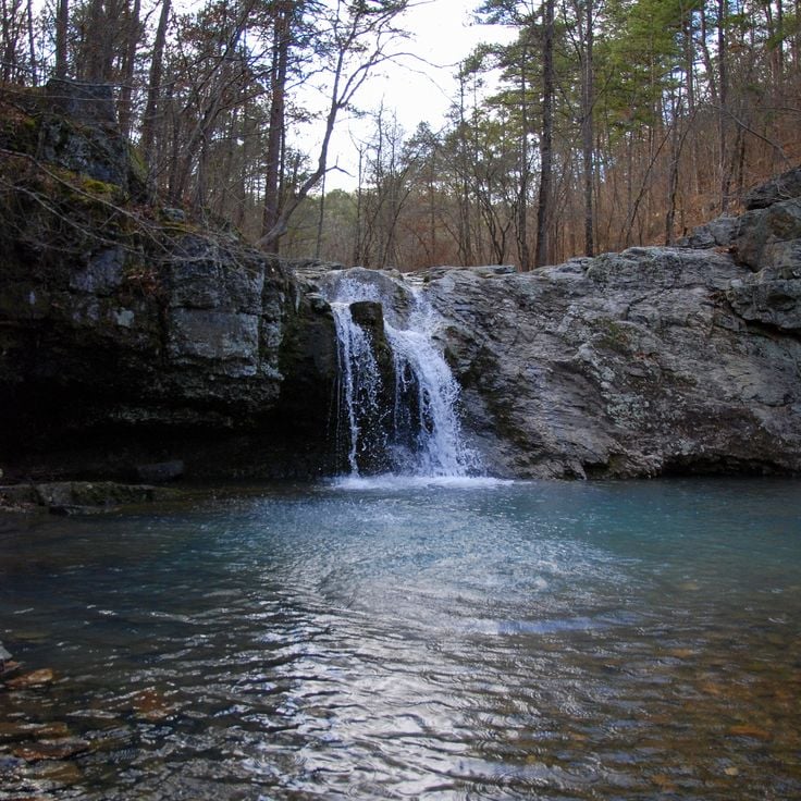
This small waterfall drops about 26 feet (8 meters) into a clear pool in Stone County. A short trail of roughly 1,300 feet (400 meters) leads through the forests of the Ozark National Forest to this quiet spot, which sits away from the main tourist traffic and invites a moment of rest.
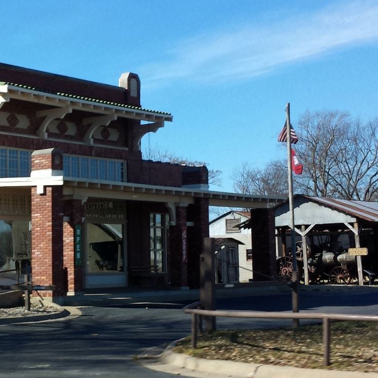
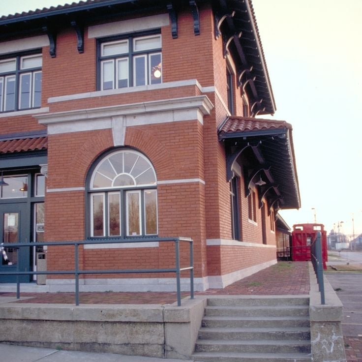
This park sits at the meeting point of the White River and Black River, preserving the memory of a former river port. The museum displays exhibits about regional river trade, including steamboat navigation and commerce during the 19th century. The buildings date back to when Jacksonport served as a stop for river steamers. Visitors see Civil War artifacts and objects that document daily life in a river town.
These waterfalls in Lake Catherine State Park sit along hiking trails that pass through pine forests. Several cascades flow over granite rocks. The routes connect different points in the park and show the wooded landscape of the region. The area belongs to the natural sites in Arkansas that lie away from regular tourist routes.
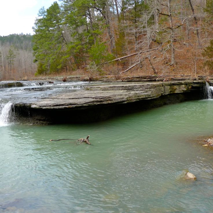
This waterfall sits in the Ozark Mountains and drops over a natural rock wall into a small pool below. The water flows through dense forest, surrounded by ferns and moss clinging to the old stones. The path to the falls follows a creek through a narrow gorge, where the sound of rushing water echoes between the trees. Falling Water Falls shows the quiet woodland scenery found in the mountains of Arkansas, away from regular routes.
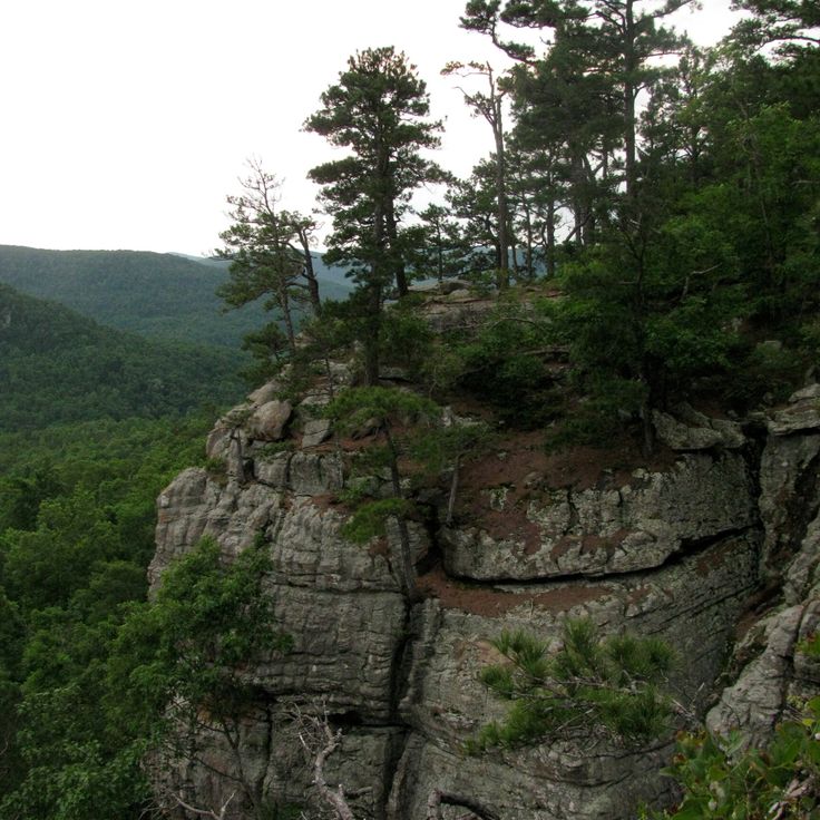
Sam's Throne is a roughly 500-foot (152 m) sandstone cliff in Newton County, Arkansas. This cliff offers climbing walls at different difficulty levels and wide views over the Ozark Mountains. The formation sits away from regular tourist paths and draws mostly climbers looking for vertical routes in a quiet setting. The rock faces show different structures, from gentle ledges to steep overhangs. From the top, the view extends across forested hills and valleys of the region.
This park in the Ozarks sits on layers of ancient rock and displays weathered sandstone blocks, underground passages, and bands of flint. The forest grows over rocky slopes and dry streambeds that fill after rain. Trails lead through the terrain, passing crevices and cave openings. Historic structures from the 1930s stand among the trees, linking the visitor history to the geology of the region.
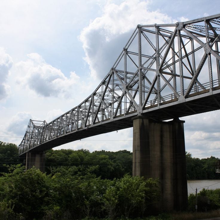
This abandoned railway bridge in Monroe County has stood unused since 1983. Plants grow between the steel beams and birds build their nests within the structure. The bridge sits away from regular tourist routes in Arkansas and shows how nature slowly reclaims a space once built by people. This structure belongs among the historical sites that make visible the industrial heritage of the region.
This incorporated village near Little Rock sits between busy highways and wooded hills. Cammack Village was founded during World War II and today preserves a quiet residential layout with two parks and a small business district. The low population and older buildings give a sense of another era. For travelers exploring Arkansas beyond the usual routes, this community offers a glimpse into a planned mid-20th-century town.
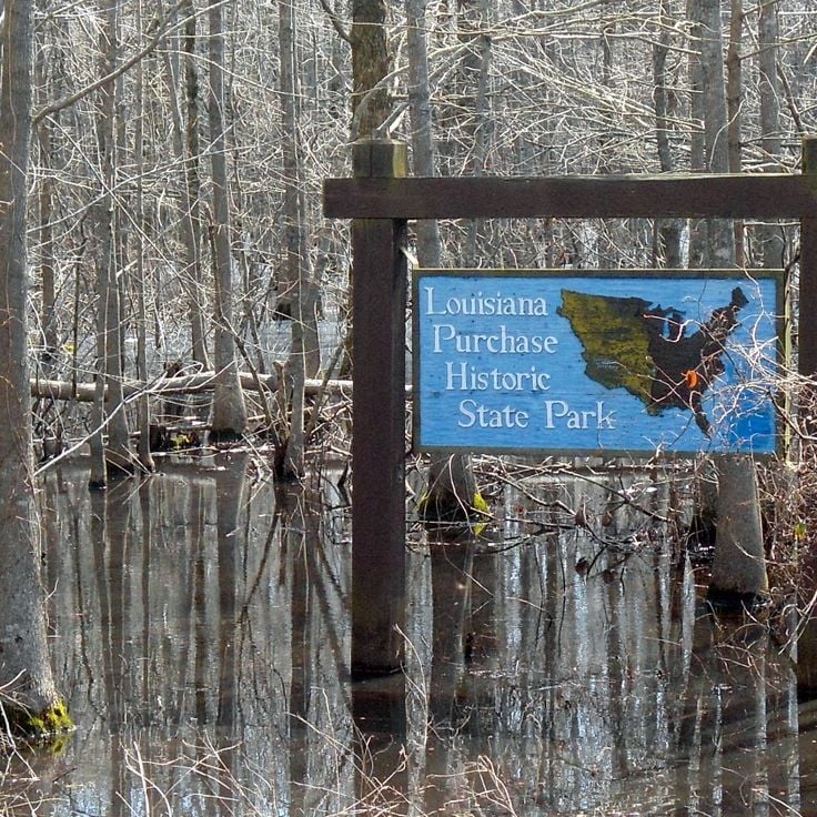
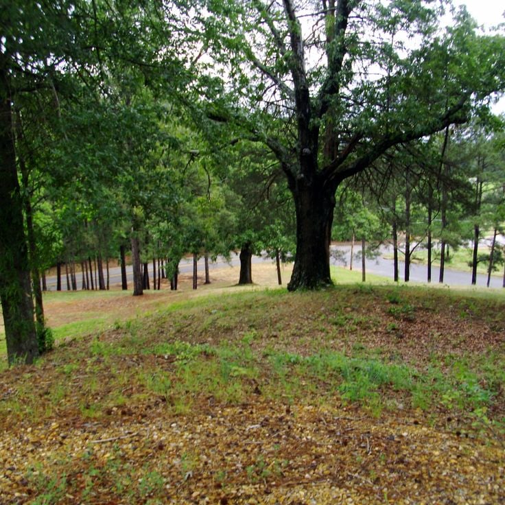
This park preserves the starting point of the 1815 survey work. A granite marker shows where surveyors began mapping the Louisiana Territory. The site recalls the early days of western expansion after the Louisiana Purchase. Visitors find walking trails and panels explaining the survey work that shaped American growth. The area lies away from regular tourist routes in Arkansas.
This museum sits in a region shaped by cotton farming for centuries. It displays agricultural equipment from the 1800s to the present, including plows, tractors, and harvesting machines that document how farm work changed over time. The exhibits explain how people worked the Delta land and what techniques they developed. The museum preserves objects that make rural life in Arkansas understandable to visitors walking through its halls.
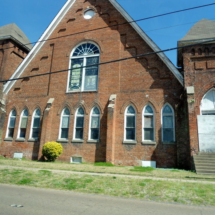
This church from 1905 held a central role for the African American community in Phillips County. The wooden building appears in the National Register of Historic Places and preserves the history of religious life and social gatherings in rural Arkansas. The simple architecture with white facade and tall windows shows features typical of Baptist houses of worship from that period. The interior with original pews tells the story of community life across several generations.
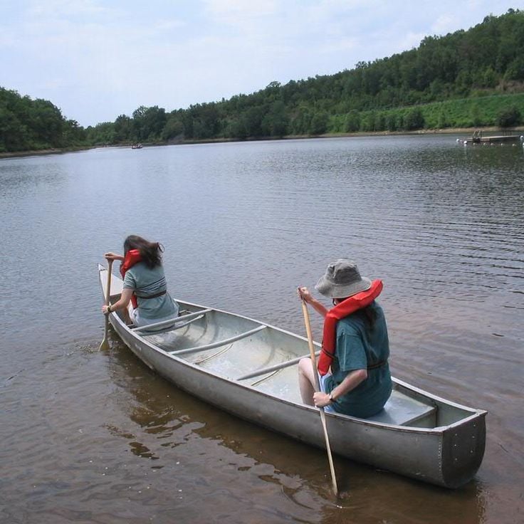
This state park sits in Nevada County, near the southern edge of the pine-bluff region. The lake covers around 2650 acres, leaving room for anglers and boats. Trails circle through forest where pine needles soften each step. Shores remain quiet most of the day, and the water holds a clear surface. Mornings bring fishermen who set their lines, and later in the day you might see a few sailboats or kayaks. The forest smells of resin and earth. Paths wind between the trees, some follow the shore, others climb gently. In autumn the leaves turn and reflect in the water, and the air cools enough to make walking pleasant.
This museum in Phillips County presents the history of the region through exhibits on blues music, civil rights, and local art. Visitors find photographs, recordings, and documents about musicians who grew up and worked in the surrounding communities. The collection includes stories about farming, Mississippi River floods, and social changes throughout the 20th century. The Delta Cultural Center sits away from common travel routes and offers insight into the cultural heritage of this part of Arkansas.
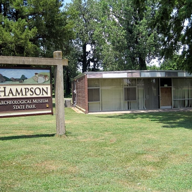
This museum displays artifacts from a Mississippi period settlement inhabited between 1400 and 1650. The collection includes pottery, stone tools, and objects used in daily life. A permanent exhibition explains how people lived in this region before European contact. The museum sits near the original site where farmers uncovered these items in the early 20th century. Glass cases hold ceramic vessels with painted designs, bone needles, and small carvings. The displays focus on agriculture, fishing, and craft production in the floodplain of the Mississippi River.
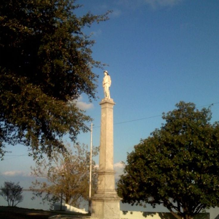
This marble monument from 1910 stands on the shore of Lake Chicot and commemorates Confederate soldiers from Chicot County. It belongs among the historical sites in Arkansas that remain outside regular tourist routes, offering insight into local history from the 19th century and the memory practices of the early 20th century.
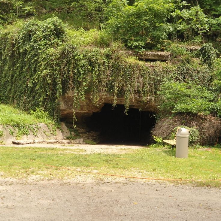
This limestone cave in Benton County holds underground passages and is tied to legends about Spanish gold coins from the 16th century. Old Spanish Treasure Cave belongs to the less visited places in Arkansas and connects geological formations with historical stories of hidden treasure. The cave lies away from usual routes and offers visitors the chance to walk through natural underground chambers while hearing tales of Spanish conquistadors who supposedly hid gold here.
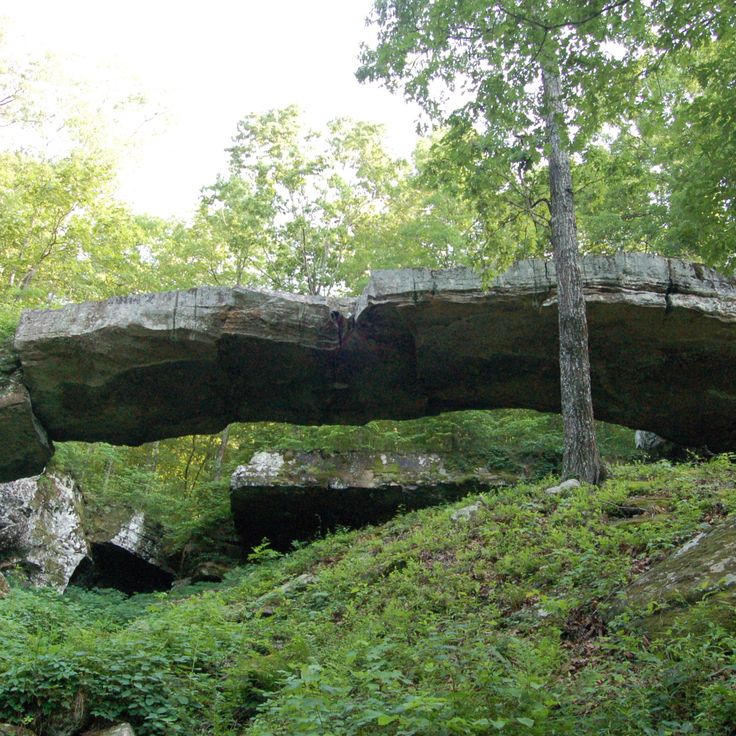
This sandstone arch formed over thousands of years through erosion and rises in a forested area. The formation reaches about 30 feet above the ground and extends across roughly 130 feet. A short trail leads through dense woods to the base of the bridge, where visitors can see the layering of the rock and the vegetation growing in the crevices. The area sits away from main roads and shows typical erosion patterns found in the Ozark Mountains. The bridge is among the less-visited geological formations in Arkansas and offers a quiet place for walking.
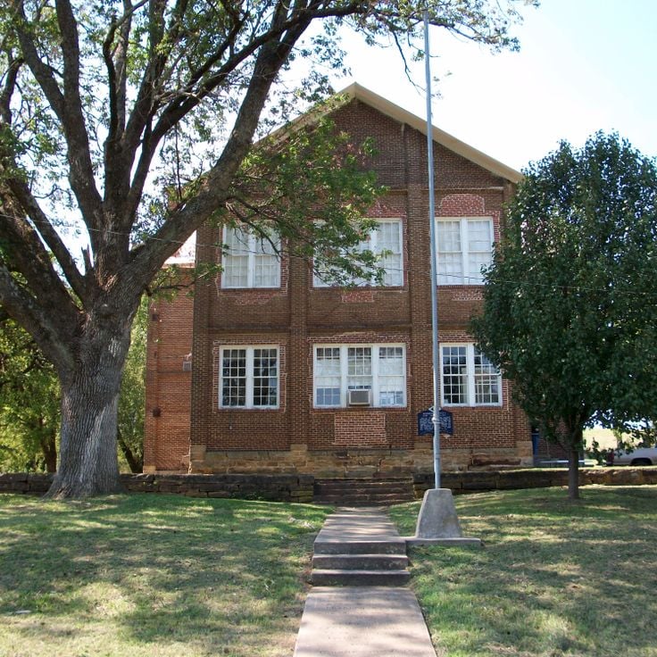
This brick school from 1850 was the first institution for higher education in Arkansas. Cane Hill College sits in rural Washington County, away from the major towns. The buildings belong to the oldest educational structures in the state and show architecture from the mid-19th century. The campus was later abandoned, and today only ruins and foundations remain. The place offers a glimpse into the early history of college education in Arkansas and the pioneer era in this region.
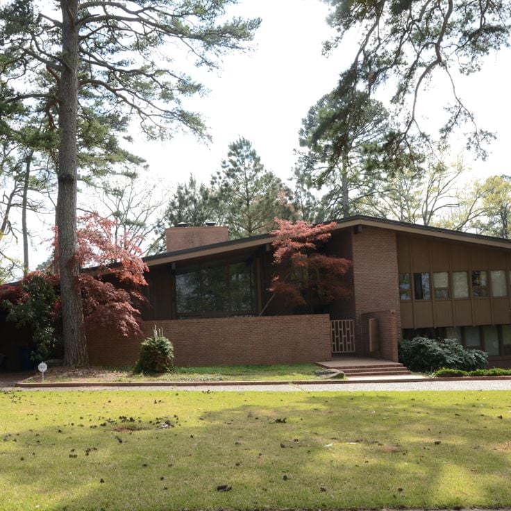
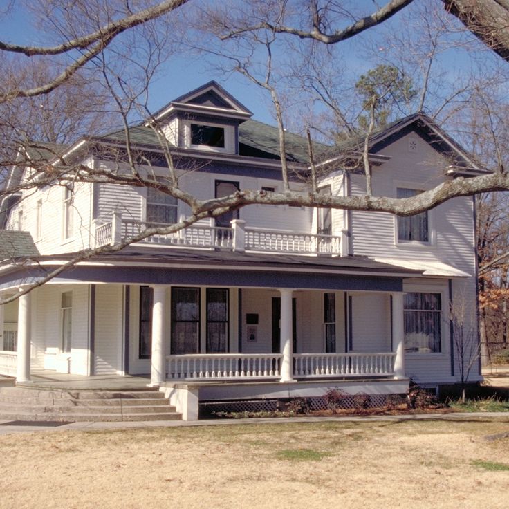
The Pfeiffer House is an estate from 1880 in Independence County. The building shows features of late-nineteenth-century German architecture, including steep roofs and stone masonry. The carriage house forms part of the historic property. This site belongs among the less-visited historical places in Arkansas and stands apart from usual travel routes.
This park shows reconstructed military installations from 1812. Visitors find trenches and defensive structures that offer insight into early American warfare. The site sits away from regular routes through Arkansas and uses rebuilt fortifications to show how soldiers organized their positions at that time. Information panels explain the historical context. A walking path leads through different sections of the grounds.
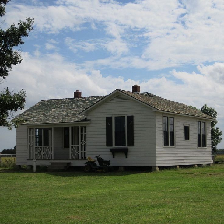
This 1930s farmhouse shows the musician's early life with furniture and objects from his youth. The Johnny Cash House offers insight into the childhood of an American music legend in a rural Arkansas community, away from regular tourist routes. The rooms preserve the feeling of a farming family during economically difficult years.
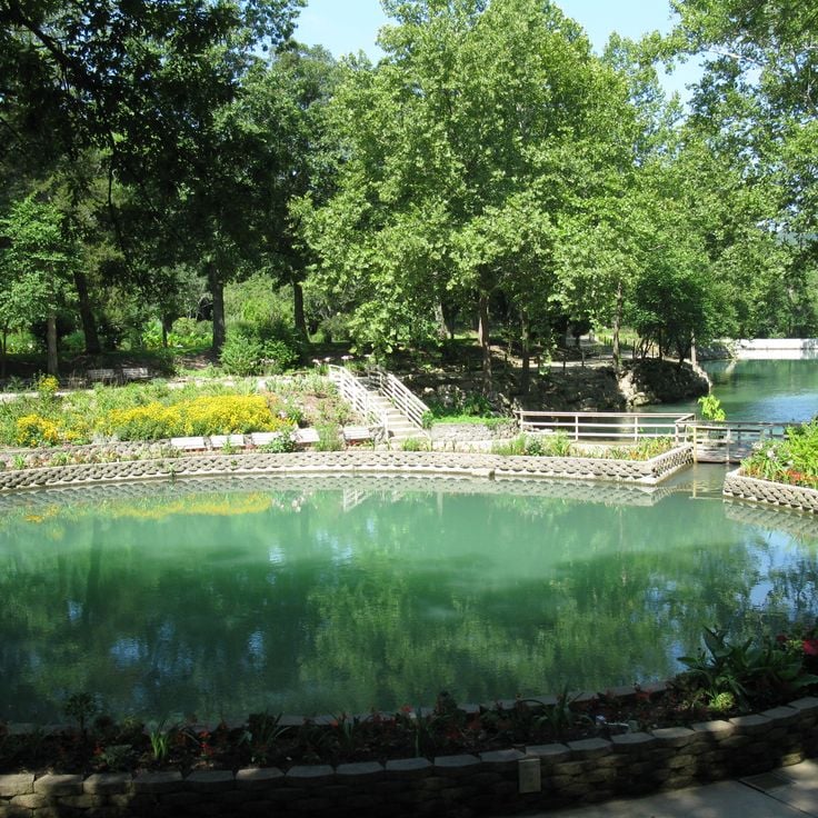
This nature preserve features springs that emerge from limestone rock. Gardens surrounding the springs include native plants and trees of the Ozark highlands. Archaeological evidence shows indigenous communities lived here centuries ago. Walking trails pass through wooded areas and open to views over the water. Blue Springs Heritage Center sits away from regular tourist routes and connects natural history with the cultural heritage of the region.
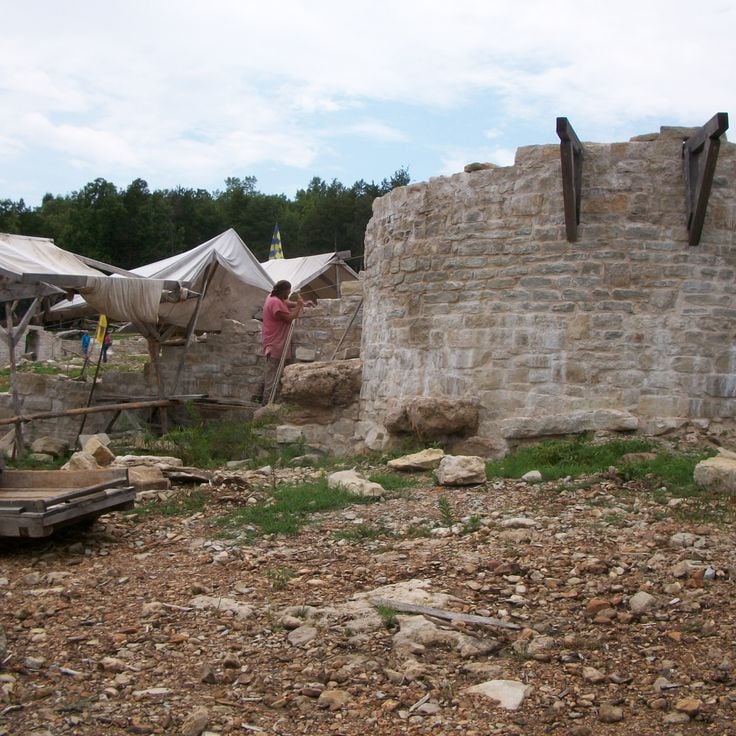
This construction site in the Ozark Mountains demonstrates building techniques from the 13th century. Craftsmen work with medieval methods: they cut stone by hand, shape timber, and raise walls without modern tools. The fortress grows slowly, stone by stone, following historical models. Visitors watch stonemasons, carpenters, and blacksmiths at their craft. The project shows how castles rose eight centuries ago. For this collection, the Ozark Medieval Fortress offers a hands-on look at how Arkansas brings history to life away from usual tourist paths.
This park in central Arkansas centers on Lake Bennett, a small reservoir surrounded by wooded hills. Trails wind through thick forest, a sand beach sits on the lake shore, and fishing spots line the water edge. The area shows the typical landscape of the Ozark foothills, with oak and pine trees. The water stays cool in summer, and the trails see few visitors.
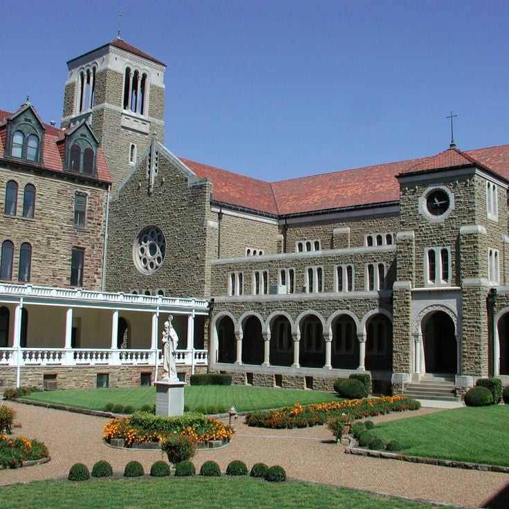
This Benedictine abbey was founded in 1878 by Swiss monks and remains an active monastic community in the Magazine Mountains. The stone buildings show Romanesque elements with rounded arches and solid walls. Inside there is a library holding theological collections and manuscripts, spaces for worship, and quiet rooms for prayer. The gardens around the structures are tended by the monks and offer places for contemplation. Visitors can attend services or explore the grounds through guided tours. Subiaco Abbey sits away from the main tourist trails in Arkansas, combining religious life with the landscape of the region.
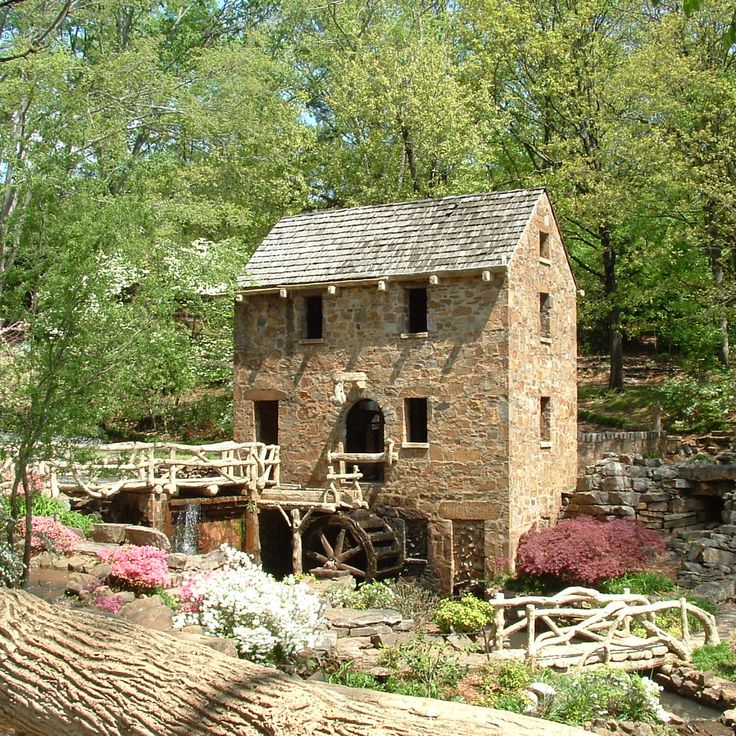
This mill in North Little Rock shows how grain was processed in the 19th century using water power. The building was reconstructed and stands beside a stream that turns the wooden waterwheel. Visitors can watch the mechanical workings as water flows through the paddles and sets the gears in motion. The surrounding park sits quietly and offers paths under trees. The mill appeared in old film footage and draws people interested in craft and rural work methods, away from regular routes through Arkansas.
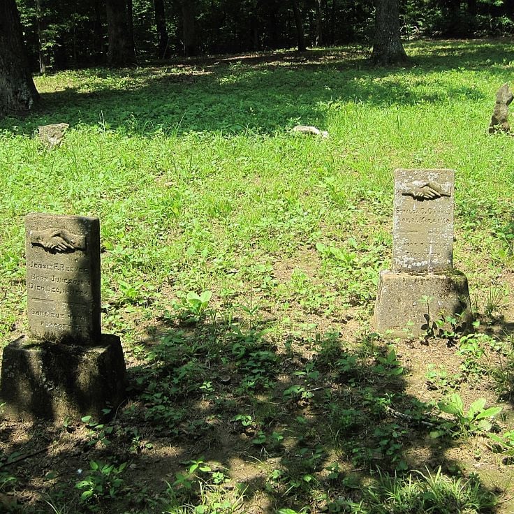
This park preserves the remains of a settlement from 1815 that held the first post office and courthouse in Arkansas Territory. Davidsonville Historic State Park sits in northeastern Arkansas and shows foundation stones and markers where houses, stores, and public buildings once stood. Interpretive panels explain daily life for early settlers who used river routes to move goods. A short walking trail leads through the site, passing old foundations and a small cemetery. Trees and tall grass grow between the historical points.
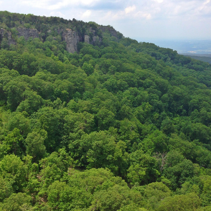
This park sits atop the highest point in Arkansas and offers fourteen miles of marked hiking trails that wind through forests and rock formations. From the summit, views open across the Arkansas River Valley, with rolling hills and wooded valleys extending to the horizon. The trails pass cliffs and open clearings where on clear days you can see the layers of the Ozark Mountains stretching into the distance.
This state park in northeastern Arkansas covers forest land interrupted by two lakes for fishing and boating. Trails wind through hills and flatlands, passing trees that change with the seasons. Mornings bring birdsong, and the water reflects the sky. People come here to hike, camp, or simply be outdoors, away from the usual routes.
This waterfall flows over several rock ledges into a natural pool, deep in the woods of Ozark National Forest. Haw Creek Falls sits away from usual tourist paths in Arkansas and shows the quiet forest landscape of the region. Mosses and ferns grow on the wet stones as the water drops between the trees.
This waterfall in the Ozark National Forest flows through a circular opening in the rock ceiling and drops about 25 feet (7.6 meters) below. The passage formed through erosion of the limestone over thousands of years. Water falls only after heavy rain, especially in spring. The path leads through dense forest over slippery rocks. Glory Hole Waterfall remains a remote spot in the mountains of Arkansas.
This cave system extends across three levels, showing stalactites, stalagmites and underground streams. The limestone has created formations over thousands of years, and guided tours walk through lit chambers of varying sizes. The temperature stays cool year-round, and water still drips from the ceilings, continuing to shape the structures. The caverns sit within the Ozark National Forest and remain one of the less traveled natural sites in Arkansas, offering a look at geology that formed long before human presence.
This sunken ruin in Beaver Lake shows the remains of an 1901 hotel. Concrete walls and foundations rise from the water when the lake level drops. The site lies off regular routes and gives a sense of past times and failed ambitions in the Ozarks.
This park lies in the southwest of the state, where the river cuts through narrow granite canyons and forms several sets of rapids. Trails follow the water through thick forest, and you can hear the rush of water over rocks. In some places, you can walk right down to the bank and see the clear current. The area is quiet and undeveloped, good for those who want to hike away from regular routes or experience the river.
This valley sits in the Ozark Mountains and holds 19th century barns alongside a herd of about 200 elk living in the wild. Boxley Valley offers a look at the region's early farming history and the successful return of wildlife to the area. Visitors can see early settler architecture and open grasslands where the elk roam, especially at sunrise and sunset.
This abandoned settlement sits in the Ozark National Forest and shows stone buildings from the 1880s. The mine extracted zinc until 1940, after which residents left the area. Today several structures stand along the Buffalo River, including an old post office and homes. Trails lead through the ruins and to mine shafts. In spring and fall, hikers come here to explore the history of mining in the Ozarks. The forest has reclaimed the buildings, with trees growing between the walls. A short walk from the parking area brings visitors to the main ruins, where signs explain the history of the settlement.
This small waterfall drops about 26 feet (8 meters) into a clear pool in Stone County. A short trail of roughly 1,300 feet (400 meters) leads through the forests of the Ozark National Forest to this quiet spot, which sits away from the main tourist traffic and invites a moment of rest.
This park sits at the meeting point of the White River and Black River, preserving the memory of a former river port. The museum displays exhibits about regional river trade, including steamboat navigation and commerce during the 19th century. The buildings date back to when Jacksonport served as a stop for river steamers. Visitors see Civil War artifacts and objects that document daily life in a river town.
These waterfalls in Lake Catherine State Park sit along hiking trails that pass through pine forests. Several cascades flow over granite rocks. The routes connect different points in the park and show the wooded landscape of the region. The area belongs to the natural sites in Arkansas that lie away from regular tourist routes.
This waterfall sits in the Ozark Mountains and drops over a natural rock wall into a small pool below. The water flows through dense forest, surrounded by ferns and moss clinging to the old stones. The path to the falls follows a creek through a narrow gorge, where the sound of rushing water echoes between the trees. Falling Water Falls shows the quiet woodland scenery found in the mountains of Arkansas, away from regular routes.
Sam's Throne is a roughly 500-foot (152 m) sandstone cliff in Newton County, Arkansas. This cliff offers climbing walls at different difficulty levels and wide views over the Ozark Mountains. The formation sits away from regular tourist paths and draws mostly climbers looking for vertical routes in a quiet setting. The rock faces show different structures, from gentle ledges to steep overhangs. From the top, the view extends across forested hills and valleys of the region.
This park in the Ozarks sits on layers of ancient rock and displays weathered sandstone blocks, underground passages, and bands of flint. The forest grows over rocky slopes and dry streambeds that fill after rain. Trails lead through the terrain, passing crevices and cave openings. Historic structures from the 1930s stand among the trees, linking the visitor history to the geology of the region.
This abandoned railway bridge in Monroe County has stood unused since 1983. Plants grow between the steel beams and birds build their nests within the structure. The bridge sits away from regular tourist routes in Arkansas and shows how nature slowly reclaims a space once built by people. This structure belongs among the historical sites that make visible the industrial heritage of the region.
This incorporated village near Little Rock sits between busy highways and wooded hills. Cammack Village was founded during World War II and today preserves a quiet residential layout with two parks and a small business district. The low population and older buildings give a sense of another era. For travelers exploring Arkansas beyond the usual routes, this community offers a glimpse into a planned mid-20th-century town.
This park preserves the starting point of the 1815 survey work. A granite marker shows where surveyors began mapping the Louisiana Territory. The site recalls the early days of western expansion after the Louisiana Purchase. Visitors find walking trails and panels explaining the survey work that shaped American growth. The area lies away from regular tourist routes in Arkansas.
This museum sits in a region shaped by cotton farming for centuries. It displays agricultural equipment from the 1800s to the present, including plows, tractors, and harvesting machines that document how farm work changed over time. The exhibits explain how people worked the Delta land and what techniques they developed. The museum preserves objects that make rural life in Arkansas understandable to visitors walking through its halls.
This church from 1905 held a central role for the African American community in Phillips County. The wooden building appears in the National Register of Historic Places and preserves the history of religious life and social gatherings in rural Arkansas. The simple architecture with white facade and tall windows shows features typical of Baptist houses of worship from that period. The interior with original pews tells the story of community life across several generations.
This state park sits in Nevada County, near the southern edge of the pine-bluff region. The lake covers around 2650 acres, leaving room for anglers and boats. Trails circle through forest where pine needles soften each step. Shores remain quiet most of the day, and the water holds a clear surface. Mornings bring fishermen who set their lines, and later in the day you might see a few sailboats or kayaks. The forest smells of resin and earth. Paths wind between the trees, some follow the shore, others climb gently. In autumn the leaves turn and reflect in the water, and the air cools enough to make walking pleasant.
This museum in Phillips County presents the history of the region through exhibits on blues music, civil rights, and local art. Visitors find photographs, recordings, and documents about musicians who grew up and worked in the surrounding communities. The collection includes stories about farming, Mississippi River floods, and social changes throughout the 20th century. The Delta Cultural Center sits away from common travel routes and offers insight into the cultural heritage of this part of Arkansas.
This museum displays artifacts from a Mississippi period settlement inhabited between 1400 and 1650. The collection includes pottery, stone tools, and objects used in daily life. A permanent exhibition explains how people lived in this region before European contact. The museum sits near the original site where farmers uncovered these items in the early 20th century. Glass cases hold ceramic vessels with painted designs, bone needles, and small carvings. The displays focus on agriculture, fishing, and craft production in the floodplain of the Mississippi River.
This marble monument from 1910 stands on the shore of Lake Chicot and commemorates Confederate soldiers from Chicot County. It belongs among the historical sites in Arkansas that remain outside regular tourist routes, offering insight into local history from the 19th century and the memory practices of the early 20th century.
This limestone cave in Benton County holds underground passages and is tied to legends about Spanish gold coins from the 16th century. Old Spanish Treasure Cave belongs to the less visited places in Arkansas and connects geological formations with historical stories of hidden treasure. The cave lies away from usual routes and offers visitors the chance to walk through natural underground chambers while hearing tales of Spanish conquistadors who supposedly hid gold here.
This sandstone arch formed over thousands of years through erosion and rises in a forested area. The formation reaches about 30 feet above the ground and extends across roughly 130 feet. A short trail leads through dense woods to the base of the bridge, where visitors can see the layering of the rock and the vegetation growing in the crevices. The area sits away from main roads and shows typical erosion patterns found in the Ozark Mountains. The bridge is among the less-visited geological formations in Arkansas and offers a quiet place for walking.
This brick school from 1850 was the first institution for higher education in Arkansas. Cane Hill College sits in rural Washington County, away from the major towns. The buildings belong to the oldest educational structures in the state and show architecture from the mid-19th century. The campus was later abandoned, and today only ruins and foundations remain. The place offers a glimpse into the early history of college education in Arkansas and the pioneer era in this region.
The Pfeiffer House is an estate from 1880 in Independence County. The building shows features of late-nineteenth-century German architecture, including steep roofs and stone masonry. The carriage house forms part of the historic property. This site belongs among the less-visited historical places in Arkansas and stands apart from usual travel routes.
This park shows reconstructed military installations from 1812. Visitors find trenches and defensive structures that offer insight into early American warfare. The site sits away from regular routes through Arkansas and uses rebuilt fortifications to show how soldiers organized their positions at that time. Information panels explain the historical context. A walking path leads through different sections of the grounds.
This 1930s farmhouse shows the musician's early life with furniture and objects from his youth. The Johnny Cash House offers insight into the childhood of an American music legend in a rural Arkansas community, away from regular tourist routes. The rooms preserve the feeling of a farming family during economically difficult years.
This nature preserve features springs that emerge from limestone rock. Gardens surrounding the springs include native plants and trees of the Ozark highlands. Archaeological evidence shows indigenous communities lived here centuries ago. Walking trails pass through wooded areas and open to views over the water. Blue Springs Heritage Center sits away from regular tourist routes and connects natural history with the cultural heritage of the region.
This construction site in the Ozark Mountains demonstrates building techniques from the 13th century. Craftsmen work with medieval methods: they cut stone by hand, shape timber, and raise walls without modern tools. The fortress grows slowly, stone by stone, following historical models. Visitors watch stonemasons, carpenters, and blacksmiths at their craft. The project shows how castles rose eight centuries ago. For this collection, the Ozark Medieval Fortress offers a hands-on look at how Arkansas brings history to life away from usual tourist paths.
This park in central Arkansas centers on Lake Bennett, a small reservoir surrounded by wooded hills. Trails wind through thick forest, a sand beach sits on the lake shore, and fishing spots line the water edge. The area shows the typical landscape of the Ozark foothills, with oak and pine trees. The water stays cool in summer, and the trails see few visitors.
This Benedictine abbey was founded in 1878 by Swiss monks and remains an active monastic community in the Magazine Mountains. The stone buildings show Romanesque elements with rounded arches and solid walls. Inside there is a library holding theological collections and manuscripts, spaces for worship, and quiet rooms for prayer. The gardens around the structures are tended by the monks and offer places for contemplation. Visitors can attend services or explore the grounds through guided tours. Subiaco Abbey sits away from the main tourist trails in Arkansas, combining religious life with the landscape of the region.
This mill in North Little Rock shows how grain was processed in the 19th century using water power. The building was reconstructed and stands beside a stream that turns the wooden waterwheel. Visitors can watch the mechanical workings as water flows through the paddles and sets the gears in motion. The surrounding park sits quietly and offers paths under trees. The mill appeared in old film footage and draws people interested in craft and rural work methods, away from regular routes through Arkansas.
This park preserves the remains of a settlement from 1815 that held the first post office and courthouse in Arkansas Territory. Davidsonville Historic State Park sits in northeastern Arkansas and shows foundation stones and markers where houses, stores, and public buildings once stood. Interpretive panels explain daily life for early settlers who used river routes to move goods. A short walking trail leads through the site, passing old foundations and a small cemetery. Trees and tall grass grow between the historical points.
This park sits atop the highest point in Arkansas and offers fourteen miles of marked hiking trails that wind through forests and rock formations. From the summit, views open across the Arkansas River Valley, with rolling hills and wooded valleys extending to the horizon. The trails pass cliffs and open clearings where on clear days you can see the layers of the Ozark Mountains stretching into the distance.
This state park in northeastern Arkansas covers forest land interrupted by two lakes for fishing and boating. Trails wind through hills and flatlands, passing trees that change with the seasons. Mornings bring birdsong, and the water reflects the sky. People come here to hike, camp, or simply be outdoors, away from the usual routes.