Blanchard Springs Caverns, Show cave in Arkansas, United States.
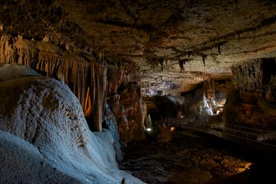
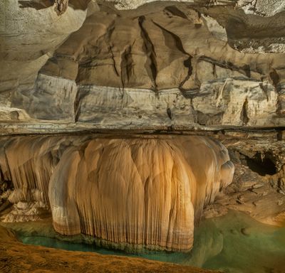
Blanchard Springs Caverns is a limestone cave system in Stone County, Arkansas, United States. The site spreads across multiple levels with chambers filled with white formations, underground streams, and natural columns.
The U.S. Forest Service opened the system to visitors in 1973 after installing walkways and lighting. However, exploration began in the 1950s when cavers started mapping the passages.
The name comes from Blanchard Springs, a nearby water source. The cave sits within the Ozark-St. Francis National Forest and supports several bat species.
The temperature stays around 58 degrees Fahrenheit (14 degrees Celsius) year-round, so bringing a light jacket helps. Sturdy footwear works well on the damp paths inside.
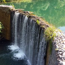
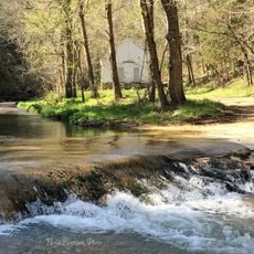
An active underground river continues to carve new passages through limestone dissolution. Visitors can hear and see flowing water in some sections.
Location: Arkansas
Location: Stone County
GPS coordinates: 35.96368,-92.17933
Latest update: December 5, 2025 22:30
Arkansas sits in the southern United States, where the Ozark and Ouachita mountains meet forested valleys and slow rivers. Away from the main highways, the state holds waterfalls hidden in national forests, abandoned settlements from mining days, and caves filled with limestone formations. Haw Creek Falls drops over a series of ledges in the Ozarks, while Blanchard Springs Caverns opens into chambers where underground streams have carved stone over thousands of years. Rush, once a zinc mining town, now stands empty along the Buffalo River. Boxley Valley offers open fields where elk graze beneath ridges, and the Cossatot River cuts through rocky rapids in the Ouachita range. These places show different chapters of the region's natural and human history. Historical sites and cultural centers add depth to the landscape. Monte Ne preserves the ruins of an early resort built beside Beaver Lake. The Hampson Archeological Museum holds artifacts from indigenous peoples who lived in the Mississippi River floodplain. Jacksonport once served as a river port on the White River, and the Delta Cultural Center documents the agricultural heritage of eastern Arkansas. From Sam's Throne, a rock outcrop with views across the Ozarks, to the old railway bridge in Clarendon, these locations lie off the usual routes and reward those who take the time to seek them out.
Sylamore Creek Bridge
6.1 km
Stone County Courthouse
11.9 km
Mount Olive Cumberland Presbyterian Church
8.7 km
John Avey Barn
10.7 km
Mirror Lake Historic District
620 m
John F. Brewer House
12 km
Cold Water School
21.4 km
Alco School
19.2 km
Roasting Ear Church and School
10 km
Lackey General Merchandise and Warehouse
12 km
Boswell School
14.1 km
Jumbo Church of Christ
21.1 km
George W. Lackey House
11.8 km
Bluff Springs Church and School
19.9 km
Calico Rock Methodist Episcopal Church
17.8 km
Calico Rock Historic District
17.5 km
Fred Lancaster Barn
12.3 km
Orvall Gammill Barn
10.4 km
Mountain View Waterworks
11.5 km
H.S. Mabry Barn
17.1 km
Sylvester Smith Farmstead
15 km
Samuel Brown House
15.2 km
Clarence Anderson Barn
10.5 km
West Richwoods Church & School
15.3 km
William Dillard Homestead
13.5 km
Calico Rock Home Economics Building
17.5 km
Clark-King House
10.1 km
Newton Sutterfield Farmstead
20 kmVisited this place? Tap the stars to rate it and share your experience / photos with the community! Try now! You can cancel it anytime.
Discover hidden gems everywhere you go!
From secret cafés to breathtaking viewpoints, skip the crowded tourist spots and find places that match your style. Our app makes it easy with voice search, smart filtering, route optimization, and insider tips from travelers worldwide. Download now for the complete mobile experience.
A unique approach to discovering new places❞
— Le Figaro
All the places worth exploring❞
— France Info
A tailor-made excursion in just a few clicks❞
— 20 Minutes