Devil's Den State Park
Devil's Den State Park, State park in Washington County, Arkansas
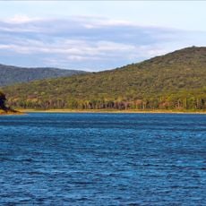
Devil's Den State Park is a state park in Washington County in northwest Arkansas that spreads across wooded valleys and rocky slopes within the Ozark Mountains. A small lake sits at the center, surrounded by campsites, cabins, and trails that run through dense forest and over rock ledges.
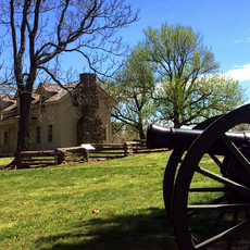
Young men of the Civilian Conservation Corps built the first infrastructure of the park between 1933 and 1942, including wooden and stone buildings and paths through the terrain. This work came during the Great Depression as part of a nationwide program to create jobs and recreation areas.
The name comes from a crevice about six feet deep (1.8 meters) between two sandstone boulders that looks like an entrance into the earth. Visitors today can walk around this formation and explore the narrow passages between the large stone blocks.
Most trails are well marked and lead through terrain of varying steepness with many natural rock formations. Visitors should wear sturdy footwear and watch for slippery spots, especially after rain or near streams.
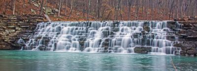
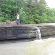
The lake water often has a greenish tint from algae and minerals that have accumulated over decades. The stone dam that holds the lake was built by hand and still shows the joints and shapes of the original construction.
Location: Washington County
Inception: 1933
Architects: Civilian Conservation Corps
Phone: +14797613325
Website: https://arkansasstateparks.com/parks/devils-den-state-park
GPS coordinates: 35.77978,-94.25004
Latest update: December 5, 2025 22:30
Arkansas sits in the southern United States, where the Ozark and Ouachita mountains meet forested valleys and slow rivers. Away from the main highways, the state holds waterfalls hidden in national forests, abandoned settlements from mining days, and caves filled with limestone formations. Haw Creek...
Prairie Grove Airlight Outdoor Telephone Booth
23.2 km
Prairie Grove Battlefield State Park
23.3 km
Lake Fort Smith State Park
14.6 km
Arkansas Air & Military Museum
26.2 km
Cane Hill College
19.7 km
Woolsey Bridge
13.8 km
Lee Creek Bridge
19.8 km
Borden House
23.4 km
Lake-Bell House
25.1 km
Twin Bridges Historic District
21.3 km
Earle House
19.2 km
Our Lady of the Ozarks Shrine
12.3 km
Frog Bayou Bridge
19 km
Highway B-29 Bridge
24.5 km
Cane Hill Road Bridge
24.6 km
Cane Hill Battlefield
13.9 km
Cane Hill Cemetery
20.1 km
Walnut Grove Presbyterian Church
24.8 km
Chester Masonic Lodge and Community Building
12.9 km
Blackburn House
19.6 km
D.N. Edmiston House
19.6 km
John Edmiston House
19.9 km
Cedarville School Building
25.4 km
Evansville-Dutch Mills Road Bridge
24.4 km
United Presbyterian Church of Canehill
19.6 km
Zeb Edmiston House
19.4 km
No. 12 School
8.5 km
Methodist Manse
19.5 kmVisited this place? Tap the stars to rate it and share your experience / photos with the community! Try now! You can cancel it anytime.
Discover hidden gems everywhere you go!
From secret cafés to breathtaking viewpoints, skip the crowded tourist spots and find places that match your style. Our app makes it easy with voice search, smart filtering, route optimization, and insider tips from travelers worldwide. Download now for the complete mobile experience.
A unique approach to discovering new places❞
— Le Figaro
All the places worth exploring❞
— France Info
A tailor-made excursion in just a few clicks❞
— 20 Minutes