Chest opened
+${chestReward.xp} XP
Explorer
NOUVEAU ×${chestReward.collectible.quantity}
tapez pour fermer
Chest locked

Open chests in the app

Around Us is built for your phone — chests unlock when you walk, explore and capture nearby places.

Enable Location

We need your location to show you interesting places around you

Discover nearby places

Find interesting locations and hidden gems around you

Precise directions

Get accurate directions and distances to places

Your location is never shared with other users. It's only used when you tap the location button.

Log in to your account

Start exploring — it's free

Trusted by 73,072 travelers worldwide

Continue with Google
Continue with Apple
or

We will send you a code to connect

By continuing, you accept our Terms and Conditions and our Privacy Policy

Check your inbox

We've sent a pincode in your inbox. Please enter the code below.

Arkansas's 4th congressional district
Discussion Reviews Photo
19.2k Popularity

Arkansas's 4th congressional district, Congressional district in southwestern Arkansas, United States.

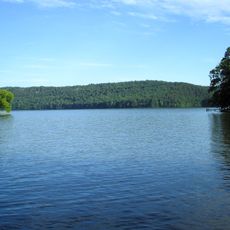
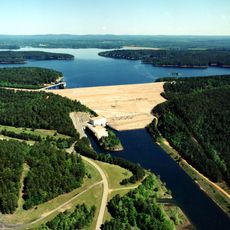
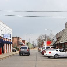
Arkansas's 4th congressional district is a voting area in the southwestern part of the state. It stretches across multiple counties and includes several larger cities like Hot Springs, Pine Bluff, and Texarkana.

The district was established in 1875 and was long dominated by one political party. Political support shifted toward a different party during the early 2000s.

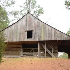
The region brings together farming traditions and city life in a single area. People here connect through shared interests in agriculture, local businesses, and community gatherings.

Residents can look up who represents them in Congress and find information about the district online. Local government buildings and offices provide more details about representation and services.

One county within the boundaries is split among three different districts, while the rest of the area is represented solely by this one. This arrangement means some voters live in overlapping representation zones.

The community of curious travelers

AroundUs brings together thousands of curated places, local tips, and hidden gems, enriched daily by 60,000 contributors worldwide.

Start exploring
Location
GPS coordinates
34.21972,-93.20444
Latest update
December 7, 2025 10:07
Around this place
Lake Hamilton and Lake Catherine
United States of America

Lake Hamilton and Lake Catherine

26 km
DeGray Lake
United States of America

DeGray Lake

8.6 km
DeGray Lake Resort State Park
United States of America

DeGray Lake Resort State Park

5.8 km
Scouting in Arkansas
United States of America

Scouting in Arkansas

17.1 km
Rosedale Plantation Barn
United States of America

Rosedale Plantation Barn

11.5 km
Arkadelphia Confederate Monument
United States of America

Arkadelphia Confederate Monument

18.1 km
Van Lyell House
United States of America

Van Lyell House

26.7 km
Ouachita River Bridge
United States of America

Ouachita River Bridge

18.1 km
James E. M. Barkman House
United States of America

James E. M. Barkman House

17.2 km
Clark County Courthouse
United States of America

Clark County Courthouse

18.1 km
Capt. Charles C. Henderson House
United States of America

Capt. Charles C. Henderson House

17.5 km
Blakely House
United States of America

Blakely House

20.9 km
Old Bank of Amity
United States of America

Old Bank of Amity

24.2 km
Bozeman House
United States of America

Bozeman House

14.7 km
Helena National Guard Armory
United States of America

Helena National Guard Armory

18.1 km
Arkadelphia Boy Scout Hut
United States of America

Arkadelphia Boy Scout Hut

17.1 km
Clark County Library
United States of America

Clark County Library

17.7 km
Dr. Boaz House
United States of America

Dr. Boaz House

22.5 km
Dardanelle Commercial Historic District
United States of America

Dardanelle Commercial Historic District

4.7 km
Habicht-Cohn-Crow House
United States of America

Habicht-Cohn-Crow House

17.5 km
Hodges House
United States of America

Hodges House

7.9 km
DeGray Creek Bridge
United States of America

DeGray Creek Bridge

8.4 km
C. E. Thompson General Store and House
United States of America

C. E. Thompson General Store and House

15.1 km
Loy Kirksey House
United States of America

Loy Kirksey House

8.6 km
W. H. Young House
United States of America

W. H. Young House

18.5 km
Nannie Gresham Biscoe House
United States of America

Nannie Gresham Biscoe House

17.9 km
Domestic Science Building
United States of America

Domestic Science Building

18.4 km
Clear Springs Tabernacle
United States of America

Clear Springs Tabernacle

25.1 km
Show the full map
Reviews
Share your experience

No review yet

Discussions
Start a discussion...

No discussion yet

« Arkansas's 4th congressional district - Congressional district in southwestern Arkansas, United States » is provided by Around Us (aroundus.com). Images and texts are derived from Wikimedia project under a Creative Commons license. You are allowed to copy, distribute, and modify copies of this page, under the conditions set by the license, as long as this note is clearly visible.

Discover hidden gems everywhere you go!

From secret cafés to breathtaking viewpoints, skip the crowded tourist spots and find places that match your style. Our app makes it easy with voice search, smart filtering, route optimization, and insider tips from travelers worldwide. Download now for the complete mobile experience.

Around Us App Screenshot

A unique approach to discovering new places

Le Figaro

All the places worth exploring

France Info

A tailor-made excursion in just a few clicks

20 Minutes

Around Us
Travel Guide & Maps
Download

Send to your phone

QR Code
1

Open the camera app on your mobile.

2

Point at the QR code with your camera. A notification will appear.

3

Tap the notification to open the link.