Chest opened
+${chestReward.xp} XP
Explorer
NOUVEAU ×${chestReward.collectible.quantity}
tapez pour fermer
Chest locked

Open chests in the app

Around Us is built for your phone — chests unlock when you walk, explore and capture nearby places.

Enable Location

We need your location to show you interesting places around you

Discover nearby places

Find interesting locations and hidden gems around you

Precise directions

Get accurate directions and distances to places

Your location is never shared with other users. It's only used when you tap the location button.

Sheridan

Log in to your account

Start exploring — it's free

Trusted by 72,880 travelers worldwide

Continue with Google
Continue with Apple
or

We will send you a code to connect

By continuing, you accept our Terms and Conditions and our Privacy Policy

Check your inbox

We've sent a pincode in your inbox. Please enter the code below.

Discussion Reviews 1 Photos
14.1k Popularity

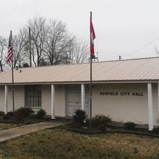
Sheridan, Administrative division in Grant County, US

Sheridan is an administrative division in Grant County and serves as a self-governing municipality within that region. The town maintains local services, schools, and public infrastructure managed by its town government.

Sheridan was established during the 19th century expansion period when settlements formed across Arkansas. The town developed as a local center for the farming communities in the surrounding area.

The division supports local community engagement through neighborhood associations, district councils, and regular municipal meetings focused on civic participation.

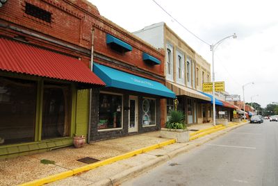
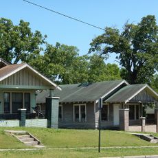
Visitors will find a small town with basic amenities and services scattered throughout the downtown area. Most of the town can be explored on foot, giving a good sense of the local community.

The administrative boundaries of Sheridan encompass specific geographical coordinates at latitude 34.3100971 and longitude -92.4013484, determining its exact jurisdictional reach.

The community of curious travelers

AroundUs brings together thousands of curated places, local tips, and hidden gems, enriched daily by 60,000 contributors worldwide.

Start exploring
GPS coordinates
34.31010,-92.40135
Latest update
December 7, 2025 20:23
Around this place
United States of America

Marylake Carmelite Monastery

26.1 km
Jenkins' Ferry Battleground State Park
United States of America

Jenkins' Ferry Battleground State Park

17.2 km
Dollarway Road
United States of America

Dollarway Road

24.8 km
Camp White Sulphur Springs Confederate Cemetery
United States of America

Camp White Sulphur Springs Confederate Cemetery

29.5 km
Old River Bridge
United States of America

Old River Bridge

31.9 km
Royal Theatre
United States of America

Royal Theatre

33 km
Oak Grove School
United States of America

Oak Grove School

11.1 km
Old Benton-Sardis Road Bridge
United States of America

Old Benton-Sardis Road Bridge

29.4 km
Charles "Bullet" Dean Hyten House
United States of America

Charles "Bullet" Dean Hyten House

32.8 km
Redfield School Historic District
United States of America

Redfield School Historic District

25.1 km
Bank of Carthage
United States of America

Bank of Carthage

29.8 km
Gann House
United States of America

Gann House

32.8 km
Gann Building
United States of America

Gann Building

32.8 km
Mt. Zion Methodist Church
United States of America

Mt. Zion Methodist Church

22.5 km
Koon House No. 1
United States of America

Koon House No. 1

3.9 km
Koon House No. 6
United States of America

Koon House No. 6

5.2 km
Dr. T.E. Buffington House
United States of America

Dr. T.E. Buffington House

33.1 km
Gann Row Historic District
United States of America

Gann Row Historic District

32.6 km
Rucker House
United States of America

Rucker House

29.1 km
J. W. and Ann Lowe Clary House
United States of America

J. W. and Ann Lowe Clary House

33.1 km
Glaser-Kelly House
United States of America

Glaser-Kelly House

63 m
Dr. John L. Butler House
United States of America

Dr. John L. Butler House

51 m
Walter B. Sorrells Cottage
United States of America

Walter B. Sorrells Cottage

30.6 km
Samuel D. Byrd Sr. Homestead
United States of America

Samuel D. Byrd Sr. Homestead

24.2 km
White Hall Museum
United States of America

White Hall Museum

28.4 km
Redfield City Hall
United States of America

Redfield City Hall

25.1 km
Tull Bridge
United States of America

Tull Bridge

23.4 km
Francois Baptist Church
United States of America

Francois Baptist Church

32.3 km
Show the full map
Reviews
Share your experience

No review yet

Discussions
Start a discussion...

No discussion yet

« Sheridan - Administrative division in Grant County, US » is provided by Around Us (aroundus.com). Images and texts are derived from Wikimedia project under a Creative Commons license. You are allowed to copy, distribute, and modify copies of this page, under the conditions set by the license, as long as this note is clearly visible.

Discover hidden gems everywhere you go!

From secret cafés to breathtaking viewpoints, skip the crowded tourist spots and find places that match your style. Our app makes it easy with voice search, smart filtering, route optimization, and insider tips from travelers worldwide. Download now for the complete mobile experience.

Around Us App Screenshot

A unique approach to discovering new places

Le Figaro

All the places worth exploring

France Info

A tailor-made excursion in just a few clicks

20 Minutes

Around Us
Travel Guide & Maps
Download

Send to your phone

QR Code
1

Open the camera app on your mobile.

2

Point at the QR code with your camera. A notification will appear.

3

Tap the notification to open the link.