Chest opened
+${chestReward.xp} XP
Explorer
NOUVEAU ×${chestReward.collectible.quantity}
tapez pour fermer
Chest locked

Open chests in the app

Around Us is built for your phone — chests unlock when you walk, explore and capture nearby places.

Enable Location

We need your location to show you interesting places around you

Discover nearby places

Find interesting locations and hidden gems around you

Precise directions

Get accurate directions and distances to places

Your location is never shared with other users. It's only used when you tap the location button.

Log in to your account

Start exploring — it's free

Trusted by 72,880 travelers worldwide

Continue with Google
Continue with Apple
or

We will send you a code to connect

By continuing, you accept our Terms and Conditions and our Privacy Policy

Check your inbox

We've sent a pincode in your inbox. Please enter the code below.

McIntosh Bluff
Discussion Reviews Photo
1.5k Popularity

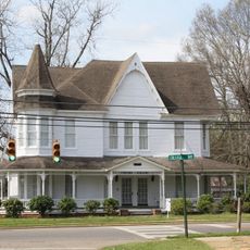
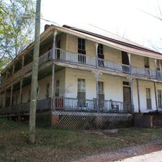
McIntosh Bluff, Historical riverside elevation in Washington County, Alabama

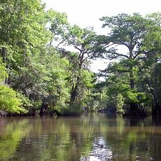
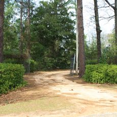
McIntosh Bluff is an elevated area along the Tombigbee River in Washington County with views across the surrounding landscape. The site rises about 4 meters above sea level and connects to U.S. Highway 43 and County Highway 35.

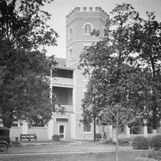
The site served as Washington County's first administrative center from 1800 to 1804 and later as Baldwin County's seat from 1809 to 1820. This dual role shows its importance in early regional government.

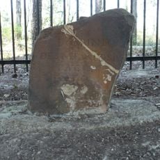
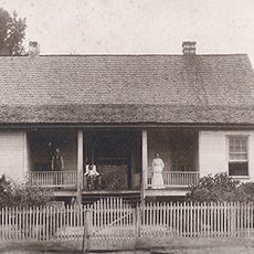
The name comes from Captain John McIntosh, a British officer of Scottish origin who received land grants near the river after the Seven Years War. Visitors today see a place tied to early settlement patterns along this waterway.

The site is easily reached by U.S. Highway 43 and lies near County Highway 35 for local travel. Larger services and facilities are available in Mobile to the south.

During the Civil War, the site housed industrial operations including a sawmill, gristmill, and blacksmith shop that supported gunboat construction. These workshops played an unexpected role in the region's wartime production.

The community of curious travelers

AroundUs brings together thousands of curated places, local tips, and hidden gems, enriched daily by 60,000 contributors worldwide.

Start exploring
Location
Elevation above the sea
4 m
GPS coordinates
31.25720,-87.98880
Latest update
December 14, 2025 15:00
Around this place
General W.K. Wilson Jr. Bridge
United States of America

General W.K. Wilson Jr. Bridge

38.3 km
United States of America

Old Mobile Site

32.1 km
Bottle Creek Indian Mounds
United States of America

Bottle Creek Indian Mounds

28 km
Mount Vernon Arsenal
United States of America

Mount Vernon Arsenal

19.2 km
Ellicott's Stone
United States of America

Ellicott's Stone

29.1 km
Fort Sinquefield
United States of America

Fort Sinquefield

52.4 km
Magee Farm
United States of America

Magee Farm

51.3 km
Andrews Chapel
United States of America

Andrews Chapel

3.9 km
N.Q. and Virginia M. Thompson House
United States of America

N.Q. and Virginia M. Thompson House

29.1 km
J. P. McKee Lustron House
United States of America

J. P. McKee Lustron House

30.2 km
Latham United Methodist Church
United States of America

Latham United Methodist Church

23.2 km
First Baptist Church
United States of America

First Baptist Church

46.1 km
Montgomery Hill Baptist Church
United States of America

Montgomery Hill Baptist Church

21.9 km
Jackson Historic District
United States of America

Jackson Historic District

29.7 km
Isaac Nettles Gravestones
United States of America

Isaac Nettles Gravestones

15.2 km
Citronelle Railroad Historic District
United States of America

Citronelle Railroad Historic District

29.8 km
St. Stephens Courthouse
United States of America

St. Stephens Courthouse

32.1 km
Whatley Historic District
United States of America

Whatley Historic District

51.3 km
Stephen Beech Cleveland House
United States of America

Stephen Beech Cleveland House

48.6 km
Gainestown Methodist Church and Cemetery
United States of America

Gainestown Methodist Church and Cemetery

34.7 km
Gainestown Schoolhouse
United States of America

Gainestown Schoolhouse

35.6 km
Doit W. McClellan Lustron House
United States of America

Doit W. McClellan Lustron House

30.2 km
Nelson House
United States of America

Nelson House

24.3 km
Willis G. Clark House
United States of America

Willis G. Clark House

35.3 km
Davis-Oak Grove District
United States of America

Davis-Oak Grove District

47.9 km
Jesse Pickens Pugh Farmstead
United States of America

Jesse Pickens Pugh Farmstead

51.6 km
Central Core Historic District
United States of America

Central Core Historic District

28.9 km
Stockton Methodist Church
United States of America

Stockton Methodist Church

29.8 km
Show the full map
Reviews
Share your experience

No review yet

Discussions
Start a discussion...

No discussion yet

« McIntosh Bluff - Historical riverside elevation in Washington County, Alabama » is provided by Around Us (aroundus.com). Images and texts are derived from Wikimedia project under a Creative Commons license. You are allowed to copy, distribute, and modify copies of this page, under the conditions set by the license, as long as this note is clearly visible.

Discover hidden gems everywhere you go!

From secret cafés to breathtaking viewpoints, skip the crowded tourist spots and find places that match your style. Our app makes it easy with voice search, smart filtering, route optimization, and insider tips from travelers worldwide. Download now for the complete mobile experience.

Around Us App Screenshot

A unique approach to discovering new places

Le Figaro

All the places worth exploring

France Info

A tailor-made excursion in just a few clicks

20 Minutes

Around Us
Travel Guide & Maps
Download

Send to your phone

QR Code
1

Open the camera app on your mobile.

2

Point at the QR code with your camera. A notification will appear.

3

Tap the notification to open the link.