Enable Location

We need your location to show you interesting places around you

Discover nearby places

Find interesting locations and hidden gems around you

Precise directions

Get accurate directions and distances to places

Your location is never shared with other users. It's only used when you tap the location button.

Tom Bevill Lock and Dam

Log in to your account

Start exploring — it's free

Trusted by 62,453 travelers worldwide

Continue with Google
Continue with Apple
or

We will send you a code to connect

By continuing, you accept our Terms and Conditions and our Privacy Policy

Check your inbox

We've sent a pincode in your inbox. Please enter the code below.

Tom Bevill Lock and Dam

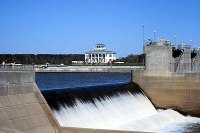
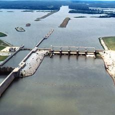
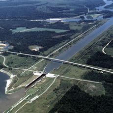
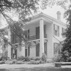
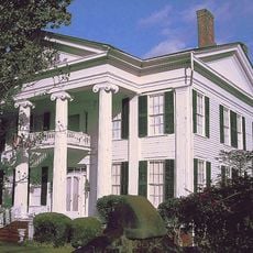
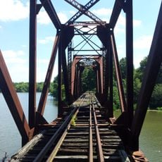
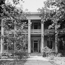
Tom Bevill Lock and Dam, Lock and dam system on Tennessee-Tombigbee Waterway in Pickens County, United States.

Tom Bevill Lock and Dam is a lock and dam system on the Tennessee-Tombigbee Waterway that creates Aliceville Lake and controls water flow between two river networks. The facility allows boats to move safely between different water levels while managing the flow throughout the connected waterway system.

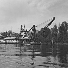
Construction started in 1977 as part of a broader effort to connect river systems across the southeastern United States. This project was a major step in developing modern navigation routes for commercial shipping in the region.

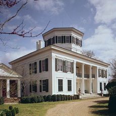
The facility represents American engineering excellence in waterway management, enabling commercial navigation and recreation across Alabama's river systems.

You can view the lock system from several vantage points to see how vessels pass through the structure. The best time to visit is during daylight hours when boat traffic is active through the lock.

The dam maintains an elevation of 41 meters and creates specific water conditions that support diverse fish populations in Aliceville Lake.

The community of curious travelers

AroundUs brings together thousands of curated places, local tips, and hidden gems, enriched daily by 60,000 contributors worldwide.

Start exploring
Location
Elevation above the sea
41 m
GPS coordinates
33.21070,-88.28780
Latest update
December 14, 2025 11:00
Around this place
Waverley
United States of America

Waverley

44.7 km
Pickens County Courthouse
United States of America

Pickens County Courthouse

18.8 km
John C. Stennis Lock and Dam
United States of America

John C. Stennis Lock and Dam

39 km
Aduston Hall
United States of America

Aduston Hall

45.8 km
Montgomery
United States of America

Montgomery

231 m
Sam D. Hamilton Noxubee National Wildlife Refuge
United States of America

Sam D. Hamilton Noxubee National Wildlife Refuge

46.6 km
Everhope Plantation
United States of America

Everhope Plantation

45.4 km
Howell Heflin Lock and Dam
United States of America

Howell Heflin Lock and Dam

44 km
Old Fort House
United States of America

Old Fort House

34.7 km
Charles McLaran House
United States of America

Charles McLaran House

33.9 km
Oakhurst
United States of America

Oakhurst

47.9 km
Stephen D. Lee House
United States of America

Stephen D. Lee House

34.5 km
South Columbus Historic District
United States of America

South Columbus Historic District

31.9 km
Brownrigg-Harris-Kennebrew House
United States of America

Brownrigg-Harris-Kennebrew House

34.8 km
The Cedars
United States of America

The Cedars

35.5 km
Gainesville Historic District
United States of America

Gainesville Historic District

45.6 km
Hugh Wilson Hill House
United States of America

Hugh Wilson Hill House

18.8 km
Main–Yankee Street Historic District
United States of America

Main–Yankee Street Historic District

45 km
Rev. John H. Gray House
United States of America

Rev. John H. Gray House

54.2 km
Cox-Uithoven House
United States of America

Cox-Uithoven House

46.2 km
Yates-Flora House
United States of America

Yates-Flora House

27.5 km
Colonel Green G. Mobley House
United States of America

Colonel Green G. Mobley House

45.3 km
Gibbs House
United States of America

Gibbs House

45.7 km
Waverly Bridge
United States of America

Waverly Bridge

44 km
William A. Rogers House
United States of America

William A. Rogers House

53.2 km
Weaver Place
United States of America

Weaver Place

34 km
Harris-Banks House
United States of America

Harris-Banks House

33.6 km
Goodwin-Harrison House
United States of America

Goodwin-Harrison House

27.6 km
Show the full map
« Tom Bevill Lock and Dam - Lock and dam system on Tennessee-Tombigbee Waterway in Pickens County, United States » is provided by Around Us (aroundus.com). Images and texts are derived from Wikimedia project under a Creative Commons license. You are allowed to copy, distribute, and modify copies of this page, under the conditions set by the license, as long as this note is clearly visible.

Discover hidden gems everywhere you go!

From secret cafés to breathtaking viewpoints, skip the crowded tourist spots and find places that match your style. Our app makes it easy with voice search, smart filtering, route optimization, and insider tips from travelers worldwide. Download now for the complete mobile experience.

Around Us App Screenshot

A unique approach to discovering new places

Le Figaro

All the places worth exploring

France Info

A tailor-made excursion in just a few clicks

20 Minutes

Around Us
Travel Guide & Maps
Download

Send to your phone

QR Code
1

Open the camera app on your mobile.

2

Point at the QR code with your camera. A notification will appear.

3

Tap the notification to open the link.