Etowah County

Log in to your account

AroundUs is a community-driven map of interesting places, built by curious explorers like you. It grows with every review, story, and photo you share.
Connect to save your favorite spots, contribute locations, and create personalized routes.
Continue with Google
Continue with Apple
Continue with X
Continue with Facebook
Continue with email
By continuing, you accept our Terms and Conditions and our Privacy Policy
Create an account
Add to collection
Map
Suggest a change
Share

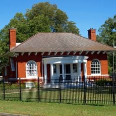
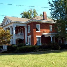
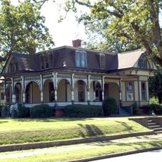
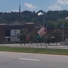
Etowah County, Administrative division in northeastern Alabama, United States.

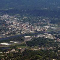
Etowah County is an administrative division in northeastern Alabama, with Gadsden serving as its administrative center. The county encompasses multiple towns and communities spread across the region, managing local government services and public affairs.

The county was established on December 1, 1868, emerging from the earlier Baine County following the Civil War. This creation reflected Alabama's reorganization during the Reconstruction period after the conflict.

The name comes from the Cherokee language, connecting to the Native American people who lived here before removal from their homeland. This link to the past remains part of how local residents understand their region.

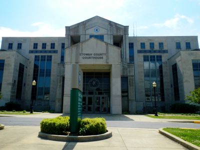
Visitors can access local government services in Gadsden, where the main courthouse and administrative offices handle legal matters and property records. Most essential services are available through in-person visits or online platforms during business hours.

Despite its compact size, the county maintains one of Alabama's highest population densities within a relatively small area. This concentration of people creates a distinct community character different from Alabama's more spread-out regions.

Location: Alabama

Inception: December 7, 1866

Capital city: Gadsden

Shares border with: DeKalb County, Blount County, Cherokee County, Calhoun County, St. Clair County, Marshall County

Website: http://etowahcounty.org

GPS coordinates: 34.05000,-86.03333

Latest update: December 20, 2025 02:34

Photos
Around this place
Noccalula Falls Park
United States of America

Noccalula Falls Park

1.5 km
Snead State Community College
United States of America

Snead State Community College

20.9 km
Gilliland-Reese Covered Bridge
United States of America

Gilliland-Reese Covered Bridge

1.5 km
United States of America

Congregation Beth Israel

4.5 km
Gadsden Downtown Historic District
United States of America

Gadsden Downtown Historic District

4.8 km
Mort Glosser Amphitheater
United States of America

Mort Glosser Amphitheater

5.5 km
Julia Street Memorial United Methodist Church
United States of America

Julia Street Memorial United Methodist Church

20.6 km
Howard Gardner Nichols Memorial Library
United States of America

Howard Gardner Nichols Memorial Library

2.9 km
Colonel O.R. Hood House
United States of America

Colonel O.R. Hood House

4.4 km
Forrest Cemetery Chapel and Comfort Station
United States of America

Forrest Cemetery Chapel and Comfort Station

4.3 km
Charles Gunn House
United States of America

Charles Gunn House

4.4 km
Thomas A. Snellgrove Homestead
United States of America

Thomas A. Snellgrove Homestead

20.3 km
Turrentine Historic District
United States of America

Turrentine Historic District

4.9 km
United States of America

Turkey Town Monument

9.8 km
Attalla Downtown Historic District
United States of America

Attalla Downtown Historic District

6 km
Eleventh Street School
United States of America

Eleventh Street School

4.3 km
Mary G. Hardin Center for Cultural Arts
United States of America

Mary G. Hardin Center for Cultural Arts

4.7 km
First Baptist Church of Glencoe
United States of America

First Baptist Church of Glencoe

13.8 km
United States of America

Rainbow City Park

10.1 km
Glencoe City Hall
United States of America

Glencoe City Hall

13.7 km
United States of America

Gadsden Kiwanis Park

1.6 km
United States of America

Bama Theatre

3.6 km
United States of America

Amuse U Theatre

4.9 km
United States of America

Carver Theatre

4.6 km
United States of America

Savoy Theatre

2.8 km
United States of America

The Brow

2.5 km
United States of America

Chandler Mountain Lake

22.2 km
United States of America

Yellow Bluff

24 km
Show the full map
Reviews

Visited this place? Tap the stars to rate it and share your experience / photos with the community! Try now! You can cancel it anytime.

Administrative divisions
« Etowah County - Administrative division in northeastern Alabama, United States » is provided by Around Us (aroundus.com). Images and texts are derived from Wikimedia project under a Creative Commons license. You are allowed to copy, distribute, and modify copies of this page, under the conditions set by the license, as long as this note is clearly visible.

Discover hidden gems everywhere you go!

From secret cafés to breathtaking viewpoints, skip the crowded tourist spots and find places that match your style. Our app makes it easy with voice search, smart filtering, route optimization, and insider tips from travelers worldwide. Download now for the complete mobile experience.

Around Us App Screenshot

A unique approach to discovering new places

Le Figaro

All the places worth exploring

France Info

A tailor-made excursion in just a few clicks

20 Minutes