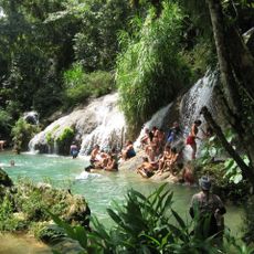
Escambray Mountains, Low mountain range in central Cuba
The Escambray Mountains, also called the Guamuhaya massif, run about 80 km east to west across Sancti Spíritus, Cienfuegos and Villa Clara provinces. The Agabama River divides them into the Guamuhaya Mountains in the west and the Sierra de Sancti Spíritus in the east. Pico San Juan is the highest summit at 960 m, followed by Caballete de Casas, Gavilanes, Loma de Banao, Caja de Agua and Pico Tuerto.
The Escambray range gave refuge to Cuban aborigines and to Mambí fighters during the wars of independence from 1868 to 1898. In 1957–1958 it sheltered guerrillas of the 26th of July Movement, the 13th of March Revolutionary Directorate and the Second National Front of Escambray against Fulgencio Batista's army. From 1959 to 1965 the mountains were the scene of the Escambray rebellion, and they were a planned refuge during the Bay of Pigs Invasion, though never used as one.
The range carries two distinct regional names reflecting local geography: Guamuhaya in the west and Sierra de Sancti Spiritus in the east. These divisions hold meaning for people living nearby, as each section has developed its own character and local identity.
The area is accessible by roads leading into the mountains, particularly to the Topes de Collantes nature reserve with its marked trails and viewpoints. Visiting during drier months works best, as rainy periods can make paths slippery and navigation challenging.
Caballete de Casas, a hard-to-reach plateau at 630 m in Sancti Spíritus municipality, held Che Guevara's base camp from 1958 until the battle of Santa Clara. The site and its historic installations are preserved as a national monument, known locally as the Comandancia del Che en el Escambray; reaching it requires climbing on foot to the summit.
The community of curious travelers
AroundUs brings together thousands of curated places, local tips, and hidden gems, enriched daily by 93,015 contributors worldwide.