Enable Location

We need your location to show you interesting places around you

Discover nearby places

Find interesting locations and hidden gems around you

Precise directions

Get accurate directions and distances to places

Your location is never shared with other users. It's only used when you tap the location button.

Log in to your account

Start exploring — it's free

Trusted by 63,193 travelers worldwide

Continue with Google
Continue with Apple
or

We will send you a code to connect

By continuing, you accept our Terms and Conditions and our Privacy Policy

Check your inbox

We've sent a pincode in your inbox. Please enter the code below.

Discussion Reviews Photo
36.3k Popularity

Saint Andrew Parish, Administrative parish in southeastern Jamaica

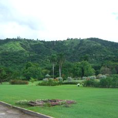
Saint Andrew Parish is an administrative division in southeastern Jamaica that stretches from Cross Roads to Rockfort in the east and extends into the Blue Mountains. The territory encompasses diverse landscapes and forms a major part of the Kingston metropolitan area.

The parish was established by law in 1867 and was formerly called Liguanea, a name derived from an Arawak word meaning lizard. This renaming reflected the administrative reorganization that took place during the colonial period.

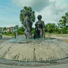
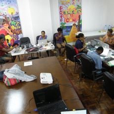
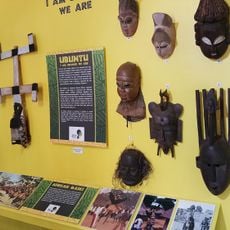
The parish is home to educational and artistic institutions that shape Jamaica's learning environment. These facilities draw students and visitors who come to study, create, and experience the island's intellectual life.

The transport hub at Half-Way-Tree serves as the main junction for public buses connecting different parts of the area. From this central point, visitors can reach various sections of the parish and the surrounding metropolitan region.

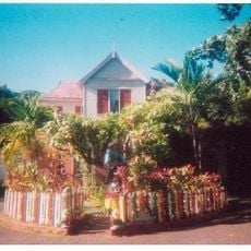
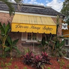
Devon House, built in 1881, represents the success of George Stiebel as Jamaica's first black millionaire. The building stands as a significant example of black entrepreneurial achievement in the 19th-century Caribbean.

The community of curious travelers

AroundUs brings together thousands of curated places, local tips, and hidden gems, enriched daily by 60,000 contributors worldwide.

Start exploring
Location
Capital city
Half Way Tree
Shares border with
Saint Thomas Parish, Portland Parish, Saint Mary Parish, Saint Catherine Parish, Kingston Parish
GPS coordinates
18.01667,-76.90000
Latest update
December 17, 2025 11:02
Reviews
Share your experience

No review yet

Discussions
Start a discussion...

No discussion yet

« Saint Andrew Parish - Administrative parish in southeastern Jamaica » is provided by Around Us (aroundus.com). Images and texts are derived from Wikimedia project under a Creative Commons license. You are allowed to copy, distribute, and modify copies of this page, under the conditions set by the license, as long as this note is clearly visible.

Discover hidden gems everywhere you go!

From secret cafés to breathtaking viewpoints, skip the crowded tourist spots and find places that match your style. Our app makes it easy with voice search, smart filtering, route optimization, and insider tips from travelers worldwide. Download now for the complete mobile experience.

Around Us App Screenshot

A unique approach to discovering new places

Le Figaro

All the places worth exploring

France Info

A tailor-made excursion in just a few clicks

20 Minutes

Around Us
Travel Guide & Maps
Download

Send to your phone

QR Code
1

Open the camera app on your mobile.

2

Point at the QR code with your camera. A notification will appear.

3

Tap the notification to open the link.