Enable Location

We need your location to show you interesting places around you

Discover nearby places

Find interesting locations and hidden gems around you

Precise directions

Get accurate directions and distances to places

Your location is never shared with other users. It's only used when you tap the location button.

Liberty County

Log in to your account

Start exploring — it's free

Trusted by 63,087 travelers worldwide

Continue with Google
Continue with Apple
or

We will send you a code to connect

By continuing, you accept our Terms and Conditions and our Privacy Policy

Check your inbox

We've sent a pincode in your inbox. Please enter the code below.

Discussion Reviews 3 Photos
30.7k Popularity

Liberty County, Administrative division in Georgia, United States

Liberty County spreads across lowlands marked by creeks and swamps where several cities and communities are located. Hinesville serves as the county seat and forms the administrative center of the region.

The county was established on December 5, 1777, and emerged from an earlier parish. Its name commemorates the American independence movement of that founding era.

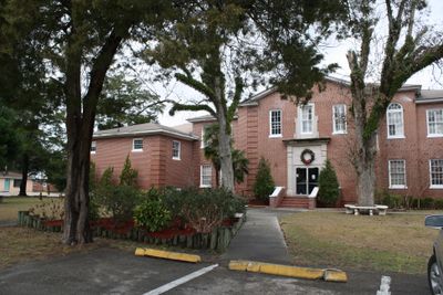
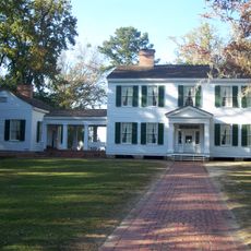
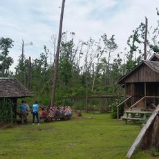
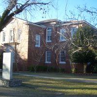
The Midway Museum and Historic Jail in Hinesville reflect the influence of Native American and European settler communities that shaped life here. These places show how different groups of people contributed to the area's development.

Fort Stewart, a major military installation within the county, shapes the local economy and provides significant employment. When planning a visit, remember that military security regulations may restrict access to certain areas.

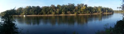
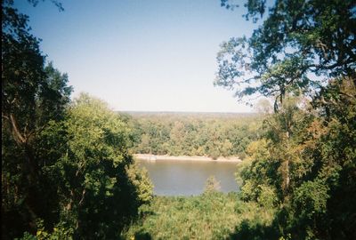
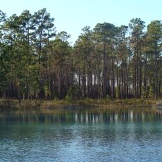
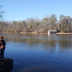
Saint Catherine's Island lies within the county's boundaries and combines maritime landscapes with mainland terrain at low elevation. This island demonstrates the region's coastal diversity.

The community of curious travelers

AroundUs brings together thousands of curated places, local tips, and hidden gems, enriched daily by 60,000 contributors worldwide.

Start exploring
Location
Inception
December 15, 1855
Capital city
Bristol
Reference
12-077
Shares border with
Gadsden County, Franklin County, Leon County, Wakulla County, Jackson County, Gulf County, Calhoun County
GPS coordinates
30.23000,-84.89000
Latest update
December 20, 2025 02:04
Around this place
Apalachicola National Forest
United States of America

Apalachicola National Forest

10.2 km
Torreya State Park
United States of America

Torreya State Park

38.1 km
United States of America

Yon Mound and Village Site

25.6 km
Leaf Theater
United States of America

Leaf Theater

50.2 km
United States of America

Cayson Mound and Village Site

25.9 km
Trammell Bridge
United States of America

Trammell Bridge

25.4 km
United States of America

Bradwell Bay Wilderness

32.9 km
Gadsden Confederate Memorial
United States of America

Gadsden Confederate Memorial

50 km
Quincy Library
United States of America

Quincy Library

50.2 km
Old Calhoun County Courthouse
United States of America

Old Calhoun County Courthouse

27.9 km
Dezell House
United States of America

Dezell House

40 km
United States of America

Mud Swamp/New River Wilderness

19.3 km
Willoughby Gregory House
United States of America

Willoughby Gregory House

45.2 km
E. B. Shelfer House
United States of America

E. B. Shelfer House

50.2 km
Quincy Historic District
United States of America

Quincy Historic District

50.3 km
Judge P. W. White House
United States of America

Judge P. W. White House

50.2 km
John Lee McFarlin House
United States of America

John Lee McFarlin House

50.4 km
Quincy Woman's Club
United States of America

Quincy Woman's Club

49.9 km
E. C. Love House
United States of America

E. C. Love House

50 km
Stockton-Curry House
United States of America

Stockton-Curry House

50.2 km
United States of America

Otis Hare Archeological Site

23.1 km
Torreya State Park
United States of America

Torreya State Park

32.9 km
Panhandle Pioneer Settlement
United States of America

Panhandle Pioneer Settlement

30.7 km
United States of America

Apalachicola River Water Management Area

24.7 km
United States of America

Coconut Bluff

24.8 km
United States of America

Alum Bluff

28.2 km
United States of America

Rock Bluff

25.1 km
United States of America

Ricko Bluff

17.4 km
Show the full map
Reviews
Share your experience

No review yet

Discussions
Start a discussion...

No discussion yet

Administrative divisions
« Liberty County - Administrative division in Georgia, United States » is provided by Around Us (aroundus.com). Images and texts are derived from Wikimedia project under a Creative Commons license. You are allowed to copy, distribute, and modify copies of this page, under the conditions set by the license, as long as this note is clearly visible.

Discover hidden gems everywhere you go!

From secret cafés to breathtaking viewpoints, skip the crowded tourist spots and find places that match your style. Our app makes it easy with voice search, smart filtering, route optimization, and insider tips from travelers worldwide. Download now for the complete mobile experience.

Around Us App Screenshot

A unique approach to discovering new places

Le Figaro

All the places worth exploring

France Info

A tailor-made excursion in just a few clicks

20 Minutes

Around Us
Travel Guide & Maps
Download

Send to your phone

QR Code
1

Open the camera app on your mobile.

2

Point at the QR code with your camera. A notification will appear.

3

Tap the notification to open the link.