Enable Location

We need your location to show you interesting places around you

Discover nearby places

Find interesting locations and hidden gems around you

Precise directions

Get accurate directions and distances to places

Your location is never shared with other users. It's only used when you tap the location button.

Apalachicola National Forest

Log in to your account

Start exploring — it's free

Trusted by 63,062 travelers worldwide

Continue with Google
Continue with Apple
or

We will send you a code to connect

By continuing, you accept our Terms and Conditions and our Privacy Policy

Check your inbox

We've sent a pincode in your inbox. Please enter the code below.

Apalachicola National Forest
Discussion Reviews 1 Photos
17.8k Popularity

Apalachicola National Forest, Nature reserve in Florida Panhandle, US.

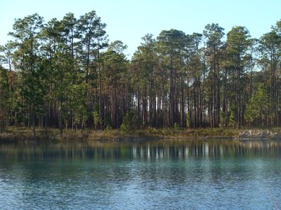
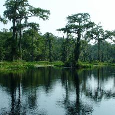
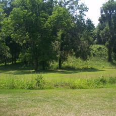
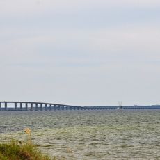
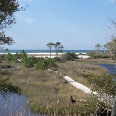
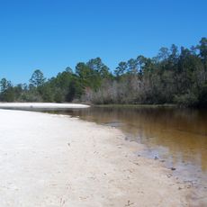
Apalachicola National Forest is a nature reserve in the Florida Panhandle that stretches across three counties and covers more than 632,000 acres (255,000 hectares) of pine forest, wetlands, and hardwood swamps. Sandy trails run through the landscape, linking open savannas with dense riparian zones along slow-moving streams.

The United States Forest Service founded this reserve in 1936 to regulate timber operations and control erosion across the region. Decades later, officials expanded the area through land purchases and designated wilderness zones to protect sensitive ecosystems permanently.

The name comes from the Apalachicola River, whose designation derives from a native trading people. Rangers now lead tours to prehistoric sites where visitors can understand how groups used river corridors and forest resources across millennia.

Multiple entry points near Bristol and Crawfordville lead to hiking, camping, and fishing spots accessible via unpaved forest roads. Summer visitors should bring insect protection and pack enough water, as shaded sections are often marked by humidity.

Two designated wilderness areas, Bradwell Bay and Mud Swamp/New River, protect old stands of slash pine and tupelo trees across roughly 100 acres (40 hectares). These rare formations attract researchers who study the interplay of moisture and forest development over centuries.

The community of curious travelers

AroundUs brings together thousands of curated places, local tips, and hidden gems, enriched daily by 60,000 contributors worldwide.

Start exploring
Operator
United States Forest Service
GPS coordinates
30.17269,-84.80676
Latest update
December 5, 2025 22:30
Around this place
Florida Legislature
United States of America

Florida Legislature

58.5 km
Doak Campbell Stadium
United States of America

Doak Campbell Stadium

56.6 km
Florida Governor's Mansion
United States of America

Florida Governor's Mansion

59.1 km
Florida State Capitol
United States of America

Florida State Capitol

58.5 km
Wakulla Springs
United States of America

Wakulla Springs

49 km
Grayton Beach State Park
United States of America

Grayton Beach State Park

123.2 km
Miracle Strip Amusement Park
United States of America

Miracle Strip Amusement Park

98 km
Air Force Armament Museum
United States of America

Air Force Armament Museum

171.8 km
St. Andrews State Park
United States of America

St. Andrews State Park

90.3 km
Donald L. Tucker Center
United States of America

Donald L. Tucker Center

58.1 km
Fort Gadsden
United States of America

Fort Gadsden

33.5 km
Topsail Hill Preserve State Park
United States of America

Topsail Hill Preserve State Park

145.1 km
Henderson Beach State Park
United States of America

Henderson Beach State Park

172.5 km
Lake Jackson Mounds Archaeological State Park
United States of America

Lake Jackson Mounds Archaeological State Park

59.8 km
Torreya State Park
United States of America

Torreya State Park

46.1 km
Eden Gardens State Park
United States of America

Eden Gardens State Park

128.5 km
Edward Ball Wakulla Springs State Park
United States of America

Edward Ball Wakulla Springs State Park

51.7 km
Bragg Memorial Stadium
United States of America

Bragg Memorial Stadium

57 km
Big Kahuna's
United States of America

Big Kahuna's

161.8 km
Mid-Bay Bridge
United States of America

Mid-Bay Bridge

157.6 km
Fort Walton Mound
United States of America

Fort Walton Mound

175 km
Camp Helen State Park
United States of America

Camp Helen State Park

114.4 km
Blackwater River State Park
United States of America

Blackwater River State Park

207.5 km
FSU Flying High Circus
United States of America

FSU Flying High Circus

56.9 km
Lewis House
United States of America

Lewis House

59.1 km
Gulf World Marine Park
United States of America

Gulf World Marine Park

102.1 km
Ochlockonee River State Park
United States of America

Ochlockonee River State Park

36.5 km
Tallahassee Museum
United States of America

Tallahassee Museum

51.6 km
Show the full map
Reviews
Share your experience

No review yet

Discussions
Start a discussion...

No discussion yet

« Apalachicola National Forest - Nature reserve in Florida Panhandle, US » is provided by Around Us (aroundus.com). Images and texts are derived from Wikimedia project under a Creative Commons license. You are allowed to copy, distribute, and modify copies of this page, under the conditions set by the license, as long as this note is clearly visible.

Discover hidden gems everywhere you go!

From secret cafés to breathtaking viewpoints, skip the crowded tourist spots and find places that match your style. Our app makes it easy with voice search, smart filtering, route optimization, and insider tips from travelers worldwide. Download now for the complete mobile experience.

Around Us App Screenshot

A unique approach to discovering new places

Le Figaro

All the places worth exploring

France Info

A tailor-made excursion in just a few clicks

20 Minutes

Around Us
Travel Guide & Maps
Download

Send to your phone

QR Code
1

Open the camera app on your mobile.

2

Point at the QR code with your camera. A notification will appear.

3

Tap the notification to open the link.