Enable Location

We need your location to show you interesting places around you

Discover nearby places

Find interesting locations and hidden gems around you

Precise directions

Get accurate directions and distances to places

Your location is never shared with other users. It's only used when you tap the location button.

Mid-Bay Bridge

Log in to your account

Start exploring — it's free

Trusted by 65,095 travelers worldwide

Continue with Google
Continue with Apple
or

We will send you a code to connect

By continuing, you accept our Terms and Conditions and our Privacy Policy

Check your inbox

We've sent a pincode in your inbox. Please enter the code below.

Mid-Bay Bridge
Discussion Reviews 1 Photos
7k Popularity

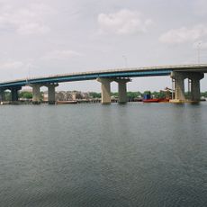
Mid-Bay Bridge, Toll bridge in Okaloosa County, Florida, United States

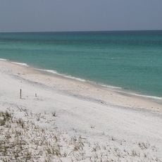
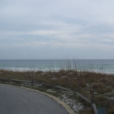
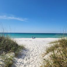
The Mid-Bay Bridge is a toll bridge in northern Florida that links Niceville to Destin by crossing Choctawhatchee Bay. It runs along State Road 293 and passes over the Intracoastal Waterway as it crosses the bay.

The bridge opened in 1993 and gave the Okaloosa County area its first direct road link between the inland and the coastal communities. It was built in response to growing traffic pressure along the Emerald Coast.

Crossing the bridge marks a clear shift from the quieter inland town of Niceville to the busier beach side of Destin. Many locals make this crossing regularly as part of their daily routine, especially during the summer season.

Drivers should be ready to pay a toll, with options available for both cash and electronic payment. Crossing outside peak times, particularly on summer weekends and holidays, helps avoid longer waits.

The bridge is designated as an official evacuation route during hurricanes, and when that happens the toll collection is suspended so vehicles can move through without stopping. This makes it one of the few toll bridges in Florida where the fee can disappear overnight based on weather alerts.

The community of curious travelers

AroundUs brings together thousands of curated places, local tips, and hidden gems, enriched daily by 60,000 contributors worldwide.

Start exploring
Location
Official opening
June 1993
GPS coordinates
30.43339,-86.41801
Latest update
March 3, 2026 10:10
Around this place
Grayton Beach State Park
United States of America

Grayton Beach State Park

35.6 km
Air Force Armament Museum
United States of America

Air Force Armament Museum

14.2 km
Topsail Hill Preserve State Park
United States of America

Topsail Hill Preserve State Park

13.6 km
McKinley Climatic Laboratory
United States of America

McKinley Climatic Laboratory

9.8 km
Henderson Beach State Park
United States of America

Henderson Beach State Park

16.4 km
Eden Gardens State Park
United States of America

Eden Gardens State Park

29.1 km
Big Kahuna's
United States of America

Big Kahuna's

7.1 km
Fort Walton Mound
United States of America

Fort Walton Mound

18.5 km
Deer Lake State Park
United States of America

Deer Lake State Park

35.6 km
Fred Gannon Rocky Bayou State Park
United States of America

Fred Gannon Rocky Bayou State Park

7.1 km
Santa Rosa Island Range Complex
United States of America

Santa Rosa Island Range Complex

37.5 km
Brooks Bridge
United States of America

Brooks Bridge

17.9 km
Governor Stone
United States of America

Governor Stone

19.4 km
Wild Willy's Adventure Zone
United States of America

Wild Willy's Adventure Zone

17.1 km
St. Agatha's Episcopal Church
United States of America

St. Agatha's Episcopal Church

42.8 km
Camp Pinchot Historic District
United States of America

Camp Pinchot Historic District

17.4 km
Destin History & Fishing Museum
United States of America

Destin History & Fishing Museum

9.7 km
Sun Bright
United States of America

Sun Bright

42.7 km
Destin Beach
United States of America

Destin Beach

6.4 km
Gulfview Hotel Historic District
United States of America

Gulfview Hotel Historic District

19 km
Crestview Commercial Historic District
United States of America

Crestview Commercial Historic District

39.1 km
Eglin Field Historic District
United States of America

Eglin Field Historic District

9 km
The Vicarage
United States of America

The Vicarage

42.8 km
Heritage Museum of Northwest Florida
United States of America

Heritage Museum of Northwest Florida

10.5 km
Destin Army Recreation Area
United States of America

Destin Army Recreation Area

8.1 km
Princess Beach
United States of America

Princess Beach

12.6 km
Emerald Coast Science Center
United States of America

Emerald Coast Science Center

20.4 km
Alys Beach
United States of America

Alys Beach

40.8 km
Show the full map
Reviews
Share your experience

No review yet

Discussions
Start a discussion...

No discussion yet

« Mid-Bay Bridge - Toll bridge in Okaloosa County, Florida, United States » is provided by Around Us (aroundus.com). Images and texts are derived from Wikimedia project under a Creative Commons license. You are allowed to copy, distribute, and modify copies of this page, under the conditions set by the license, as long as this note is clearly visible.

Discover hidden gems everywhere you go!

From secret cafés to breathtaking viewpoints, skip the crowded tourist spots and find places that match your style. Our app makes it easy with voice search, smart filtering, route optimization, and insider tips from travelers worldwide. Download now for the complete mobile experience.

Around Us App Screenshot

A unique approach to discovering new places

Le Figaro

All the places worth exploring

France Info

A tailor-made excursion in just a few clicks

20 Minutes

Around Us
Travel Guide & Maps
Download

Send to your phone

QR Code
1

Open the camera app on your mobile.

2

Point at the QR code with your camera. A notification will appear.

3

Tap the notification to open the link.