Enable Location

We need your location to show you interesting places around you

Discover nearby places

Find interesting locations and hidden gems around you

Precise directions

Get accurate directions and distances to places

Your location is never shared with other users. It's only used when you tap the location button.

Dale County

Log in to your account

Start exploring — it's free

Trusted by 61,875 travelers worldwide

Continue with Google
Continue with Apple
or

We will send you a code to connect

By continuing, you accept our Terms and Conditions and our Privacy Policy

Check your inbox

We've sent a pincode in your inbox. Please enter the code below.

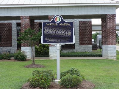
Dale County, County administration zone in southeastern Alabama, United States.

Dale County is an administrative division in southeastern Alabama covering roughly 560 square miles (1,450 square kilometers). The city of Ozark serves as its governmental center where county services are based.

The county was established during Alabama's territorial expansion in the 1800s as a local government district. Over the decades, its law enforcement office grew from basic peacekeeping duties into a department with specialized divisions like Aviation and Criminal Investigations.

The Sheriff's Office maintains strong connections with residents through community policing programs and a dedicated crime prevention partnership system.

The county offices in Ozark operate during standard business hours from Monday through Friday, generally from morning to late afternoon. Planning your visit early in the week or day helps avoid peak times when obtaining documents or services.

The county's law enforcement uses a Czech Shepherd K-9 officer named Chief for narcotics detection work throughout the jurisdiction. This specialized canine unit represents an often-overlooked aspect of regional security operations.

The community of curious travelers

AroundUs brings together thousands of curated places, local tips, and hidden gems, enriched daily by 60,000 contributors worldwide.

Start exploring
Location
Inception
December 22, 1824
Capital city
Ozark
Shares border with
Pike County, Barbour County, Henry County, Houston County, Geneva County, Coffee County
GPS coordinates
31.43333,-85.60000
Latest update
December 23, 2025 00:54
Around this place
United States Army Aviation Museum
United States of America

United States Army Aviation Museum

16.2 km
Army Aviation Museum Foundation
United States of America

Army Aviation Museum Foundation

16.2 km
United States of America

J. D. Holman House

4.6 km
Claybank Log Church
United States of America

Claybank Log Church

6 km
Water World
United States of America

Water World

26.6 km
United States of America

Samuel Lawson Dowling House

4.8 km
United States of America

Confederate Monument (Ozark)

4.7 km
Adventure Land Theme Park
United States of America

Adventure Land Theme Park

26.4 km
United States of America

Oates-Reynolds Memorial Building

11.4 km
Boeing-Vertol BV-347 Chinook
United States of America

Boeing-Vertol BV-347 Chinook

16.2 km
Bell OH-58C Kiowa
United States of America

Bell OH-58C Kiowa

16.2 km
United States of America

Ryan XV-5B Vertifan

16.3 km
Bell AH-1S Cobra
United States of America

Bell AH-1S Cobra

16.2 km
Grumman OV-1B Mohawk
United States of America

Grumman OV-1B Mohawk

16.2 km
United States of America

Bell UH-1H Huey

16.1 km
Sikorsky CH-54A Tarhe
United States of America

Sikorsky CH-54A Tarhe

16.2 km
North American CT-39A Sabreliner
United States of America

North American CT-39A Sabreliner

16.3 km
Lockheed AP-2E Neptune
United States of America

Lockheed AP-2E Neptune

16.3 km
DHC YC-7A Caribou
United States of America

DHC YC-7A Caribou

16.2 km
Ryan U-18B Navion
United States of America

Ryan U-18B Navion

16.2 km
United States of America

Barfield Lake

16.6 km
United States of America

Sam Dale Park

5.8 km
United States of America

Lake Tholocco

11.5 km
United States of America

Murphys Mill Historical Site

22.3 km
United States of America

Fort Rucker Theatre

15.7 km
United States of America

Roy Parker Lake

4 km
United States of America

Johnsons Pond

4.1 km
United States of America

Murphy Millpond

22.6 km
Show the full map
« Dale County - County administration zone in southeastern Alabama, United States » is provided by Around Us (aroundus.com). Images and texts are derived from Wikimedia project under a Creative Commons license. You are allowed to copy, distribute, and modify copies of this page, under the conditions set by the license, as long as this note is clearly visible.

Discover hidden gems everywhere you go!

From secret cafés to breathtaking viewpoints, skip the crowded tourist spots and find places that match your style. Our app makes it easy with voice search, smart filtering, route optimization, and insider tips from travelers worldwide. Download now for the complete mobile experience.

Around Us App Screenshot

A unique approach to discovering new places

Le Figaro

All the places worth exploring

France Info

A tailor-made excursion in just a few clicks

20 Minutes

Around Us
Travel Guide & Maps
Download

Send to your phone

QR Code
1

Open the camera app on your mobile.

2

Point at the QR code with your camera. A notification will appear.

3

Tap the notification to open the link.