Chest opened
+${chestReward.xp} XP
Explorer
NOUVEAU ×${chestReward.collectible.quantity}
tapez pour fermer
Chest locked

Open chests in the app

Around Us is built for your phone — chests unlock when you walk, explore and capture nearby places.

Enable Location

We need your location to show you interesting places around you

Discover nearby places

Find interesting locations and hidden gems around you

Precise directions

Get accurate directions and distances to places

Your location is never shared with other users. It's only used when you tap the location button.

Hardeeville

Log in to your account

Start exploring — it's free

Trusted by 72,874 travelers worldwide

Continue with Google
Continue with Apple
or

We will send you a code to connect

By continuing, you accept our Terms and Conditions and our Privacy Policy

Check your inbox

We've sent a pincode in your inbox. Please enter the code below.

Discussion Reviews 1 Photos
21.9k Popularity

Hardeeville, Administrative division in South Carolina, United States.

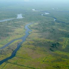
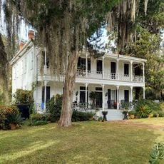
Hardeeville is a city situated across Jasper and Beaufort counties in the Lowcountry region at an elevation of about 20 feet above sea level. The town occupies a strategic position in this flat coastal landscape where the two counties meet.

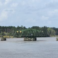
Isaac Hardee founded the settlement in the 1800s by building a depot and general store along the Charleston and Savannah Railway. This rail connection became the foundation around which the early community grew.

The city keeps local traditions alive through annual gatherings like the South Carolina Georgia Barbeque Festival and winter celebrations that draw people from surrounding areas. These events show how the community values its heritage and connections to the Lowcountry way of life.

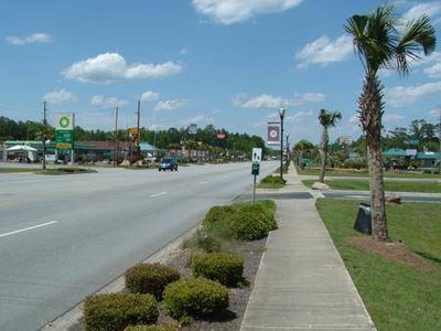
City offices and municipal services are located downtown on Main Street, making it easy to find help with local matters. The central location helps visitors and residents navigate the town and access what they need.

The Argent Lumber Company pioneered special methods for extracting timber from swampy terrain and played a key role in the town's early growth. This specialized logging operation became a major employer that shaped the local economy for decades.

The community of curious travelers

AroundUs brings together thousands of curated places, local tips, and hidden gems, enriched daily by 60,000 contributors worldwide.

Start exploring
Location
Location
Inception
1911
Elevation above the sea
7 m
GPS coordinates
32.28389,-81.07861
Latest update
December 23, 2025 17:23
Around this place
United States of America

Mulberry Grove Plantation

13 km
Savannah National Wildlife Refuge
United States of America

Savannah National Wildlife Refuge

10.4 km
Rose Hill Plantation House
United States of America

Rose Hill Plantation House

19.2 km
Seven Oaks, Bluffton SC
United States of America

Seven Oaks, Bluffton SC

21.1 km
Heyward House and Historical Center
United States of America

Heyward House and Historical Center

21.2 km
United States of America

Savannah Coastal Refuges Complex

10.4 km
United States of America

Callawassie Sugar Works

21.6 km
Bluffton Historic District
United States of America

Bluffton Historic District

21 km
D. Hasell Heyward House
United States of America

D. Hasell Heyward House

21 km
Campbell Chapel African Methodist Episcopal Church
United States of America

Campbell Chapel African Methodist Episcopal Church

21.2 km
Patz Brothers House
United States of America

Patz Brothers House

21 km
United States of America

Houston Praise House

13.2 km
United States of America

Port Wentworth City Hall

14.6 km
United States of America

Okatee Bluff

18.4 km
United States of America

Kirk Bluff

21.9 km
United States of America

Savannah River Bridge

8.7 km
United States of America

Drakies Bluff

13.8 km
James P. Houlihan Memorial Bridge
United States of America

James P. Houlihan Memorial Bridge

15 km
United States of America

Belfair

21 km
United States of America

Crescent Pointe Golf Club

21.9 km
United States of America

May River Golf Course

19.3 km
United States of America

Sun City - Okatie Creek Golf Club

11.6 km
United States of America

Sun City - Argent Lakes Golf Course

11.9 km
United States of America

Sun City - Hidden Cypress Golf Club

8.9 km
United States of America

Pinecrest Golf Club

17.9 km
United States of America

Station 300

15.1 km
United States of America

Last Mango Theater

6.2 km
United States of America

Barrell Landing

14 km
Show the full map
Reviews
Share your experience

No review yet

Discussions
Start a discussion...

No discussion yet

« Hardeeville - Administrative division in South Carolina, United States » is provided by Around Us (aroundus.com). Images and texts are derived from Wikimedia project under a Creative Commons license. You are allowed to copy, distribute, and modify copies of this page, under the conditions set by the license, as long as this note is clearly visible.

Discover hidden gems everywhere you go!

From secret cafés to breathtaking viewpoints, skip the crowded tourist spots and find places that match your style. Our app makes it easy with voice search, smart filtering, route optimization, and insider tips from travelers worldwide. Download now for the complete mobile experience.

Around Us App Screenshot

A unique approach to discovering new places

Le Figaro

All the places worth exploring

France Info

A tailor-made excursion in just a few clicks

20 Minutes

Around Us
Travel Guide & Maps
Download

Send to your phone

QR Code
1

Open the camera app on your mobile.

2

Point at the QR code with your camera. A notification will appear.

3

Tap the notification to open the link.