Chest opened
+${chestReward.xp} XP
Explorer
NOUVEAU ×${chestReward.collectible.quantity}
tapez pour fermer
Chest locked

Open chests in the app

Around Us is built for your phone — chests unlock when you walk, explore and capture nearby places.

Enable Location

We need your location to show you interesting places around you

Discover nearby places

Find interesting locations and hidden gems around you

Precise directions

Get accurate directions and distances to places

Your location is never shared with other users. It's only used when you tap the location button.

North

Log in to your account

Start exploring — it's free

Trusted by 72,887 travelers worldwide

Continue with Google
Continue with Apple
or

We will send you a code to connect

By continuing, you accept our Terms and Conditions and our Privacy Policy

Check your inbox

We've sent a pincode in your inbox. Please enter the code below.

Discussion Reviews 1 Photos
20k Popularity

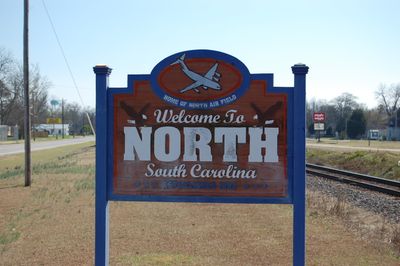
North, town in Orangeburg County, South Carolina, United States of America

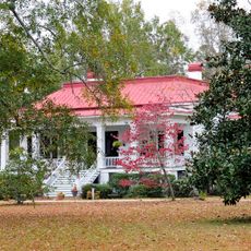
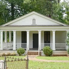
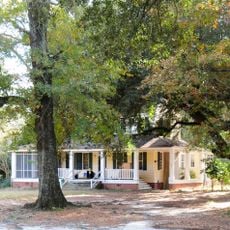
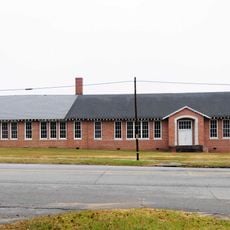
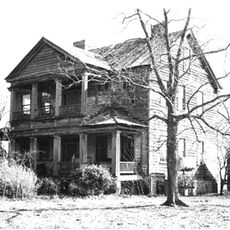
North is a small town in Orangeburg County, South Carolina, founded in the late 1800s. The settlement developed around a railroad station that connected it by rail to larger cities like Columbia, Savannah, and Miami.

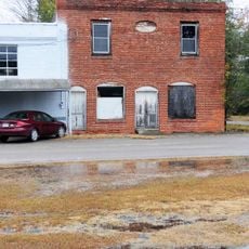
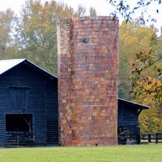
The town was founded when three men donated land for a railroad station and settlement, with John F. North playing a key role. The rail connection made North an important trading hub for cotton and other goods from the fertile surrounding area.

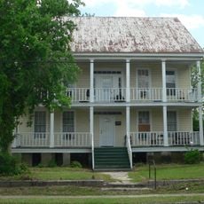
The town is named after John F. North, one of the land donors who shaped its founding. The settlement grew around the railroad station, which became the center of community life.

North is located where two highways meet, making it easy to reach by car. The nearby city of Orangeburg offers more services and a regional airport for those traveling farther.

Singer and actress Eartha Kitt was born on a farm near North and later became internationally famous in the 1950s. Her connection to the town is an often-overlooked piece of local history that shows how small places can nurture major talents.

The community of curious travelers

AroundUs brings together thousands of curated places, local tips, and hidden gems, enriched daily by 60,000 contributors worldwide.

Start exploring
Elevation above the sea
85 m
GPS coordinates
33.61611,-81.10361
Latest update
February 16, 2026 22:20
Around this place
Oliver C. Dawson Stadium
United States of America

Oliver C. Dawson Stadium

27.4 km
American Telephone and Telegraph Company Building
United States of America

American Telephone and Telegraph Company Building

32.4 km
All-Star Triangle Bowl
United States of America

All-Star Triangle Bowl

26.5 km
Hotel Eutaw
United States of America

Hotel Eutaw

26.5 km
Calhoun County Courthouse
United States of America

Calhoun County Courthouse

30.5 km
Lowman Hall, South Carolina State College
United States of America

Lowman Hall, South Carolina State College

26.8 km
Williams Chapel A.M.E. Church
United States of America

Williams Chapel A.M.E. Church

26.8 km
Col. Olin M. Dantzler House
United States of America

Col. Olin M. Dantzler House

31 km
Hodge Hall
United States of America

Hodge Hall

26.8 km
Dixie Library Building
United States of America

Dixie Library Building

25.8 km
Salley Historic District
United States of America

Salley Historic District

19.5 km
David Houser House
United States of America

David Houser House

25.7 km
Puritan Farm
United States of America

Puritan Farm

27.2 km
Donald Bruce House
United States of America

Donald Bruce House

31 km
Col. J.A. Banks House
United States of America

Col. J.A. Banks House

30.6 km
Enterprise Cotton Mills Building
United States of America

Enterprise Cotton Mills Building

27.3 km
Denmark High School
United States of America

Denmark High School

32.3 km
Springfield High School
United States of America

Springfield High School

20.7 km
F.H.W. Briggman House
United States of America

F.H.W. Briggman House

26.2 km
Orangeburg City Cemetery
United States of America

Orangeburg City Cemetery

26 km
William P. Stroman House
United States of America

William P. Stroman House

25.9 km
Calhoun County Library
United States of America

Calhoun County Library

31 km
Orangeburg Downtown Historic District
United States of America

Orangeburg Downtown Historic District

26.3 km
Tingley Memorial Hall, Claflin College
United States of America

Tingley Memorial Hall, Claflin College

26.6 km
William Baker House
United States of America

William Baker House

25.9 km
Great Branch Teacherage
United States of America

Great Branch Teacherage

14 km
Maj. John Hammond Fordham House
United States of America

Maj. John Hammond Fordham House

26.4 km
Orangeburg County Fair Main Exhibit Building
United States of America

Orangeburg County Fair Main Exhibit Building

27.7 km
Show the full map
Reviews
Share your experience

No review yet

Discussions
Start a discussion...

No discussion yet

« North - town in Orangeburg County, South Carolina, United States of America » is provided by Around Us (aroundus.com). Images and texts are derived from Wikimedia project under a Creative Commons license. You are allowed to copy, distribute, and modify copies of this page, under the conditions set by the license, as long as this note is clearly visible.

Discover hidden gems everywhere you go!

From secret cafés to breathtaking viewpoints, skip the crowded tourist spots and find places that match your style. Our app makes it easy with voice search, smart filtering, route optimization, and insider tips from travelers worldwide. Download now for the complete mobile experience.

Around Us App Screenshot

A unique approach to discovering new places

Le Figaro

All the places worth exploring

France Info

A tailor-made excursion in just a few clicks

20 Minutes

Around Us
Travel Guide & Maps
Download

Send to your phone

QR Code
1

Open the camera app on your mobile.

2

Point at the QR code with your camera. A notification will appear.

3

Tap the notification to open the link.