Enable Location

We need your location to show you interesting places around you

Discover nearby places

Find interesting locations and hidden gems around you

Precise directions

Get accurate directions and distances to places

Your location is never shared with other users. It's only used when you tap the location button.

Orangeburg County

Log in to your account

Start exploring — it's free

Trusted by 63,665 travelers worldwide

Continue with Google
Continue with Apple
or

We will send you a code to connect

By continuing, you accept our Terms and Conditions and our Privacy Policy

Check your inbox

We've sent a pincode in your inbox. Please enter the code below.

Discussion Reviews 1 Photos
23.3k Popularity

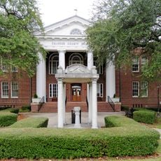
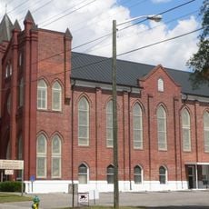
Orangeburg County, Administrative division in South Carolina, US.

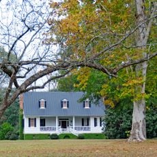
Orangeburg County is located in South Carolina's Midlands region and includes farmland, forests, and residential areas spread across the landscape. Roads and highways run through the county, connecting different towns and communities.

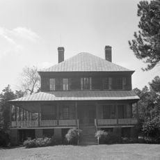
A fur trading post was established here in 1704, and the area became an official county in 1769 through settlement by Swiss, German, and Dutch colonists. These early communities laid the foundation for the region's development.

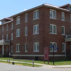
Two universities shape daily life and community in the region: South Carolina State University and Claflin University. These institutions draw people together and influence how the county develops.

Interstate highways 95 and 26 pass through the county, making travel to major cities straightforward. Visitors can easily explore the broader region from here.

The Edisto Memorial Gardens holds one of the state's largest public rose collections with many different varieties to see. This garden is often overlooked by visitors despite offering impressive plant diversity.

The community of curious travelers

AroundUs brings together thousands of curated places, local tips, and hidden gems, enriched daily by 60,000 contributors worldwide.

Start exploring
Location
Inception
1769
Capital city
Orangeburg
Shares border with
Calhoun County, Bamberg County, Clarendon County, Dorchester County, Colleton County, Aiken County, Barnwell County, Lexington County, Berkeley County
GPS coordinates
33.44000,-80.80000
Latest update
December 20, 2025 14:32
Around this place
United States of America

Lake Marion

51 km
Oliver C. Dawson Stadium
United States of America

Oliver C. Dawson Stadium

7.7 km
Francis Beidler Forest
United States of America

Francis Beidler Forest

46.8 km
UFO Welcome Center
United States of America

UFO Welcome Center

14.5 km
United States of America

Santee State Park

30.2 km
Santee National Wildlife Refuge
United States of America

Santee National Wildlife Refuge

44.9 km
American Telephone and Telegraph Company Building
United States of America

American Telephone and Telegraph Company Building

34.2 km
Indian Fields Methodist Campground
United States of America

Indian Fields Methodist Campground

33.8 km
All-Star Triangle Bowl
United States of America

All-Star Triangle Bowl

8 km
Eutaw Springs Battleground Park
United States of America

Eutaw Springs Battleground Park

46.7 km
Gen. Francis Marion Bamberg House
United States of America

Gen. Francis Marion Bamberg House

28.1 km
Woodlands
United States of America

Woodlands

20.6 km
United States of America

Dantzler Plantation

27.5 km
Santee Indian Mound and Fort Watson
United States of America

Santee Indian Mound and Fort Watson

35.4 km
United States of America

Barnwell State Park

48.2 km
Hotel Eutaw
United States of America

Hotel Eutaw

8 km
Providence Methodist Church
United States of America

Providence Methodist Church

24.7 km
Midway Plantation
United States of America

Midway Plantation

28 km
Davis House
United States of America

Davis House

58.3 km
Summerton High School
United States of America

Summerton High School

46.3 km
Calhoun County Courthouse
United States of America

Calhoun County Courthouse

24.9 km
Lawson's Pond Plantation
United States of America

Lawson's Pond Plantation

54.2 km
Lowman Hall, South Carolina State College
United States of America

Lowman Hall, South Carolina State College

7.9 km
Ulmer-Summers House
United States of America

Ulmer-Summers House

15.7 km
United States of America

St. Julien Plantation

41.7 km
Williams Chapel A.M.E. Church
United States of America

Williams Chapel A.M.E. Church

7.6 km
Oakland Plantation
United States of America

Oakland Plantation

30.1 km
Col. Olin M. Dantzler House
United States of America

Col. Olin M. Dantzler House

24.8 km
Show the full map
Reviews
Share your experience

No review yet

Discussions
Start a discussion...

No discussion yet

Administrative divisions
« Orangeburg County - Administrative division in South Carolina, US » is provided by Around Us (aroundus.com). Images and texts are derived from Wikimedia project under a Creative Commons license. You are allowed to copy, distribute, and modify copies of this page, under the conditions set by the license, as long as this note is clearly visible.

Discover hidden gems everywhere you go!

From secret cafés to breathtaking viewpoints, skip the crowded tourist spots and find places that match your style. Our app makes it easy with voice search, smart filtering, route optimization, and insider tips from travelers worldwide. Download now for the complete mobile experience.

Around Us App Screenshot

A unique approach to discovering new places

Le Figaro

All the places worth exploring

France Info

A tailor-made excursion in just a few clicks

20 Minutes

Around Us
Travel Guide & Maps
Download

Send to your phone

QR Code
1

Open the camera app on your mobile.

2

Point at the QR code with your camera. A notification will appear.

3

Tap the notification to open the link.