Enable Location

We need your location to show you interesting places around you

Discover nearby places

Find interesting locations and hidden gems around you

Precise directions

Get accurate directions and distances to places

Your location is never shared with other users. It's only used when you tap the location button.

Log in to your account

Start exploring — it's free

Trusted by 61,786 travelers worldwide

Continue with Google
Continue with Apple
or

We will send you a code to connect

By continuing, you accept our Terms and Conditions and our Privacy Policy

Check your inbox

We've sent a pincode in your inbox. Please enter the code below.

Lake Marion

Lake Marion, Reservoir between five counties in South Carolina, United States

Description

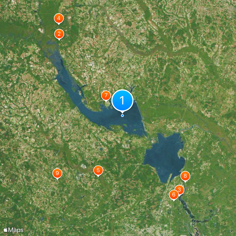
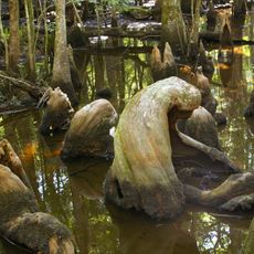
Lake Marion is a reservoir spread across five counties in South Carolina, covering roughly 110,600 acres (44,800 hectares) with a shoreline of 315 miles (507 kilometers). Countless submerged cypress trees and stumps rise from the water or remain hidden beneath the surface.

History

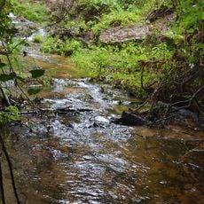
The reservoir formed in 1941 as part of the Santee Cooper Project during the Great Depression, designed to create jobs and bring electricity to rural areas. Flooding transformed much of the landscape and joined several rivers into a single basin.

Culture

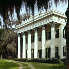
The reservoir takes its name from General Francis Marion, a fighter in the Revolutionary War whose plantation now rests beneath the surface. Anglers and boaters share the water today, and for many people in the region it has become part of weekend routines.

Practical

Several public boat ramps provide access to the water, and navigation markers help guide the way through the wide waterways. Santee State Park also offers access and serves as a starting point for trips across the reservoir.

Did you know?

The reservoir hosts a self-sustaining striped bass population that completes its entire life cycle in freshwater. This trait was discovered only after the dam closed and continues to interest researchers today.

Location
GPS coordinates
33.46222,-80.25139
Latest update
December 17, 2025 08:22

AroundUs brings together thousands of curated places, local tips, and hidden gems, enriched daily by 60,000 contributors worldwide. Discover all places nearby (South Carolina).

Around this place
Millford Plantation
United States of America

Millford Plantation

41.5 km
Lewisfield Plantation
United States of America

Lewisfield Plantation

41.3 km
Poinsett State Park
United States of America

Poinsett State Park

46.7 km
Francis Beidler Forest
United States of America

Francis Beidler Forest

27.4 km
Mulberry Plantation (Moncks Corner, South Carolina)
United States of America

Mulberry Plantation (Moncks Corner, South Carolina)

41.8 km
Santee National Wildlife Refuge
United States of America

Santee National Wildlife Refuge

9.1 km
Biggin Church
United States of America

Biggin Church

38.4 km
Indian Fields Methodist Campground
United States of America

Indian Fields Methodist Campground

38.2 km
Santee Indian Mound and Fort Watson
United States of America

Santee Indian Mound and Fort Watson

19.3 km
Providence Methodist Church
United States of America

Providence Methodist Church

27.9 km
Thorntree
United States of America

Thorntree

45.3 km
Gippy Plantation
United States of America

Gippy Plantation

39.6 km
Kingstree Historic District
United States of America

Kingstree Historic District

45 km
Davis House
United States of America

Davis House

21.3 km
Summerton High School
United States of America

Summerton High School

18.2 km
Lawson's Pond Plantation
United States of America

Lawson's Pond Plantation

10.6 km
Saint Paul Campground
United States of America

Saint Paul Campground

35.8 km
Ulmer-Summers House
United States of America

Ulmer-Summers House

44.5 km
Cypress Methodist Camp Ground
United States of America

Cypress Methodist Camp Ground

40.4 km
Oakland Plantation
United States of America

Oakland Plantation

45.9 km
Haigler House
United States of America

Haigler House

41.4 km
Numertia Plantation
United States of America

Numertia Plantation

9 km
Pineville Historic District
United States of America

Pineville Historic District

32.7 km
Colonel John Gotea Pressley House
United States of America

Colonel John Gotea Pressley House

45.1 km
J. Clinton Brogdon House
United States of America

J. Clinton Brogdon House

38.7 km
M.F. Heller House
United States of America

M.F. Heller House

45.1 km
Manning Library
United States of America

Manning Library

26.7 km
William Robertson House
United States of America

William Robertson House

32.5 km
Show the full map
« Lake Marion - Reservoir between five counties in South Carolina, United States » is provided by Around Us (aroundus.com). Images and texts are derived from Wikimedia project under a Creative Commons license. You are allowed to copy, distribute, and modify copies of this page, under the conditions set by the license, as long as this note is clearly visible.

Discover hidden gems everywhere you go!

From secret cafés to breathtaking viewpoints, skip the crowded tourist spots and find places that match your style. Our app makes it easy with voice search, smart filtering, route optimization, and insider tips from travelers worldwide. Download now for the complete mobile experience.

Around Us App Screenshot

A unique approach to discovering new places

Le Figaro

All the places worth exploring

France Info

A tailor-made excursion in just a few clicks

20 Minutes

Around Us
Travel Guide & Maps
Download

Send to your phone

QR Code
1

Open the camera app on your mobile.

2

Point at the QR code with your camera. A notification will appear.

3

Tap the notification to open the link.