Kingstree Historic District

Log in to your account

AroundUs is a community-driven map of interesting places, built by curious explorers like you. It grows with every review, story, and photo you share.
Connect to save your favorite spots, contribute locations, and create personalized routes.
Continue with Google
Continue with Apple
Continue with X
Continue with Facebook
Continue with email
By continuing, you accept our Terms and Conditions and our Privacy Policy
Create an account
Add to collection
Map
Suggest a change
Share

Kingstree Historic District, National Register historic district in Kingstree, South Carolina.

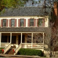
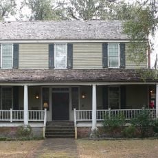
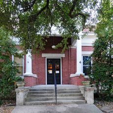
The Kingstree Historic District contains forty-eight properties spread along Main Street, Academy Street, and Hampton Street with commercial buildings and public structures from the eighteen hundreds and early nineteen hundreds. The area covers downtown Kingstree and houses a public library, railroad station, and many shops that remain in use today.

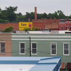
Most of the buildings were built between 1900 and 1920 when the town became a retail and tobacco market center for Williamsburg County. This growth period shaped the district's character and its economic role in the region.

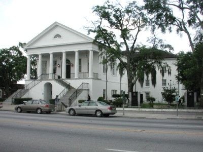
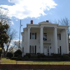
The courthouse designed by Robert Mills shows Roman neoclassical style with Doric columns standing prominently in the district. The buildings around it reflect how local merchants and civic leaders shaped their commercial spaces to reflect order and permanence during the town's development.

Main Street, Academy Street, and Hampton Street are the main streets to explore, where most buildings are within walking distance. It is best to stroll on foot and take time to notice the architectural details, especially on the older commercial facades and public structures.

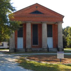
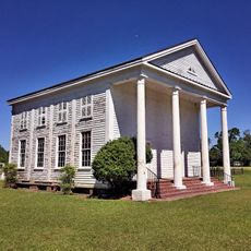
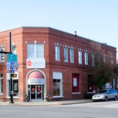
The buildings feature cast-iron columns, decorative brickwork, and pressed tin ceiling panels that show the craftsmanship from their construction era. These details reflect manufacturing techniques that were common in South Carolina during the early twentieth century.

Location: South Carolina

GPS coordinates: 33.66361,-79.83083

Latest update: December 14, 2025 17:02

Photos
Around this place
United States of America

Lake Marion

45 km
Hell Hole Swamp
United States of America

Hell Hole Swamp

49.9 km
Santee National Wildlife Refuge
United States of America

Santee National Wildlife Refuge

48.7 km
Biggin Church
United States of America

Biggin Church

51.8 km
Salem Black River Presbyterian Church
United States of America

Salem Black River Presbyterian Church

42.8 km
Moore Farms Botanical Garden
United States of America

Moore Farms Botanical Garden

22 km
Woods Bay State Park
United States of America

Woods Bay State Park

34.6 km
Rip Raps Plantation
United States of America

Rip Raps Plantation

39.6 km
Thorntree
United States of America

Thorntree

440 m
Davis House
United States of America

Davis House

36.6 km
Lawson's Pond Plantation
United States of America

Lawson's Pond Plantation

48.9 km
Pineville Historic District
United States of America

Pineville Historic District

51.7 km
United States of America

Pleasant Hill Consolidated School

42.9 km
Colonel John Gotea Pressley House
United States of America

Colonel John Gotea Pressley House

973 m
J. Clinton Brogdon House
United States of America

J. Clinton Brogdon House

43.3 km
Lynchburg Presbyterian Church
United States of America

Lynchburg Presbyterian Church

48.7 km
Goodwill Parochial School
United States of America

Goodwill Parochial School

40.4 km
Mayesville Historic District
United States of America

Mayesville Historic District

50 km
Browntown
United States of America

Browntown

24 km
M.F. Heller House
United States of America

M.F. Heller House

491 m
W.T. Askins House
United States of America

W.T. Askins House

24 km
Forest Hills Historic District
United States of America

Forest Hills Historic District

42 km
Scott House
United States of America

Scott House

7.7 km
Manning Library
United States of America

Manning Library

35.4 km
Lake City Downtown Historic District
United States of America

Lake City Downtown Historic District

24.3 km
Manning Commercial Historic District
United States of America

Manning Commercial Historic District

35.4 km
Epps-McGill Farmhouse
United States of America

Epps-McGill Farmhouse

1.8 km
John Calvin Wilson House
United States of America

John Calvin Wilson House

18.8 km
Show the full map
Reviews

Visited this place? Tap the stars to rate it and share your experience / photos with the community! Try now! You can cancel it anytime.

« Kingstree Historic District - National Register historic district in Kingstree, South Carolina » is provided by Around Us (aroundus.com). Images and texts are derived from Wikimedia project under a Creative Commons license. You are allowed to copy, distribute, and modify copies of this page, under the conditions set by the license, as long as this note is clearly visible.

Discover hidden gems everywhere you go!

From secret cafés to breathtaking viewpoints, skip the crowded tourist spots and find places that match your style. Our app makes it easy with voice search, smart filtering, route optimization, and insider tips from travelers worldwide. Download now for the complete mobile experience.

Around Us App Screenshot

A unique approach to discovering new places

Le Figaro

All the places worth exploring

France Info

A tailor-made excursion in just a few clicks

20 Minutes