Enable Location

We need your location to show you interesting places around you

Discover nearby places

Find interesting locations and hidden gems around you

Precise directions

Get accurate directions and distances to places

Your location is never shared with other users. It's only used when you tap the location button.

Hell Hole Swamp

Log in to your account

Start exploring — it's free

Trusted by 61,798 travelers worldwide

Continue with Google
Continue with Apple
or

We will send you a code to connect

By continuing, you accept our Terms and Conditions and our Privacy Policy

Check your inbox

We've sent a pincode in your inbox. Please enter the code below.

Hell Hole Swamp

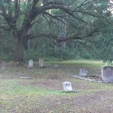
Hell Hole Swamp, Protected wilderness area in Berkeley County, United States.

Description

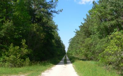
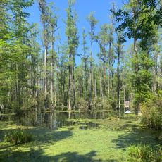
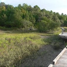
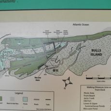
Hell Hole Swamp is a protected wetland area covering about 2,125 acres (860 hectares) within the Francis Marion National Forest, combining pine forests with natural water systems. The site offers accessible routes like the Little Hellhole Swamp Walkway where visitors can explore the landscape.

History

The name first appeared on a 1757 map of the South Carolina coastline, showing the area was known long before modern borders and development. During Prohibition in the 1920s and 1930s, the swamp became a center for illegal moonshine production, creating conflict with local authorities.

Culture

The place holds local meaning as a site where an annual festival happens each May with competitions and traditional Southern activities. These celebrations show how the region connects with this wetland and values its heritage.

Practical

The best time to visit is during drier months when trails are easiest to walk and conditions are more pleasant. Good footwear and insect repellent are recommended since the ground can be boggy and mosquitoes are present.

Did you know?

The area is one of the few places where you can still see traces of the Prohibition era, with hidden spots used by moonshiners from that time. This history is woven into the landscape itself, giving the visit a layer of local connection and intrigue.

Location
GPS coordinates
33.22780,-79.70330
Latest update
December 11, 2025 18:08

AroundUs brings together thousands of curated places, local tips, and hidden gems, enriched daily by 60,000 contributors worldwide. Discover all places nearby (Berkeley County).

Around this place
Mepkin Abbey
United States of America

Mepkin Abbey

26.1 km
Lewisfield Plantation
United States of America

Lewisfield Plantation

28.1 km
Hampton Plantation
United States of America

Hampton Plantation

24.9 km
Cypress Gardens
United States of America

Cypress Gardens

30.4 km
Cape Romain National Wildlife Refuge
United States of America

Cape Romain National Wildlife Refuge

29.2 km
Medway
United States of America

Medway

33.2 km
Hopsewee
United States of America

Hopsewee

29.7 km
Mulberry Plantation (Moncks Corner, South Carolina)
United States of America

Mulberry Plantation (Moncks Corner, South Carolina)

30.8 km
Middleburg Plantation
United States of America

Middleburg Plantation

20.9 km
Wedge Plantation
United States of America

Wedge Plantation

29 km
Annandale Plantation
United States of America

Annandale Plantation

37.3 km
Fairfield Plantation
United States of America

Fairfield Plantation

28.2 km
Harrietta Plantation
United States of America

Harrietta Plantation

29.6 km
Cypress Gardens
United States of America

Cypress Gardens

30.5 km
Biggin Church
United States of America

Biggin Church

24.6 km
Pee Dee River Rice Planters Historic District
United States of America

Pee Dee River Rice Planters Historic District

34.6 km
Bethel African Methodist Episcopal Church
United States of America

Bethel African Methodist Episcopal Church

27.7 km
Wicklow Hall Plantation
United States of America

Wicklow Hall Plantation

36.1 km
Gippy Plantation
United States of America

Gippy Plantation

28.9 km
Sewee Mound
United States of America

Sewee Mound

27.1 km
Pineville Historic District
United States of America

Pineville Historic District

30.8 km
White Church
United States of America

White Church

33.1 km
William Robertson House
United States of America

William Robertson House

31.1 km
Taveau Church
United States of America

Taveau Church

25.8 km
Bull Island
United States of America

Bull Island

36.7 km
Old Cape Romain Lighthouse
United States of America

Old Cape Romain Lighthouse

38.5 km
White Point Beach
United States of America

White Point Beach

29.3 km
Sewee Visitor and Environmental Education Center
United States of America

Sewee Visitor and Environmental Education Center

28.4 km
Show the full map
Reviews

Real people, real opinions — but not verified.

Visited this place? Tap the stars to rate it and share your experience / photos with the community! Try now! You can cancel it anytime.

tuckeradam64
@tuckeradam64

Mar 30, 2025 20:40

« Hell Hole Swamp - Protected wilderness area in Berkeley County, United States » is provided by Around Us (aroundus.com). Images and texts are derived from Wikimedia project under a Creative Commons license. You are allowed to copy, distribute, and modify copies of this page, under the conditions set by the license, as long as this note is clearly visible.

Discover hidden gems everywhere you go!

From secret cafés to breathtaking viewpoints, skip the crowded tourist spots and find places that match your style. Our app makes it easy with voice search, smart filtering, route optimization, and insider tips from travelers worldwide. Download now for the complete mobile experience.

Around Us App Screenshot

A unique approach to discovering new places

Le Figaro

All the places worth exploring

France Info

A tailor-made excursion in just a few clicks

20 Minutes

Around Us
Travel Guide & Maps
Download

Send to your phone

QR Code
1

Open the camera app on your mobile.

2

Point at the QR code with your camera. A notification will appear.

3

Tap the notification to open the link.