Enable Location

We need your location to show you interesting places around you

Discover nearby places

Find interesting locations and hidden gems around you

Precise directions

Get accurate directions and distances to places

Your location is never shared with other users. It's only used when you tap the location button.

Pee Dee River Rice Planters Historic District

Log in to your account

Start exploring — it's free

Trusted by 61,808 travelers worldwide

Continue with Google
Continue with Apple
or

We will send you a code to connect

By continuing, you accept our Terms and Conditions and our Privacy Policy

Check your inbox

We've sent a pincode in your inbox. Please enter the code below.

Pee Dee River Rice Planters Historic District

Pee Dee River Rice Planters Historic District, Rice plantations historic district in Georgetown County, US.

Description

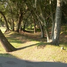
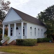
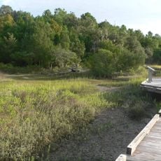
The Pee Dee River Rice Planters Historic District encompasses sixteen rice plantations along the Pee Dee River and Waccamaw River with historic buildings and agricultural structures. The area preserves old rice fields with functioning canals, dikes, and water control devices that demonstrate traditional cultivation methods.

History

The district was the primary source of rice production in South Carolina between 1750 and 1910, making the state the leading rice producer in America. This era ended as economic changes transformed the plantations.

Culture

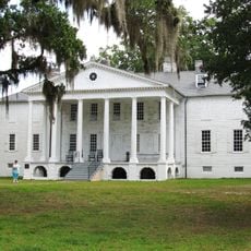
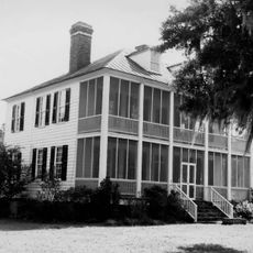
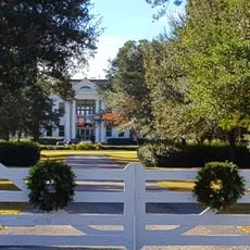
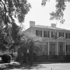
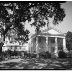
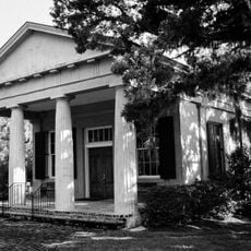
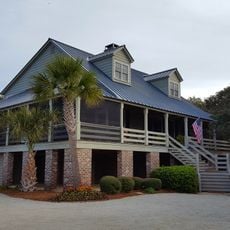
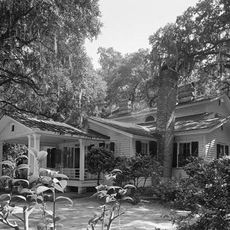
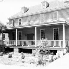
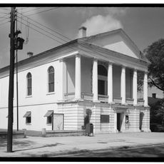
The four plantation houses show wooden frame construction and central hall layouts typical of the region. Their design reflects how wealthy planters lived and organized their homes.

Practical

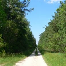
Visitors can walk through the preserved rice fields and see the historic infrastructure like canals and dikes showing water management. The plantations are spread across the area, so plan time to explore the different sites.

Did you know?

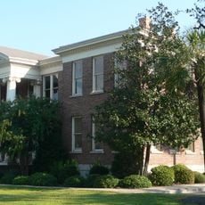
Two original rice barns still stand at Hasty Point and Exchange plantations, along with a complete rice mill and chimney at Chicora Wood. These structures offer insight into the daily work and processing during the height of rice production.

GPS coordinates
33.20250,-79.33278
Latest update
December 14, 2025 11:24

AroundUs brings together thousands of curated places, local tips, and hidden gems, enriched daily by 60,000 contributors worldwide. Discover all places nearby (Georgetown County).

Around this place
Hampton Plantation
United States of America

Hampton Plantation

9.8 km
Cape Romain National Wildlife Refuge
United States of America

Cape Romain National Wildlife Refuge

31.8 km
Hopsewee
United States of America

Hopsewee

4.9 km
Hell Hole Swamp
United States of America

Hell Hole Swamp

34.6 km
Arcadia Plantation
United States of America

Arcadia Plantation

22.6 km
Black River Plantation House
United States of America

Black River Plantation House

34.4 km
Beneventum Plantation House
United States of America

Beneventum Plantation House

27.8 km
Annandale Plantation
United States of America

Annandale Plantation

3.2 km
Battery White
United States of America

Battery White

11.8 km
All Saints' Episcopal Church, Waccamaw
United States of America

All Saints' Episcopal Church, Waccamaw

34.5 km
Georgetown Light
United States of America

Georgetown Light

13.9 km
Temple Beth Elohim
United States of America

Temple Beth Elohim

19 km
Bethel African Methodist Episcopal Church
United States of America

Bethel African Methodist Episcopal Church

17.1 km
Pawleys Island Historic District
United States of America

Pawleys Island Historic District

31 km
Prince Frederick's Chapel Ruins
United States of America

Prince Frederick's Chapel Ruins

36.6 km
Wicklow Hall Plantation
United States of America

Wicklow Hall Plantation

2 km
Georgetown Historic District
United States of America

Georgetown Historic District

18.8 km
Cedar Grove Plantation Chapel
United States of America

Cedar Grove Plantation Chapel

34.6 km
Joseph H. Rainey House
United States of America

Joseph H. Rainey House

19 km
Sewee Mound
United States of America

Sewee Mound

34.6 km
Winyah Indigo School
United States of America

Winyah Indigo School

19.4 km
Cape Romain Lighthouse
United States of America

Cape Romain Lighthouse

20.8 km
Kaminski House Museum
United States of America

Kaminski House Museum

18.9 km
Old Cape Romain Lighthouse
United States of America

Old Cape Romain Lighthouse

20.8 km
St. Mary's Church
United States of America

St. Mary's Church

19.2 km
Sewee Visitor and Environmental Education Center
United States of America

Sewee Visitor and Environmental Education Center

40.3 km
Winyah Indigo Society Hall
United States of America

Winyah Indigo Society Hall

18.8 km
Georgetown County Courthouse
United States of America

Georgetown County Courthouse

18.9 km
Show the full map
« Pee Dee River Rice Planters Historic District - Rice plantations historic district in Georgetown County, US » is provided by Around Us (aroundus.com). Images and texts are derived from Wikimedia project under a Creative Commons license. You are allowed to copy, distribute, and modify copies of this page, under the conditions set by the license, as long as this note is clearly visible.

Discover hidden gems everywhere you go!

From secret cafés to breathtaking viewpoints, skip the crowded tourist spots and find places that match your style. Our app makes it easy with voice search, smart filtering, route optimization, and insider tips from travelers worldwide. Download now for the complete mobile experience.

Around Us App Screenshot

A unique approach to discovering new places

Le Figaro

All the places worth exploring

France Info

A tailor-made excursion in just a few clicks

20 Minutes

Around Us
Travel Guide & Maps
Download

Send to your phone

QR Code
1

Open the camera app on your mobile.

2

Point at the QR code with your camera. A notification will appear.

3

Tap the notification to open the link.