Georgetown County

Log in to your account

AroundUs is a community-driven map of interesting places, built by curious explorers like you. It grows with every review, story, and photo you share.
Connect to save your favorite spots, contribute locations, and create personalized routes.
Continue with Google
Continue with Apple
Continue with X
Continue with Facebook
Continue with email
By continuing, you accept our Terms and Conditions and our Privacy Policy
Create an account
Add to collection
Map
Suggest a change
Share

Georgetown County, Administrative division in South Carolina, United States.

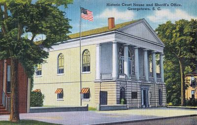
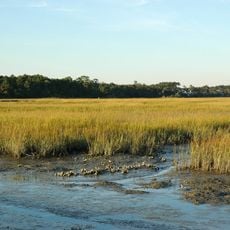
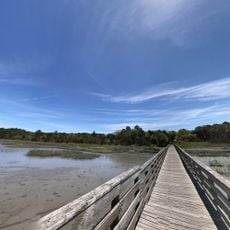
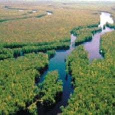
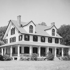
Georgetown County is an administrative division in South Carolina located along the Atlantic coast, encompassing coastal plains, river systems, and inland areas. The region features diverse terrain shaped by waterways and includes numerous historic structures that reflect centuries of settlement and development.

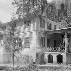
The county was established in 1769 and named after King George III, growing through rice cultivation and maritime commerce centered on Winyah Bay. These economic activities shaped the region for generations and left lasting marks on the landscape and settlement patterns.

The area maintains museums dedicated to maritime history and rice farming traditions, allowing visitors to experience how these two industries shaped daily life for centuries. The stories and restored buildings throughout the region reflect the deep connection between the community and these heritage practices.

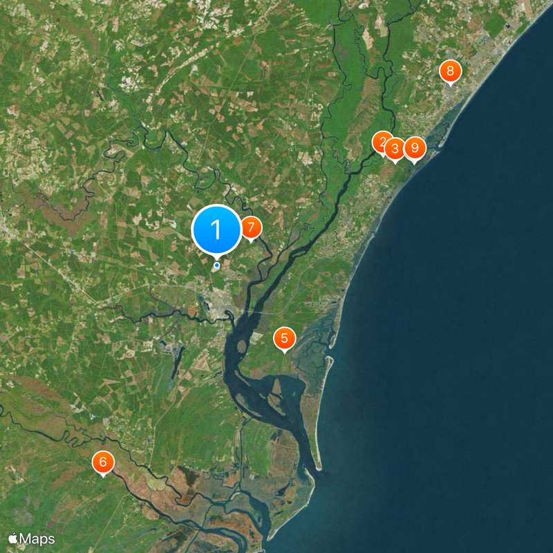
The area is accessible through Georgetown County Airport and major transportation routes, with easy connections to nearby cities. Visitors should expect local roads that wind through different landscapes and pass by various historical sites throughout the region.

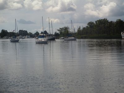
Four major rivers converge here to form Winyah Bay, one of South Carolina's most significant ports with deep sailing traditions. This water convergence has made the region a natural trading hub throughout history.

Location: South Carolina

Inception: 1769

Capital city: Georgetown

Shares border with: Horry County, Marion County, Williamsburg County, Berkeley County, Charleston County

Website: http://georgetowncountysc.org

GPS coordinates: 33.41000,-79.30000

Latest update: December 20, 2025 11:29

Photos
Around this place
Brookgreen Gardens
United States of America

Brookgreen Gardens

22.3 km
Atalaya Castle
United States of America

Atalaya Castle

23.1 km
Huntington Beach State Park
United States of America

Huntington Beach State Park

24.9 km
Hobcaw Barony
United States of America

Hobcaw Barony

12.3 km
Hampton Plantation
United States of America

Hampton Plantation

26.8 km
Mansfield Plantation
United States of America

Mansfield Plantation

4.7 km
United States of America

Palmetto Trail

33 km
Huntington Beach State Park

Huntington Beach State Park

25.1 km
Hopsewee
United States of America

Hopsewee

23.6 km
Brookgreen Gardens
United States of America

Brookgreen Gardens

24.3 km
Wedge Plantation
United States of America

Wedge Plantation

28.1 km
Waccamaw National Wildlife Refuge
United States of America

Waccamaw National Wildlife Refuge

31.5 km
Arcadia Plantation
United States of America

Arcadia Plantation

7.7 km
Black River Plantation House
United States of America

Black River Plantation House

11.2 km
Beneventum Plantation House
United States of America

Beneventum Plantation House

5.4 km
Annandale Plantation
United States of America

Annandale Plantation

21.5 km
Fairfield Plantation
United States of America

Fairfield Plantation

27.1 km
Atalaya and Brookgreen Gardens
United States of America

Atalaya and Brookgreen Gardens

23.1 km
Chicora Wood Plantation
United States of America

Chicora Wood Plantation

16.6 km
Harrietta Plantation
United States of America

Harrietta Plantation

28.2 km
The Murrells Inlet Marsh Walk

The Murrells Inlet Marsh Walk

29.9 km
Battery White
United States of America

Battery White

11.9 km
All Saints' Episcopal Church, Waccamaw
United States of America

All Saints' Episcopal Church, Waccamaw

16.2 km
Georgetown Light
United States of America

Georgetown Light

23.4 km
Pee Dee River Rice Planters Historic District
United States of America

Pee Dee River Rice Planters Historic District

23.3 km
Temple Beth Elohim
United States of America

Temple Beth Elohim

5.1 km
Crazy Sister Marina - Fishing, Cruises & Watersports

Crazy Sister Marina - Fishing, Cruises & Watersports

29.6 km
United States of America

Murrells Inlet Historic District

31 km
Show the full map
Reviews

Visited this place? Tap the stars to rate it and share your experience / photos with the community! Try now! You can cancel it anytime.

Administrative divisions
« Georgetown County - Administrative division in South Carolina, United States » is provided by Around Us (aroundus.com). Images and texts are derived from Wikimedia project under a Creative Commons license. You are allowed to copy, distribute, and modify copies of this page, under the conditions set by the license, as long as this note is clearly visible.

Discover hidden gems everywhere you go!

From secret cafés to breathtaking viewpoints, skip the crowded tourist spots and find places that match your style. Our app makes it easy with voice search, smart filtering, route optimization, and insider tips from travelers worldwide. Download now for the complete mobile experience.

Around Us App Screenshot

A unique approach to discovering new places

Le Figaro

All the places worth exploring

France Info

A tailor-made excursion in just a few clicks

20 Minutes